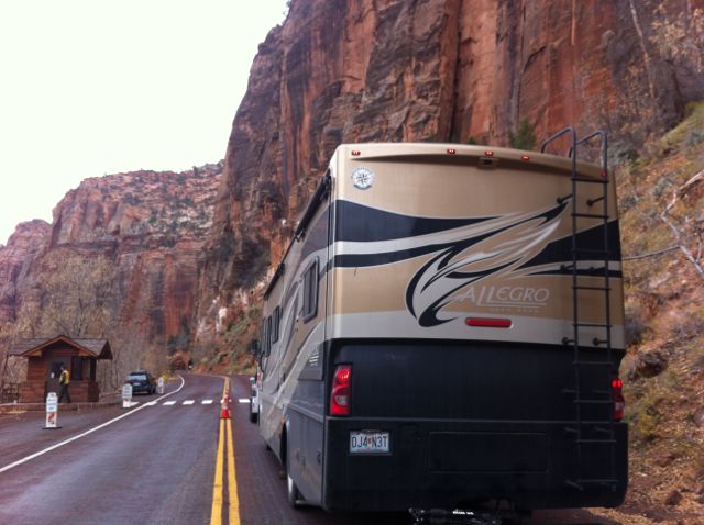
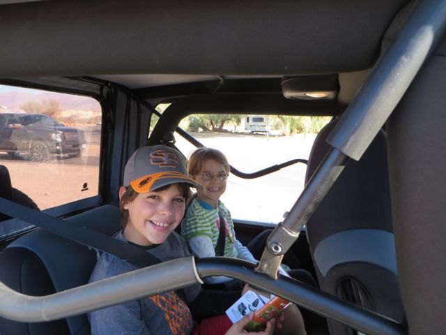
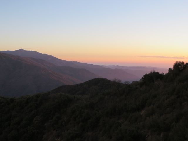
We left Zion via the Zion-Mount Carmel Tunnel. We had to get a special permit, so that they would stop traffic at one end and we could drive down the center of the lane in the tunnel. This is the longest tunnel of its type in the US(1 mile long). We drove through it in the jeep a couple days before which gave us a heads up on how it would be. Scott did an awesome job!
We are waiting to get the ok from the ranger that the tunnel is clear for us.
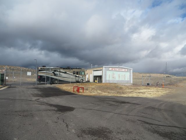
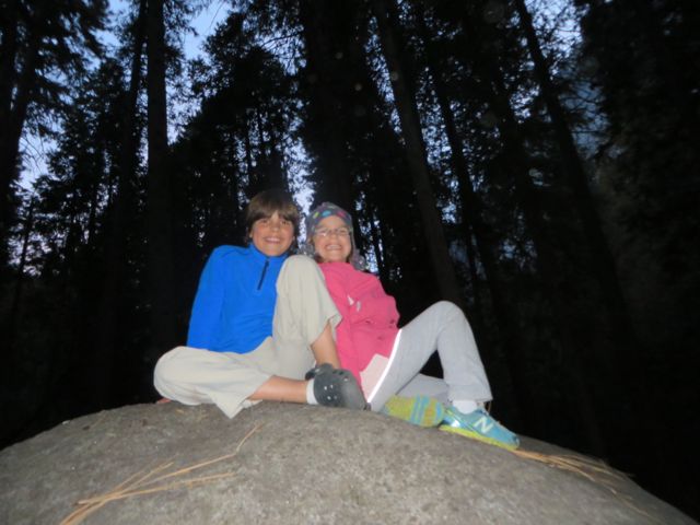
We ended up staying at the Hitch N Post in Panguitch, Utah(about 24 miles from Bryce). All the close campgrounds were already closed for the winter. I had never thought about how a difference of 4, 000-5,000 feet in elevation makes a difference in the weather.
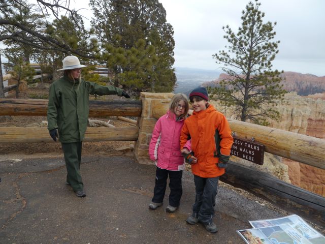
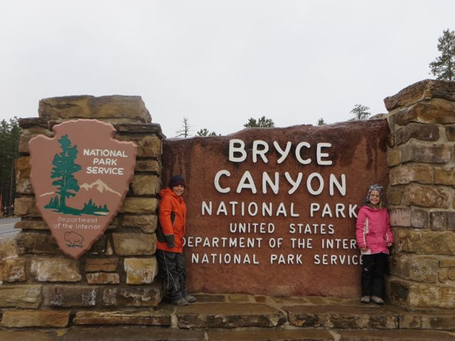
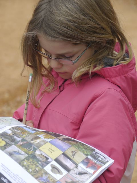
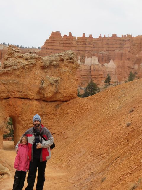
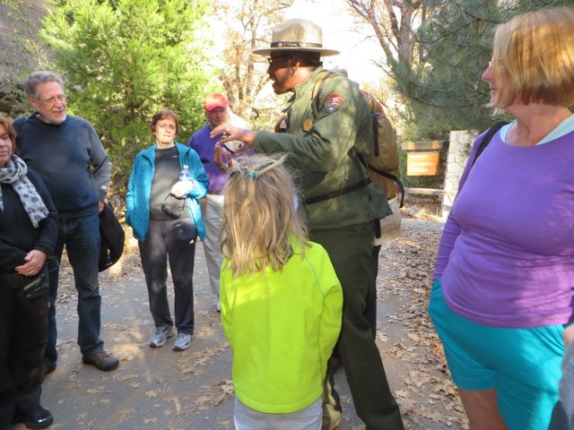
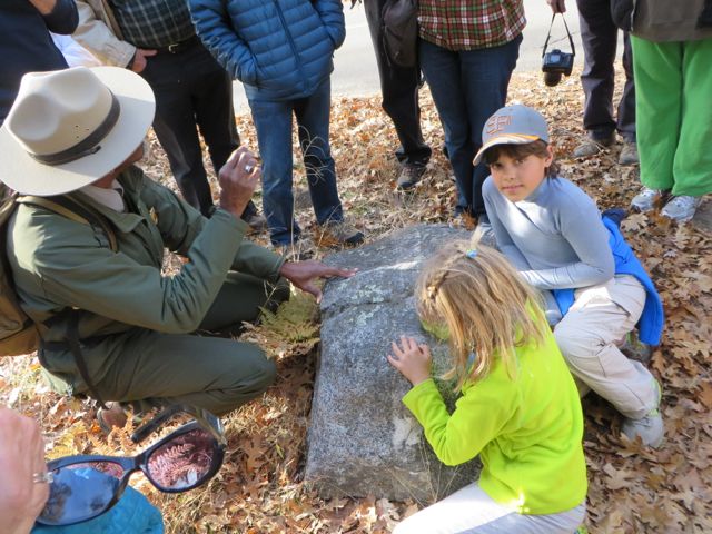
We headed to Bryce on Wednesday. It was a cold and slightly rainy day. We headed to the visitor center for the movie and for our kids to get their Junior Ranger book. We found out there was a ranger program along the rim of the canyon, so we ate lunch in our jeep and headed there.
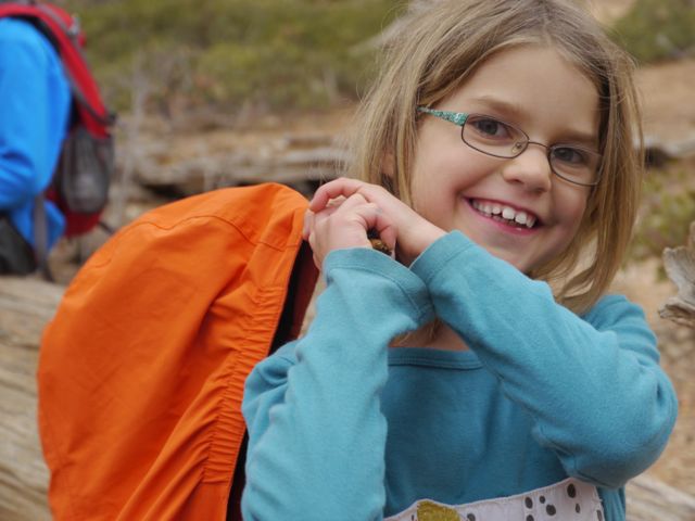
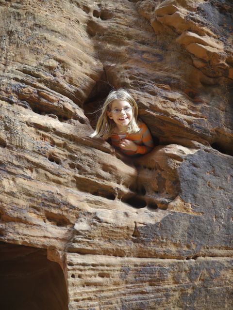
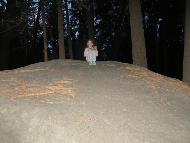
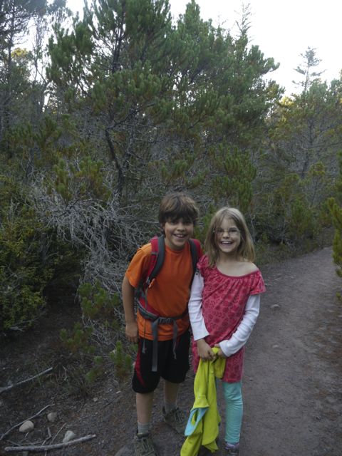
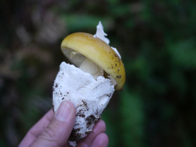
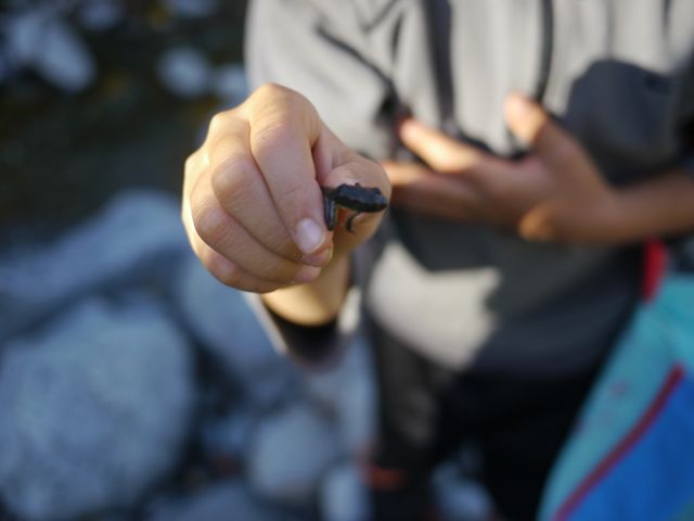
Kane and Kat showing how a hoodoo is formed at the Ranger program on the Geology of Bryce.It was cold enough to wear our winter coats.
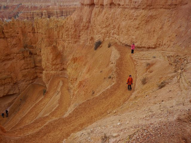
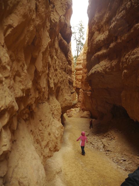
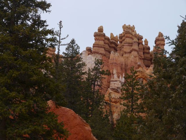
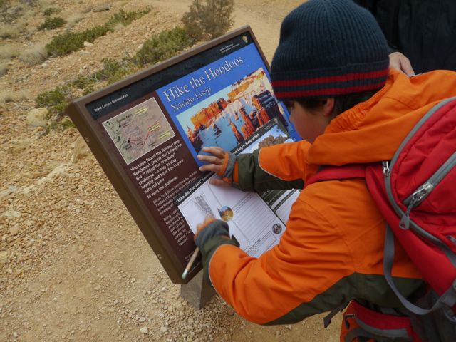
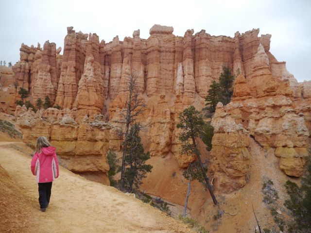
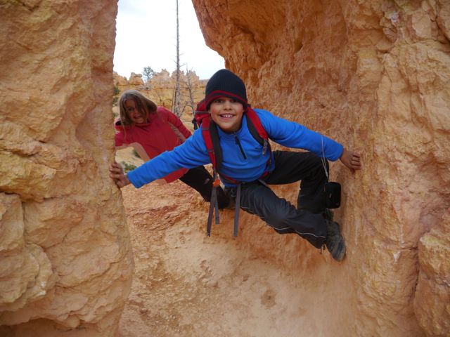
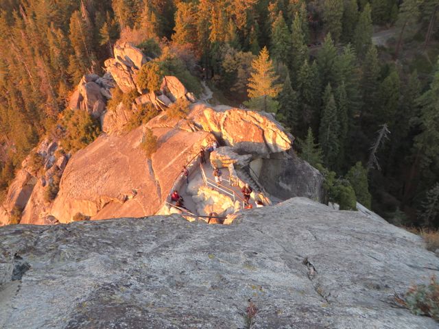
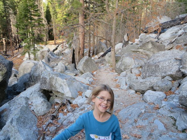
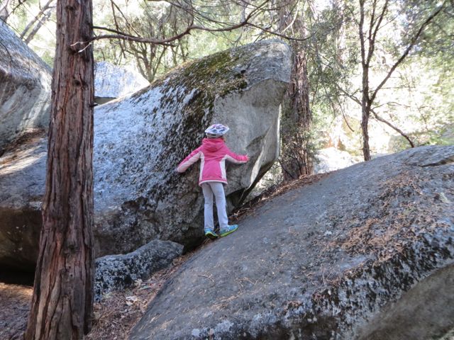
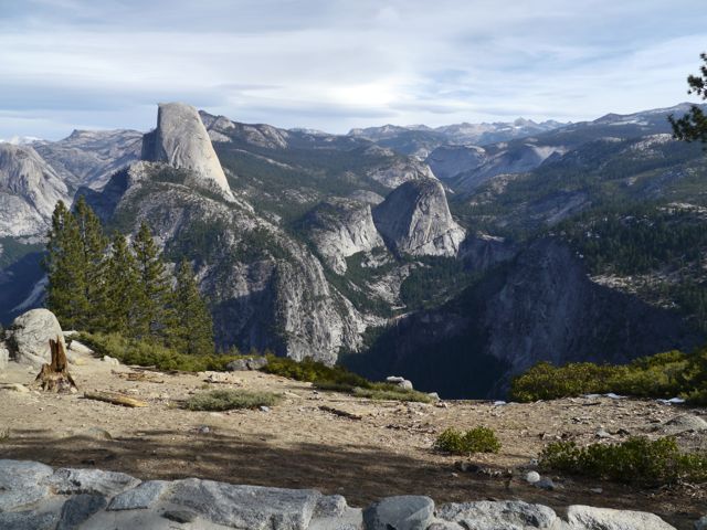
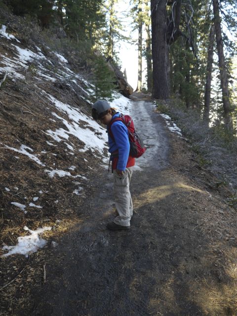
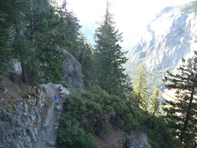
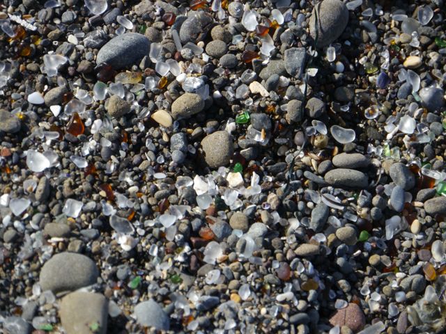
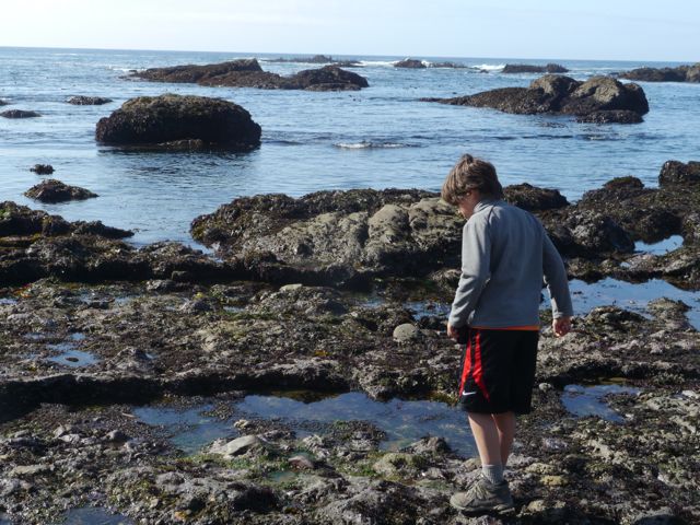
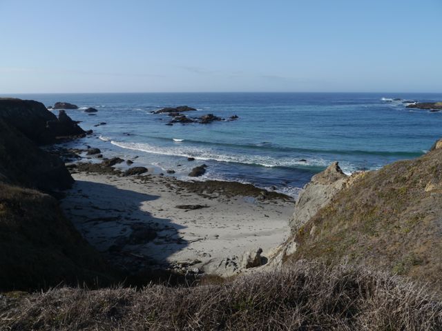
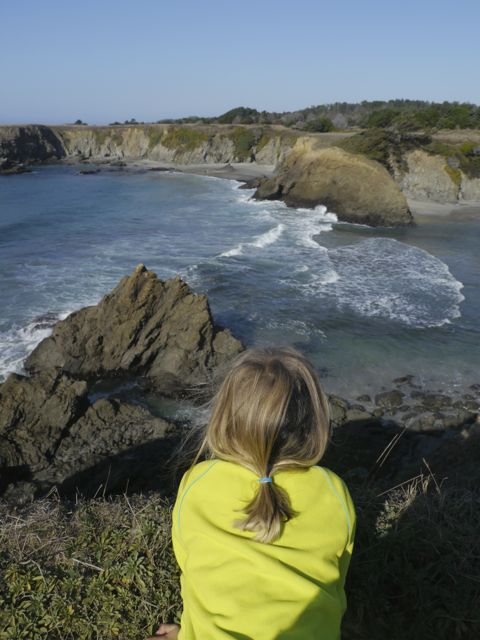
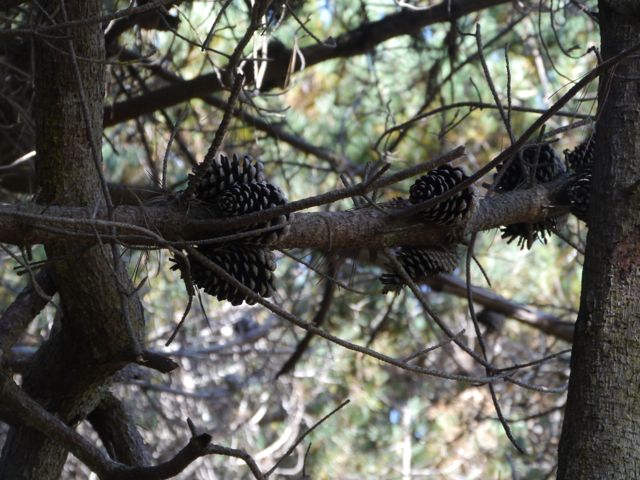
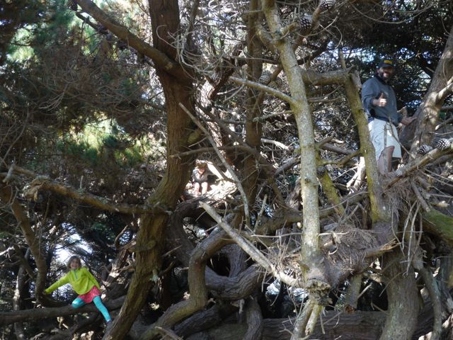
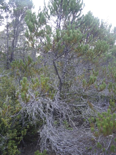
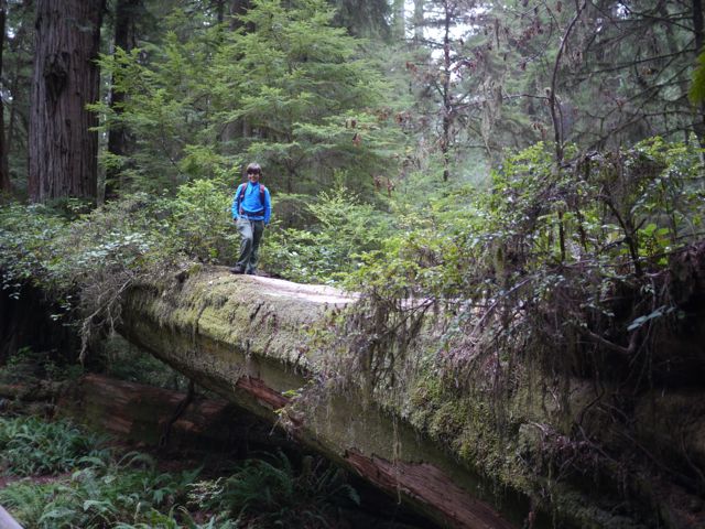
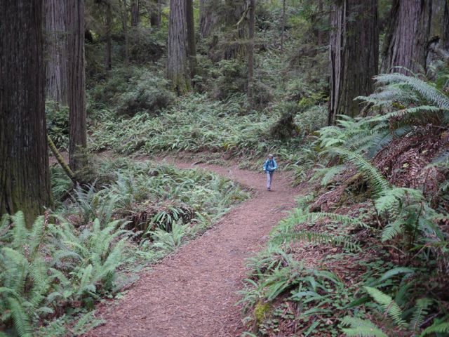
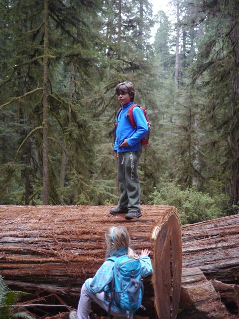
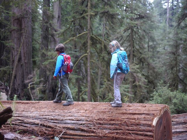
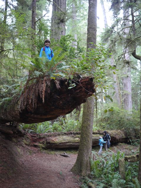
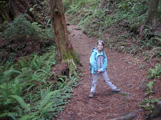
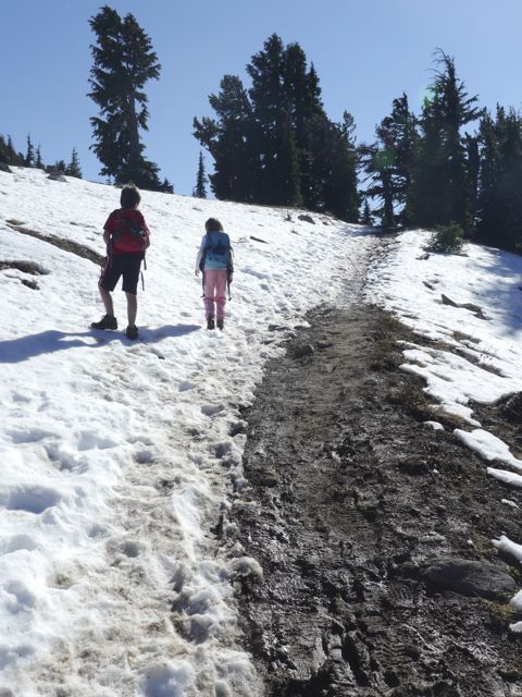
After the ranger program, we headed down into the canyon on the Navajo/Queen’s Garden Loop(luckily, the rain had stopped). The limestone walls and the different shaped Hoodoos were so amazing!
Heading down the trailKids lead the way…
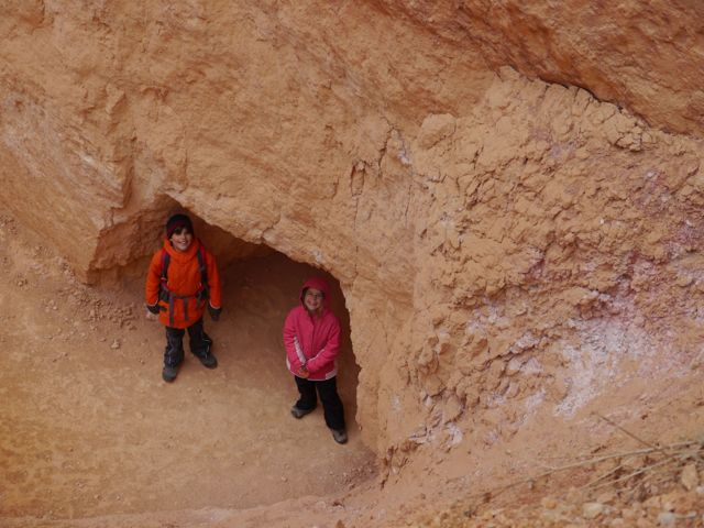
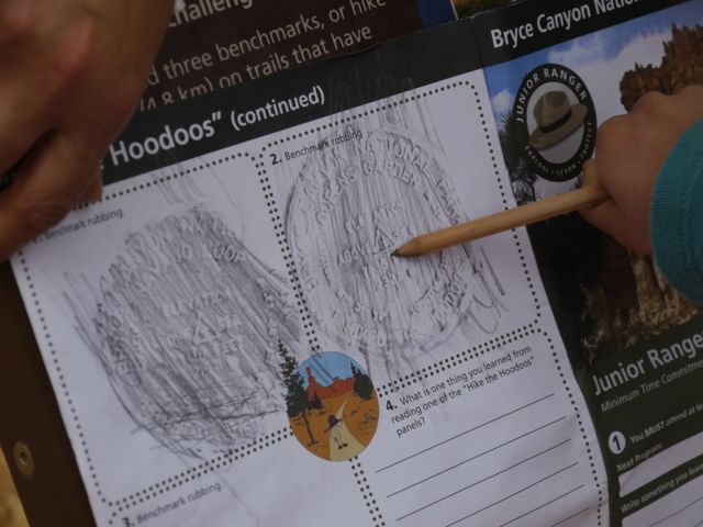
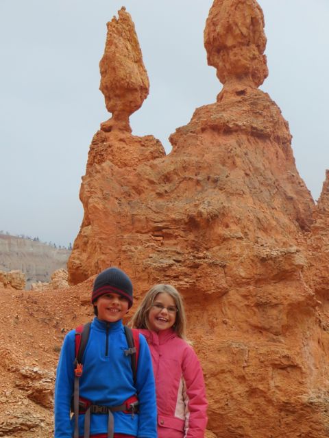
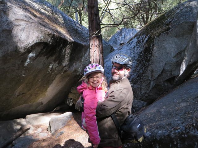
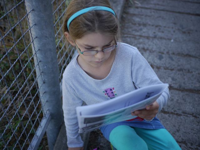
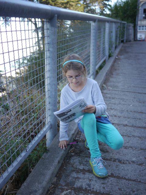
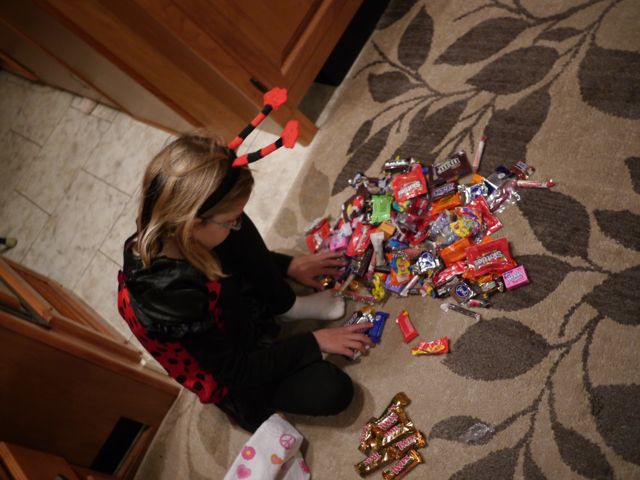
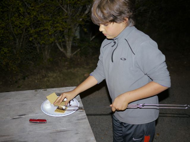
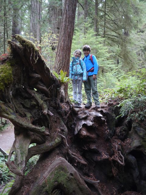
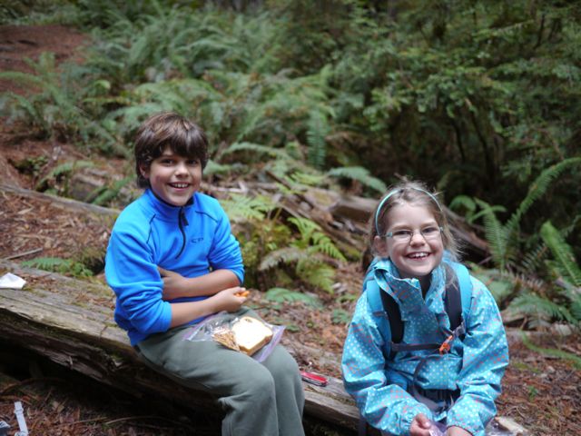
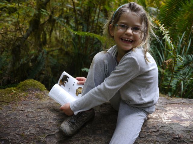
Hoodoos!Kat working on her Jr. Ranger Book. She spotted something on Bingo.Kids earned an extra badge if they completed the “I hiked the Hoodoos.” They had to do a 3 mile hike and find the hoodoo emblems.Found a “I Hiked the Hoodoos” benchmark!
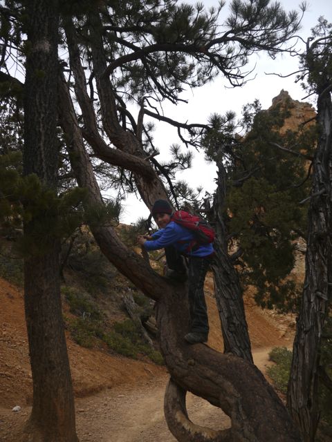
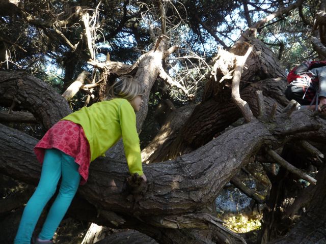
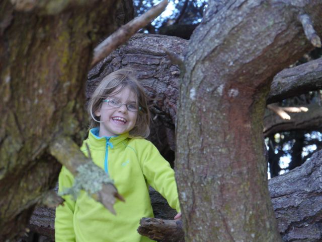
Can’t keep the monkey out of the trees! Such a sweet sister! Kat is carrying Kane’s coat.
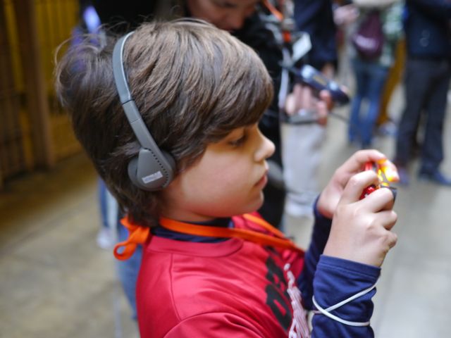
Got my camera!Gotcha!
She loves her Daddy!They could not resist.
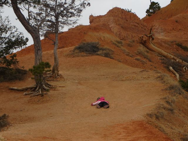
This totally cracked me up! We were almost at the top and Kat layed down on the trail right below the overlook. There was some asian tourists(at the overlook) that looked very concerned!Another great hike in an amazing place!
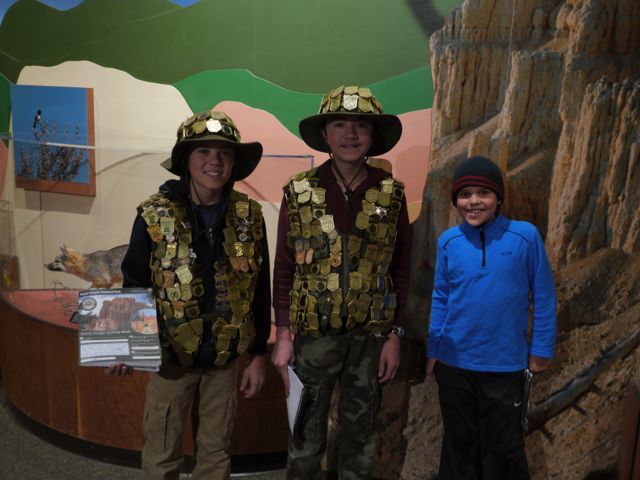
The following day it was 51 degrees in Panguitch. The owner of our campground told us about a way to get our RV cleaned at the local jail. He said the inmates that clean the RVs are only in for minor offenses. Well, our RV was SO Dirty! Had not been washed since Alaska!! We could not beat the steal of a deal(it included wash and WAX), so we dropped our baby off and headed to Bryce NP and Grand Staircase Escanlante National Monument. Time we arrived at Bryce NP it was in the low 30s and snowing! We ate lunch in the jeep again before heading into the Visitor Center. While we were sitting in the jeep, we saw a family walking in and it looked like the 2 boys had on a gold sequin vest, but it was only their 200+ Junior Ranger badges. They have been to alot of places! They are on a 2 year road trip. The husband is able to work from the road.
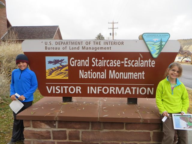
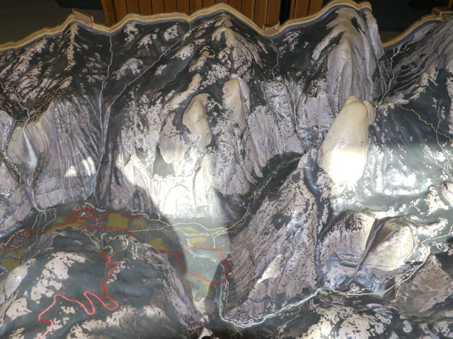
We headed to Grand Staircase Escalante National Monument Visitor Center next(it was about 20 minutes from Bryce). This Monument protects almost 1.9 million acres in southern Utah. It was a great geology lesson!
We were a little concerned since we had to leave the keys…
We met another family that was on a 2 year sabbatical. The 2 boys had over 200+ Junior Ranger badges from National Parks, Monuments, Historical Sites, etc.
The next morning, we woke to some light snow. I had checked the weather, so we were leaving Bryce to miss the snow! I guess I should I have rechecked the weather that morning.
Woke up with some light snow on the ground. Planned it so we would be heading out of the snow!
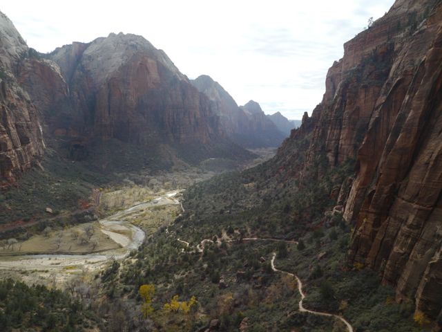
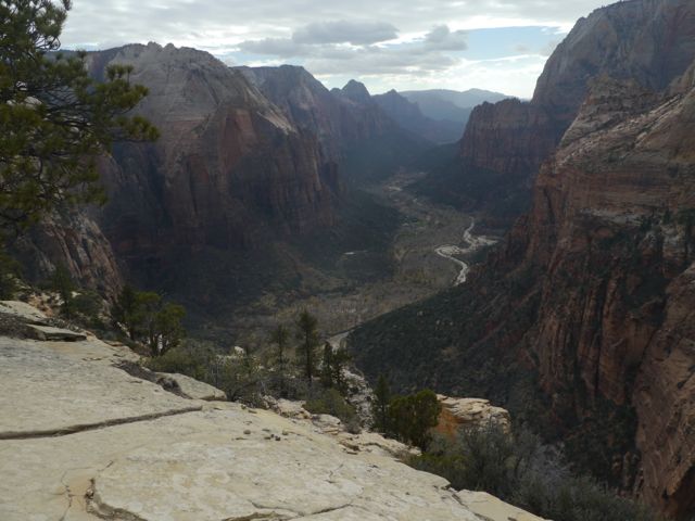
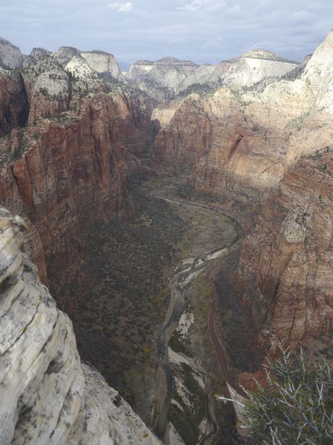
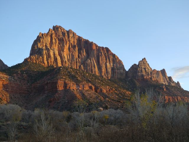
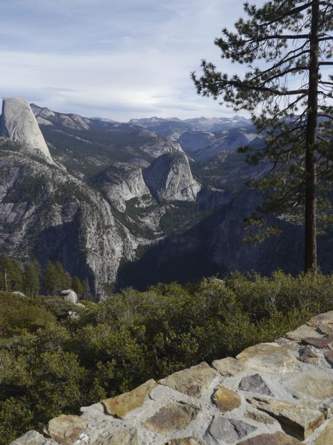
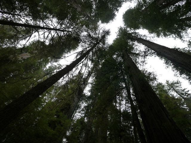
I guess I knew there were several National Parks in Utah. I guess I had visual expectations for Arches and Bryce Canyon. I had no idea what Zion was about. That’s partly why it’s now solidly in my “top 5”, and maybe as high as 3rd after Glacier and Denali. To be sure, we had 2 top 5 hikes here.
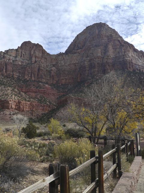
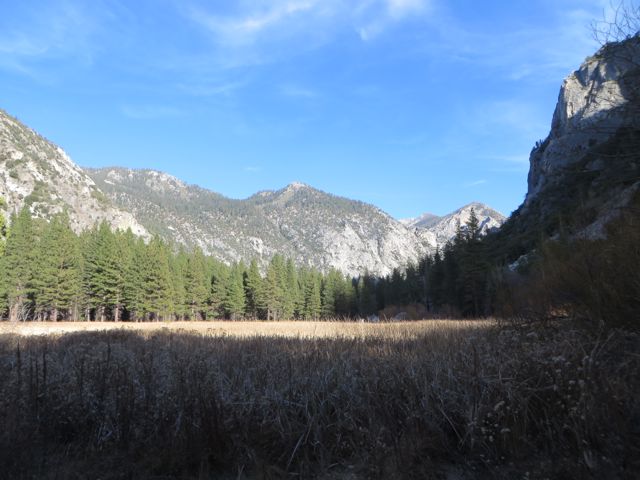
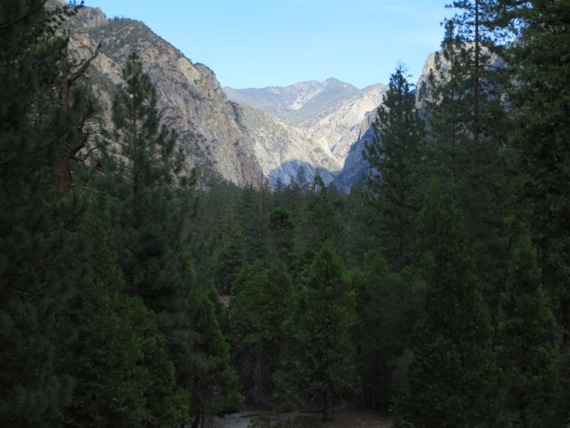
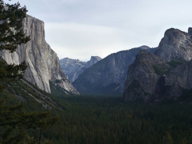
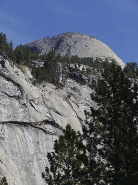
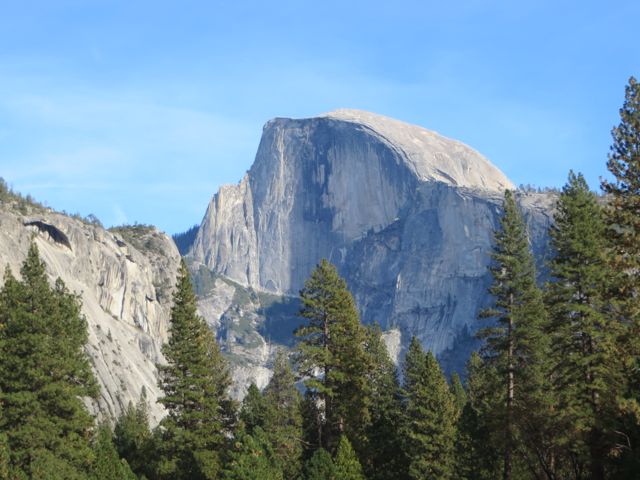
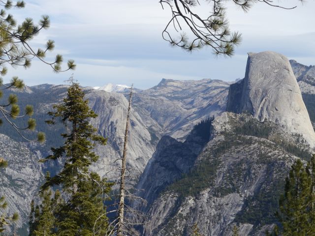
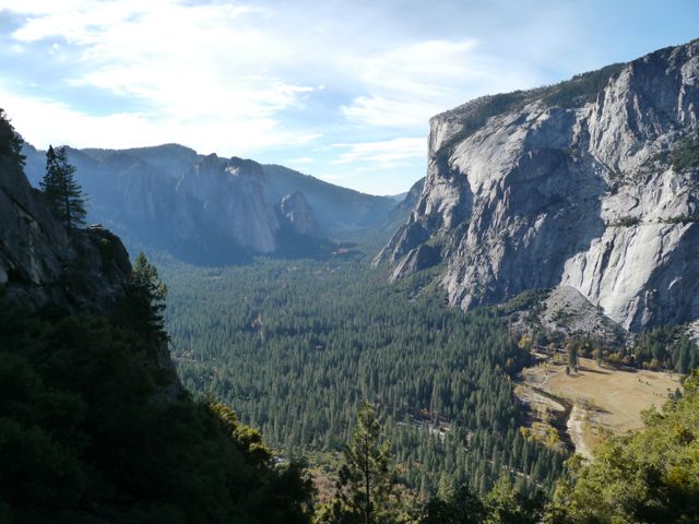
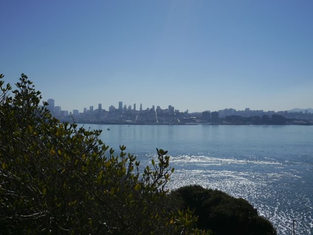
Zion is essentially a more approachable Yosemite. Zion is a Navajo Sandstone canyon carved by the Virgin River. To me, it feels like a smaller Yosemite Valley, but because the vegetation is shorter and more sparse, when you are in the canyon, you are treated to 360 degree views of the rock. It’s amazing. It’s also smaller and “cozier” than Yosemite.
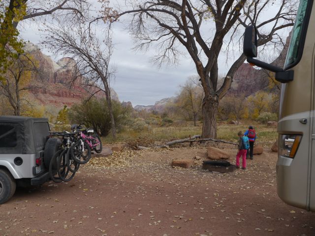
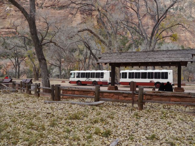
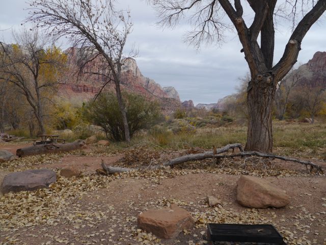
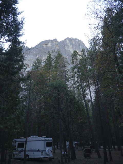
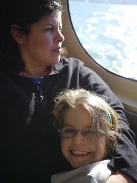
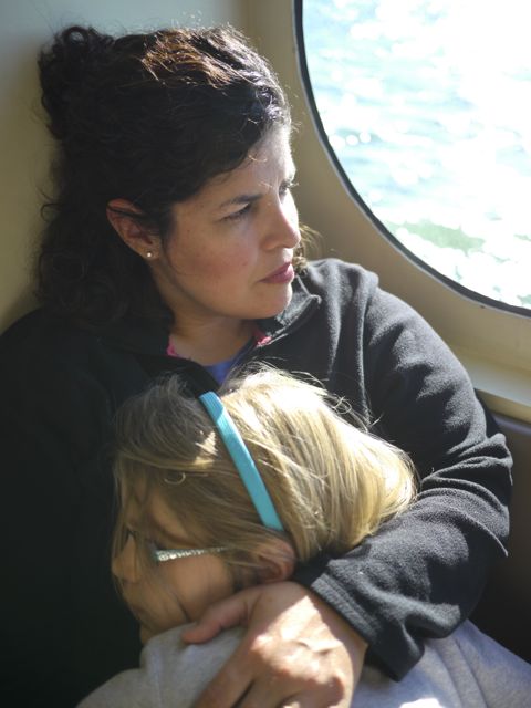
We camped at the Watchman campground, just inside the park, which was great. Nicely sized sites, electricity hookups, great views of the canyon, plenty of wildlife etc. Because it was still in season, and we were there over the weekend, we were not able to drive our Jeep into the Canyon until Monday. That simply means that you catch the shuttle at the visitor center (short walk from our camp).
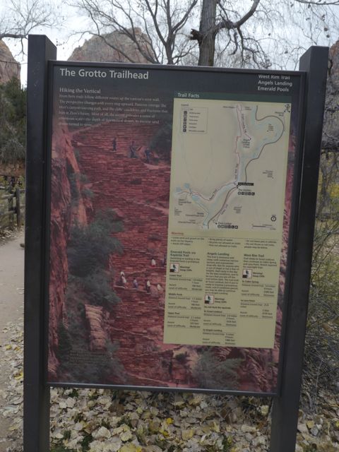
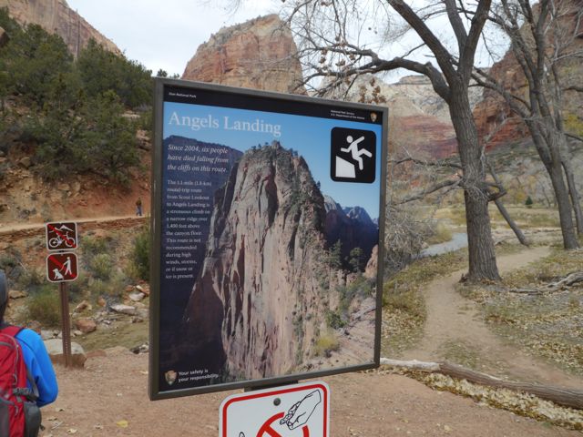
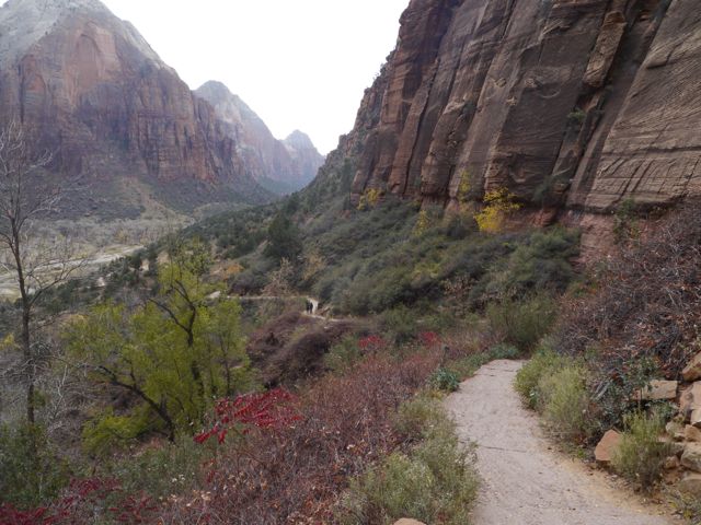
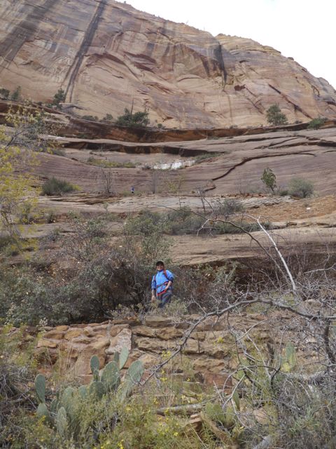
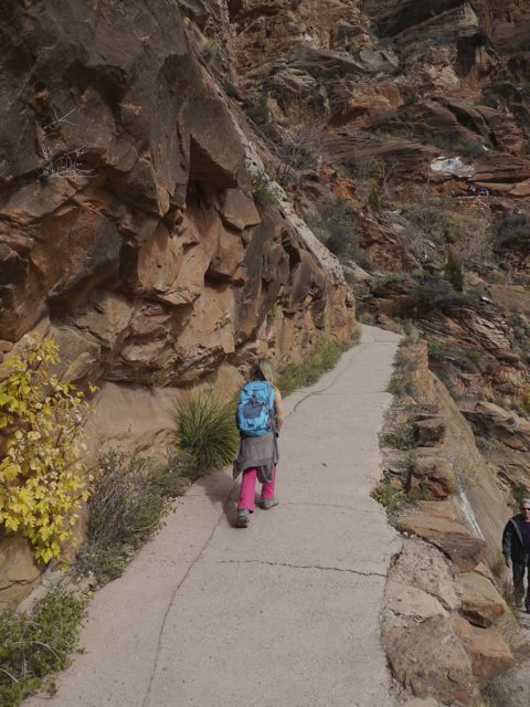
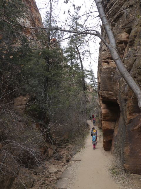
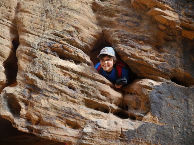
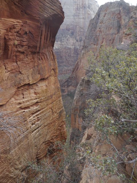
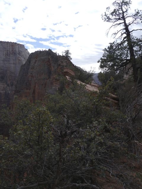
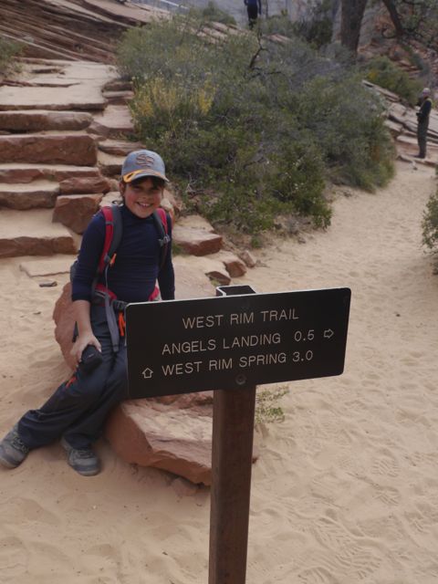
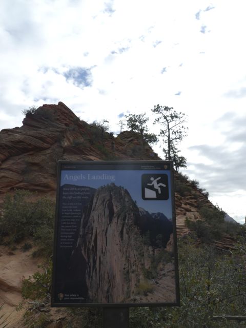
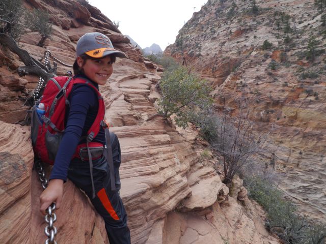
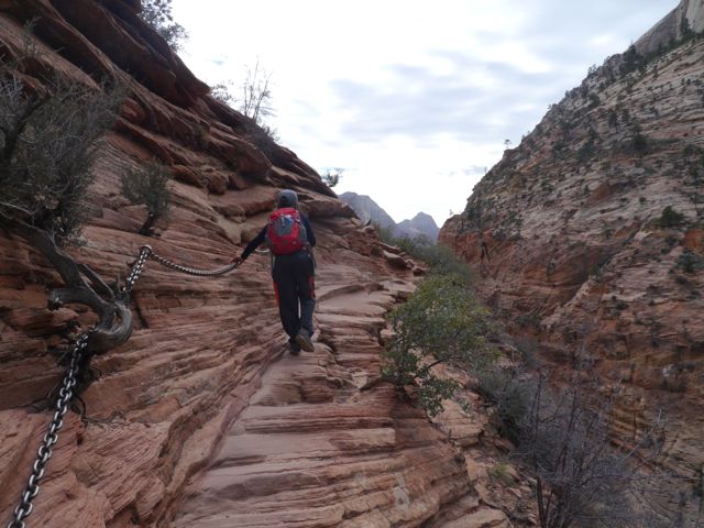
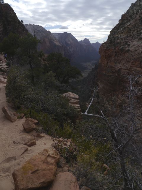
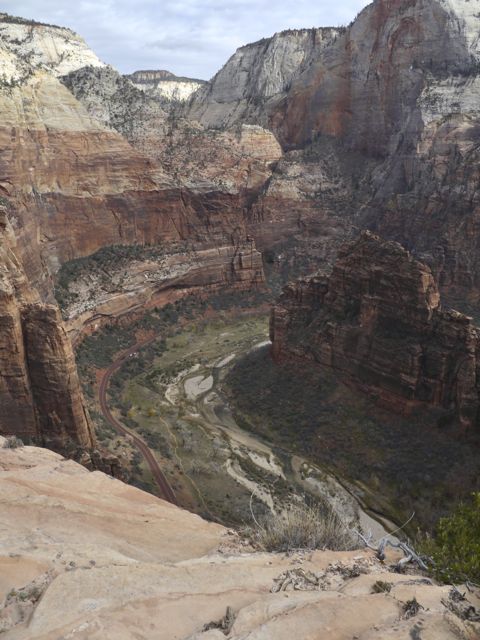
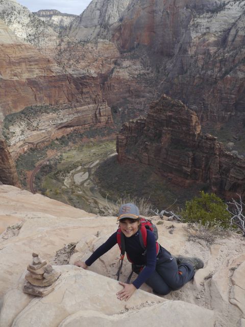
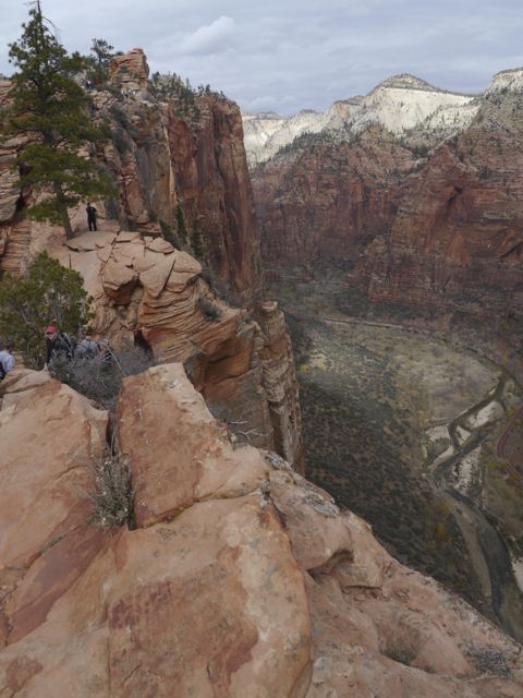
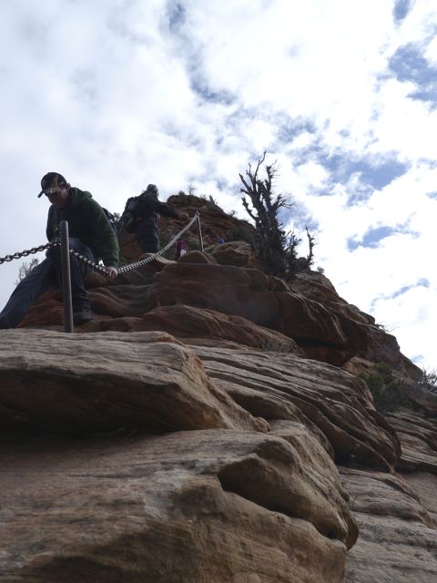
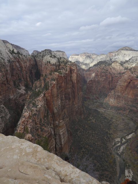
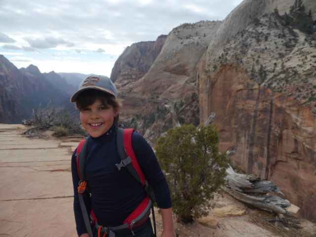
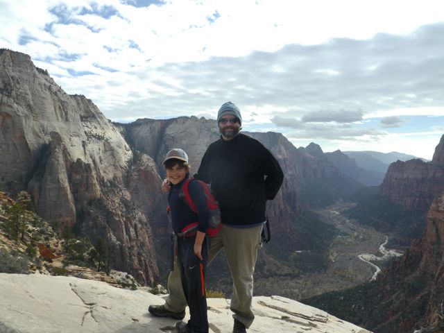
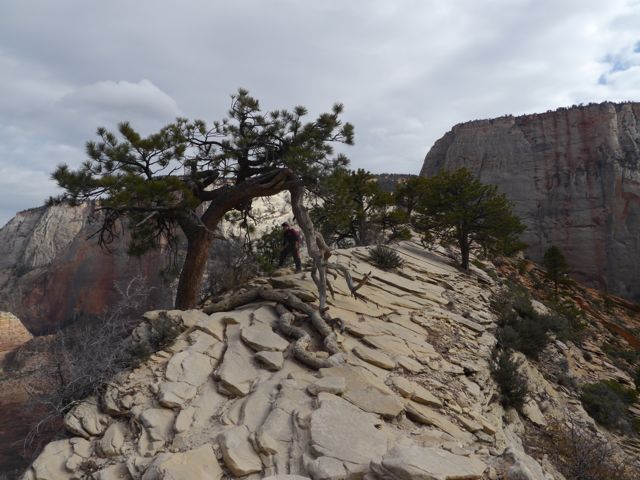
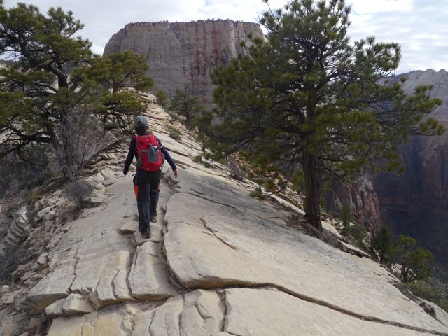
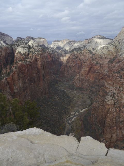
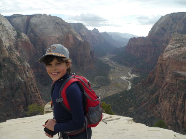
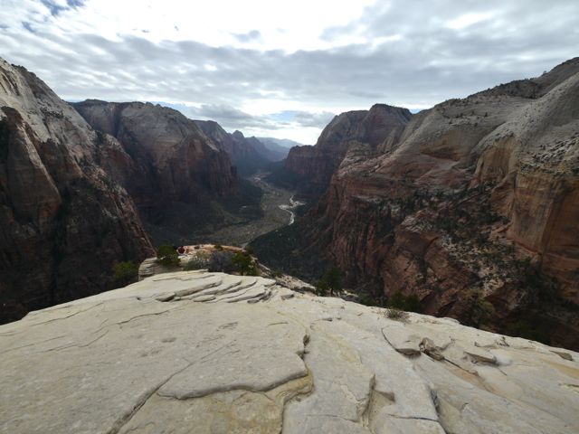
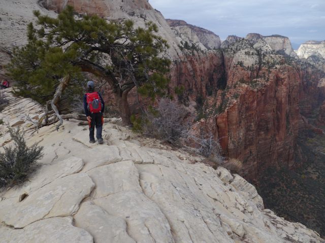
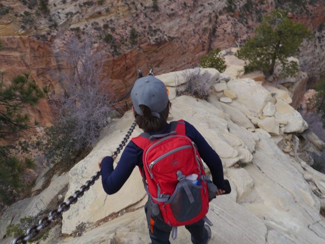
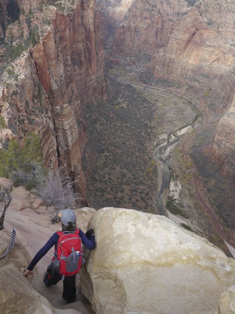
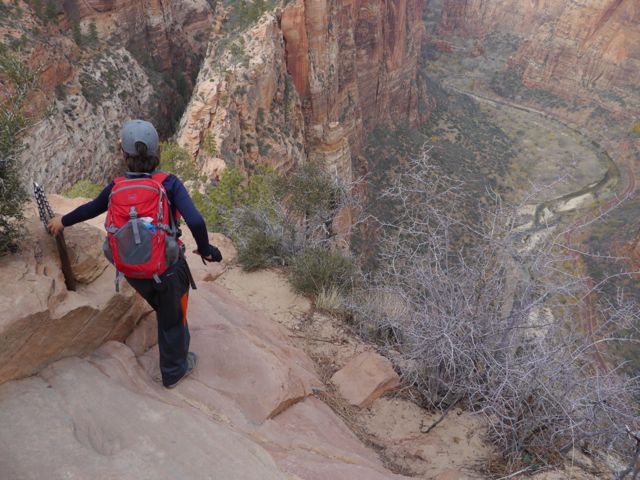
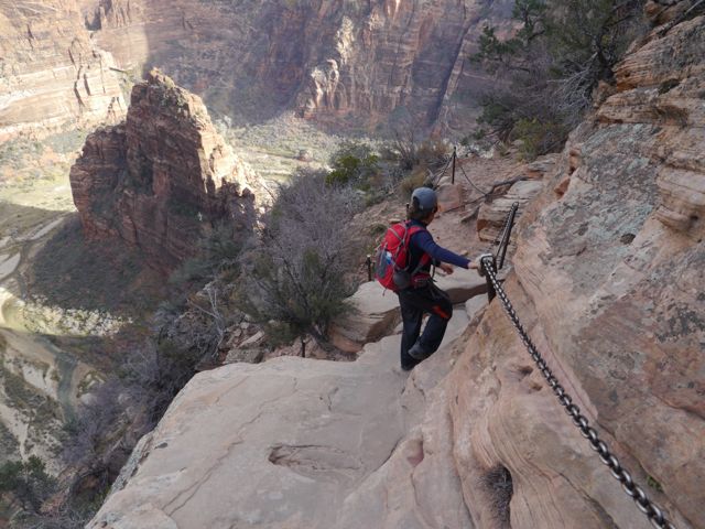
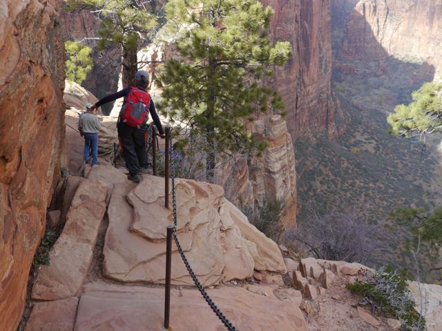
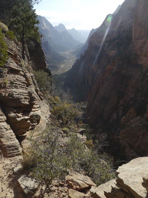
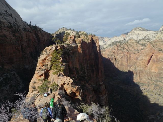
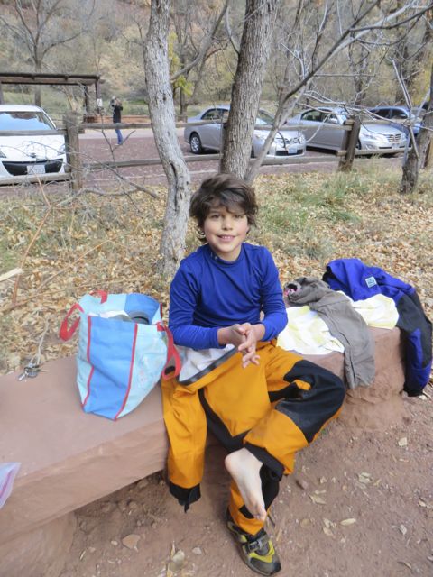
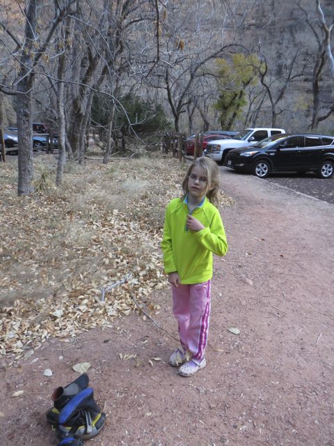
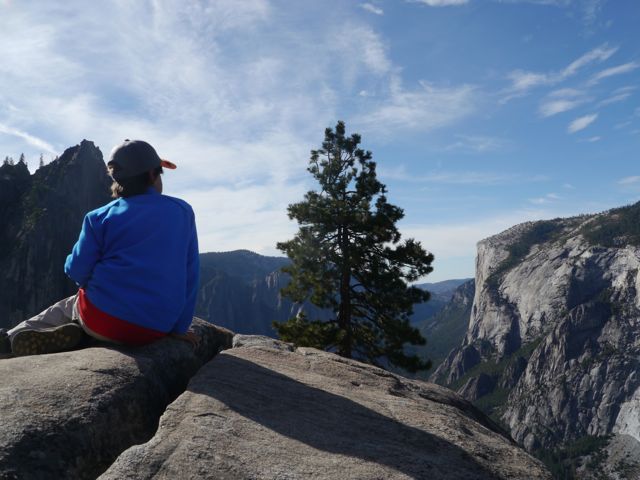
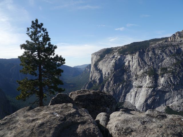
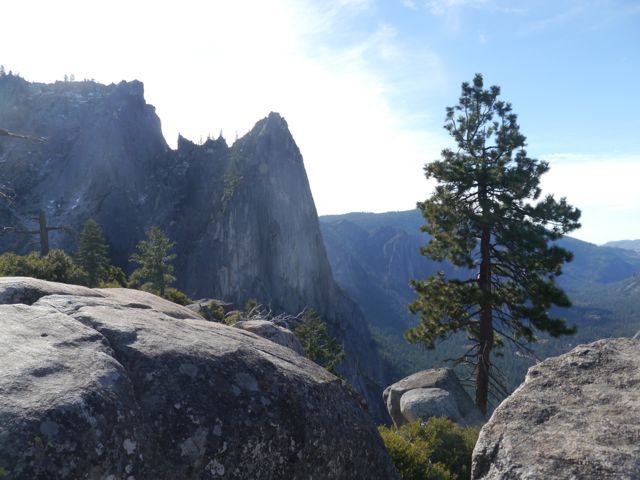
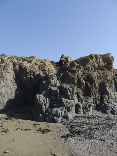
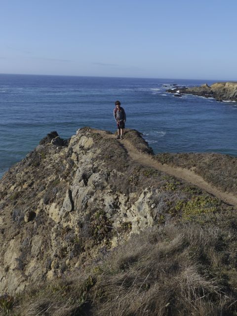
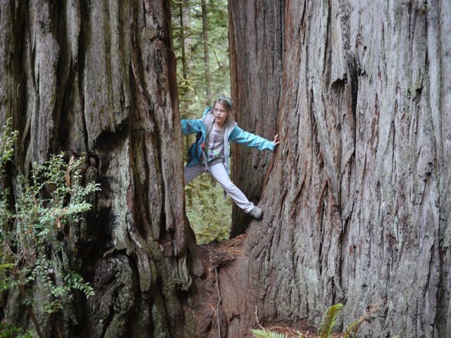
We spent 3 days here, and it was amazing. Day one: did the visitor center (kids got Jr Ranger books, and we watched the video), then rode the shuttle to the “Grotto Trailhead” stop. We ate our lunch there, and did the “Angel’s Landing” hike. It was quite a climb… 1500 feet up. The first 1/3 is pretty steep, long sweeping switchbacks, the 2nd third (thankfully) is relatively flat trek back through a slot canyon), and the last 1/3 is quite a steep set of switchbacks (21 of them). Actually, then the last 1/2 mile is steep climbing on mostly unimproved rock, with just a chain to hold.
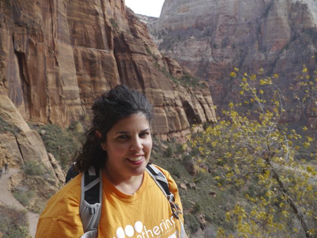
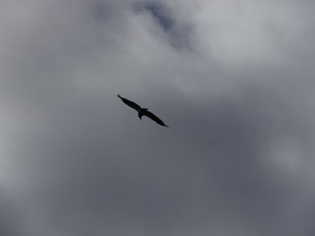
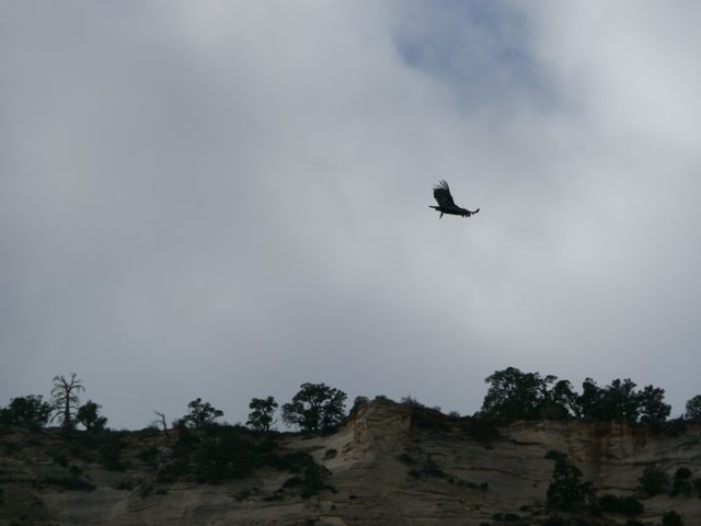
Kane and I did the entire thing, the girls stopped prior to the last .5 miles up to the landing. I was pretty beat when we got started on the last 1/2 mile to the landing, but I didn’t notice it, I was running on adrenaline! Kane had no problem doing this hike, but he’s a great climber, and (mostly) careful. When we got to the top of the landing, we finally saw our first California Condor overhead. These guys are endangered (~200 in the wild), and have an amazing 9 ft wingspan. This hike was an amazing experience for all of us.
Gallery of Angel’s Landing Hike:
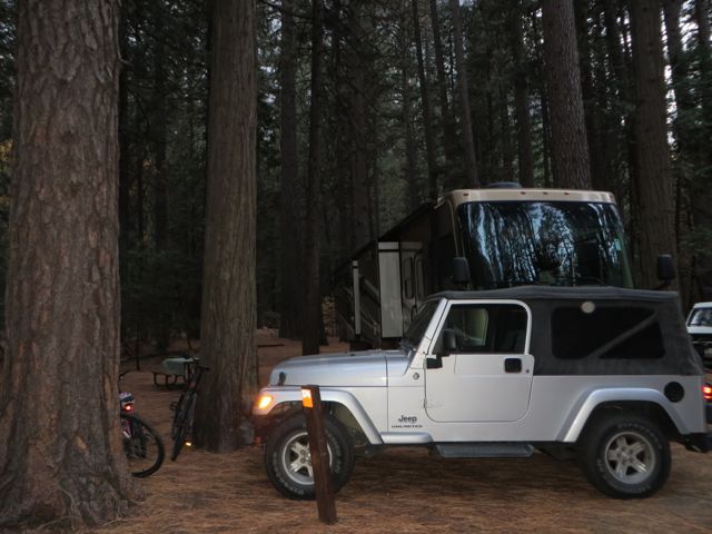
Can’t beat this campsite! They closed the loop behind us, so it was very private. Electricity is much appreciated too!
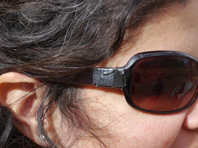
Broken glasses? No problem. 1001 uses now.
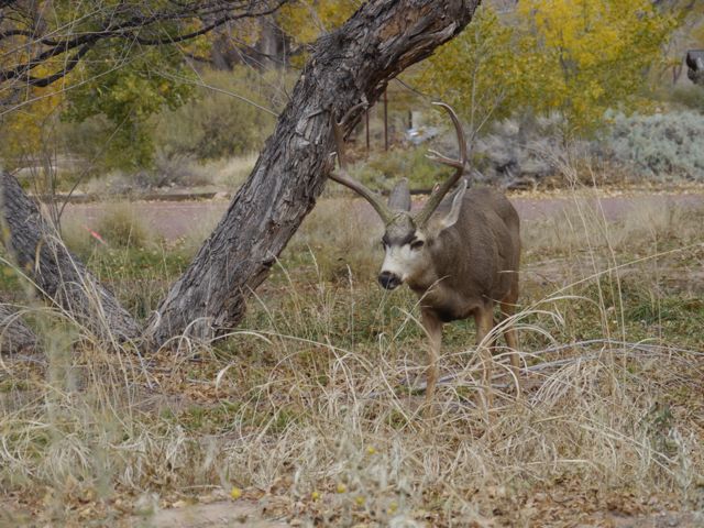
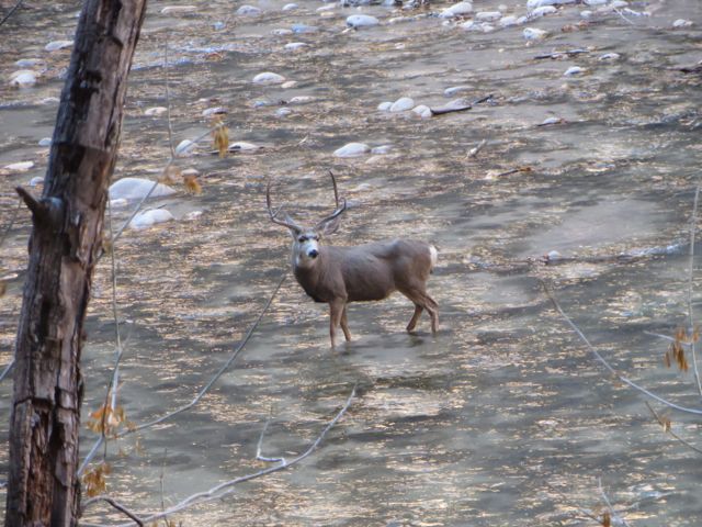
Mule deer are rampant in here.
If NPs can be photogenic, Zion is.
On the weekend, there was no auto traffic in the canyon, everybody has to ride the tram.
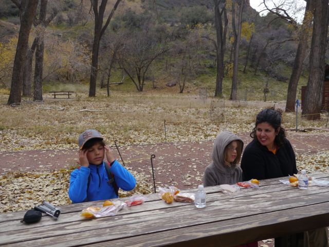
Lunch at the Grotto Trailhead.
A couple of hikes launch here, but only one is calling our name.
Love the graffic of a guy falling off the mountain. This is a MUST do hike if you come here, but it is a steep climb.
Barely up the trail, looking back. The breathlessness floods back with I look at these pics.
LOTS of switchbacks on this one… at least 21 I think and their named “Walter’s Wiggles”
Rare Kim sighting, in her Gathering T
Typical of the first 1/4 of this hike. It’s 80% uphill.
Looking back again, we can see a little more of the canyon.
This slot canyon section is the only relatively flat part of the hike, and was much welcomed
Peek
A-Boo
Can’t even describe the views, unreal.
Loooking through the slot.
Decision Time!
And another graphic of a guy falling! This time it’s for real!
Not much of a trail, kind of like a social trail, with a heavy chain fastened to the hillside.
Views keep getting better, but watch your step!
Virgin river below, and probably a few sacrafices made from up here too
Looking back on the ridge we crossed
This is typical of the last .5 miles of this. Not for the faint of heart.
Even tying his shoes, Kane can’t help himself from the view
At the top, we made it!
Had to have someone take this.
Coming back, across the ridge.
Kane was very cautious and responsible on this hike, he did great.
They’d been waiting all day to see a California Condor. He showed up just after we got to the end.
I hope you enjoy these, I re-strained my back trying to get them. Seriously, the hike didn’t hurt me, but photographing the darn condor did.
You have to see this place!
So proud and happy!
Coming down was not as bad as I feared coming up. Thank God for the chain though.
Carrying the camera down, probably not the best idea, but, no way I’m missing this.
We’re back on the normal trail again, and suddenly everything looks different!
Back in the slot.
Great view of the start of the wiggles.
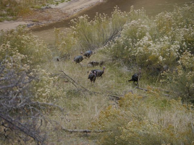
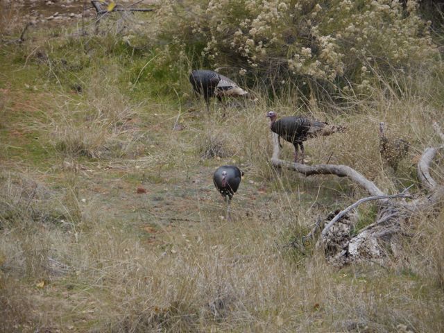
Wild Turkeys hanging by the river.
Hens
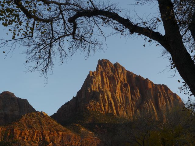
I love the hour before sunset in the desert!
Our backyard for our time there.
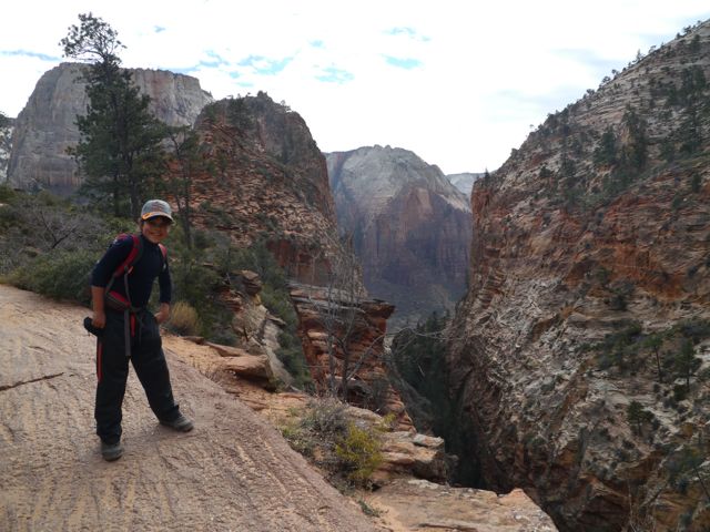
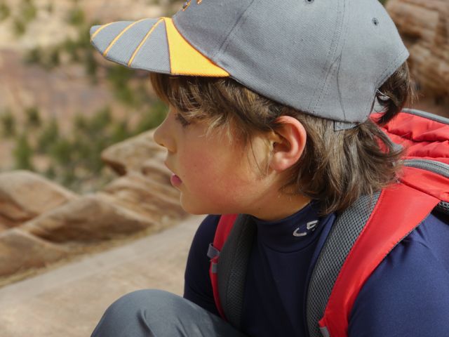
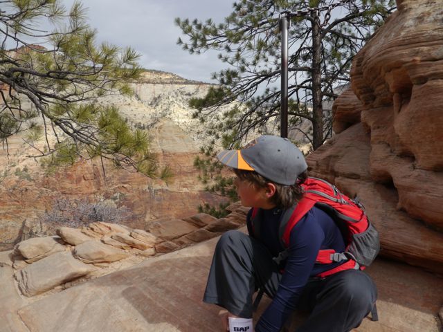
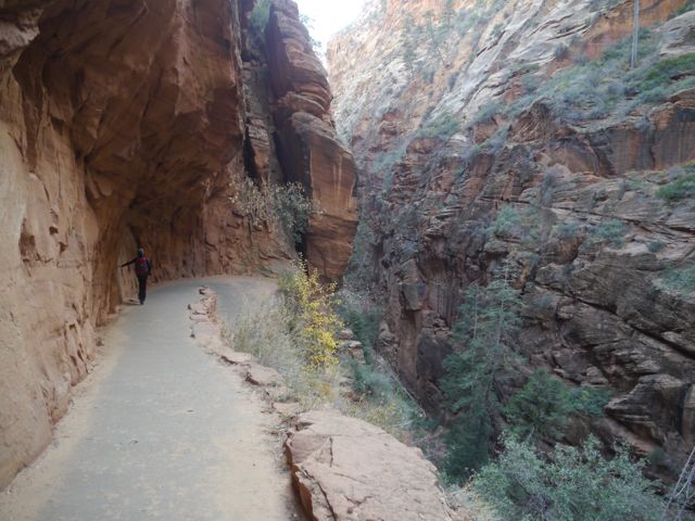
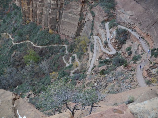
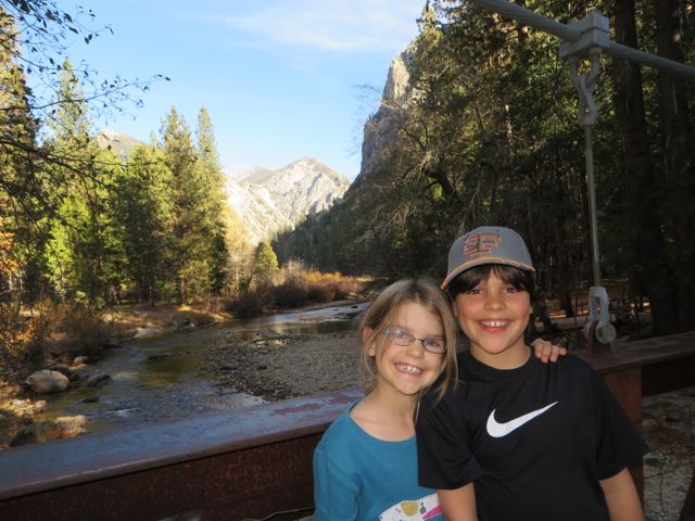
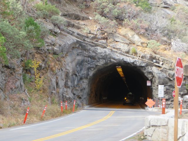
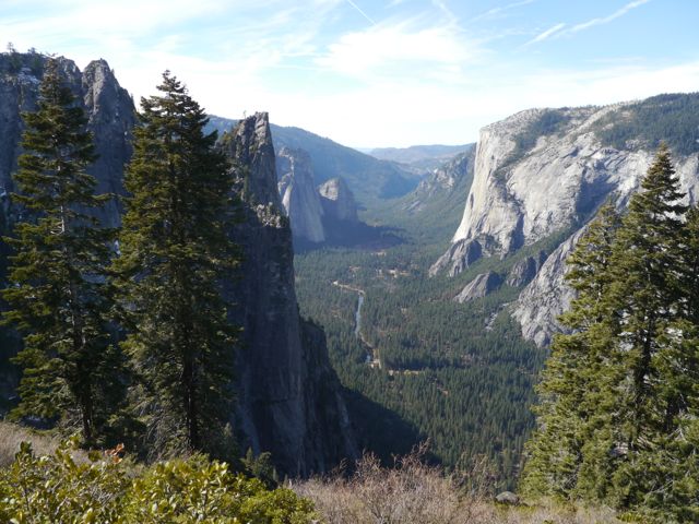
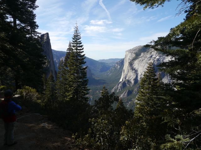
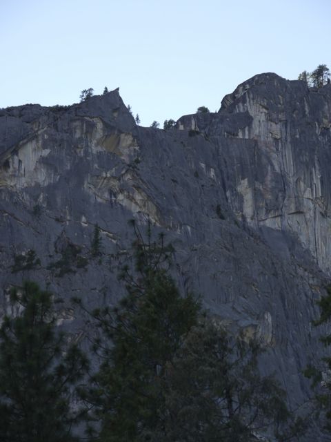
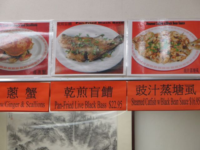
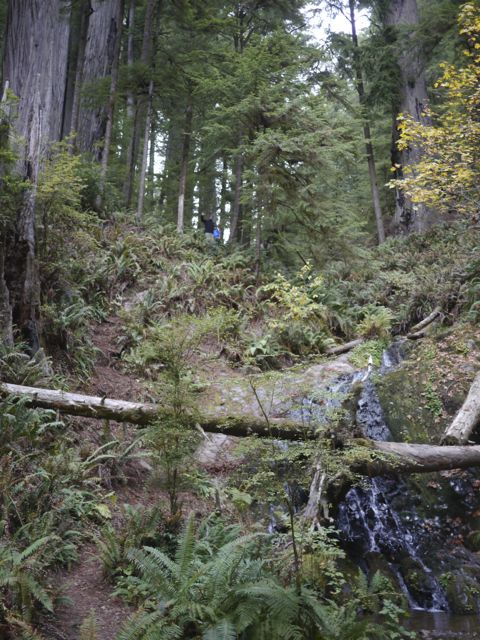
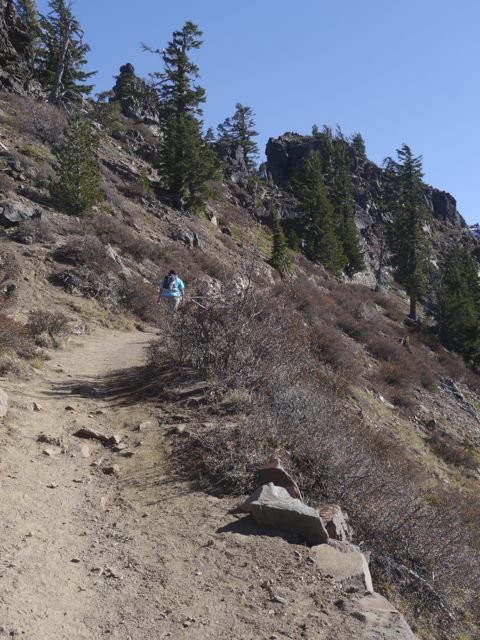
The next day, we did school in the morning, and drove over to the east side of the park to do another shorter hike… to the observation deck. It was a nice little hike with great views. One thing I really enjoyed about it was the drive over. There’s a pretty winding road over, and then a tunnel through the rock. The tunnel is listed as 13 ft, 1 in in the middle (it’s arched). I had been told that our RV was 13 ft 6 inches tall. Coming over allowed me to scope out the road and tunnel, in advance of potentially taking it out of the park. This tunnel (Zion Mt. Carmel tunnel) is simply the best, by far, way to get from Zion to Arches/Canyonlands. More on the tunnel later.
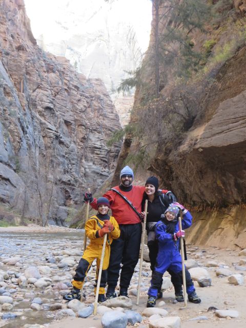
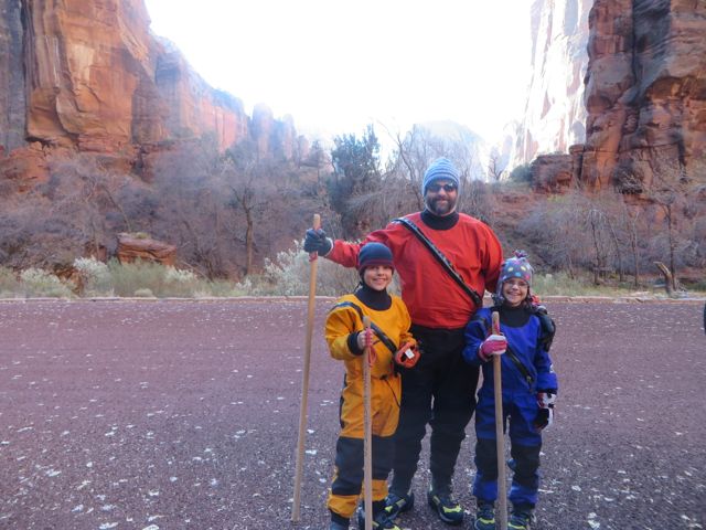
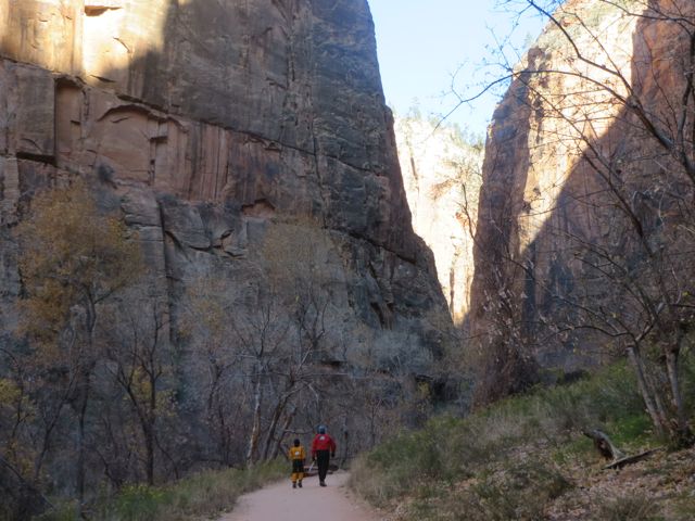
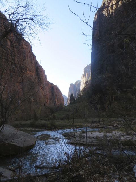
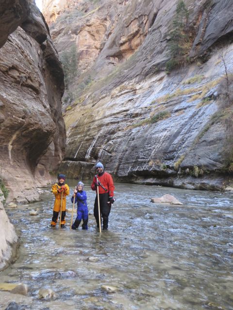
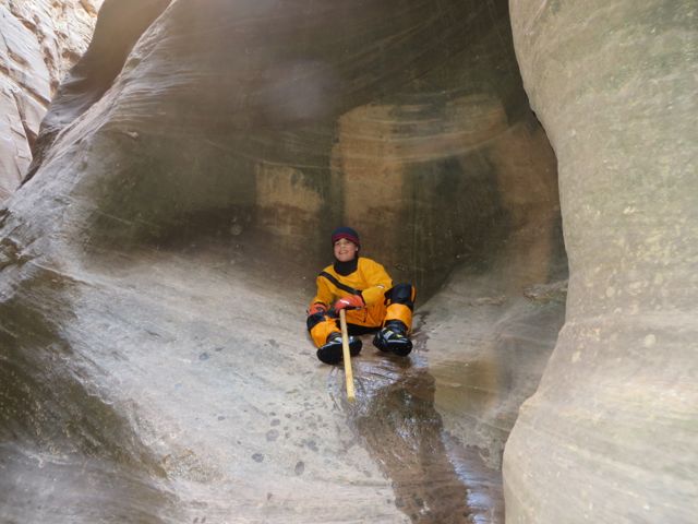
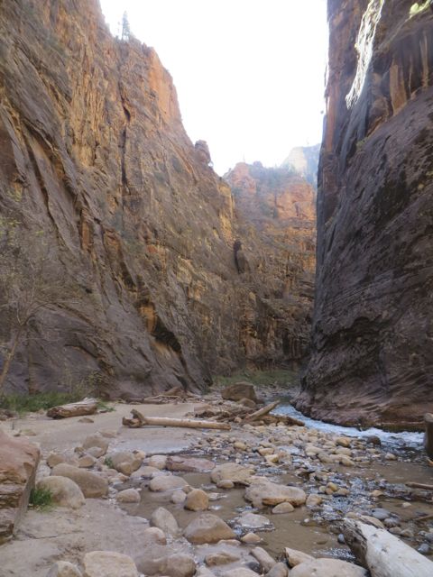
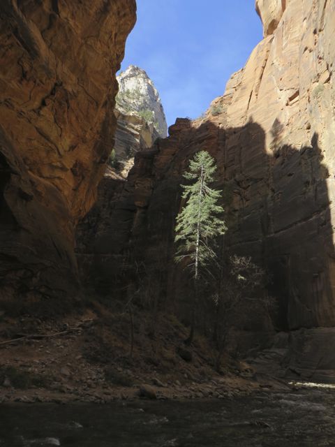
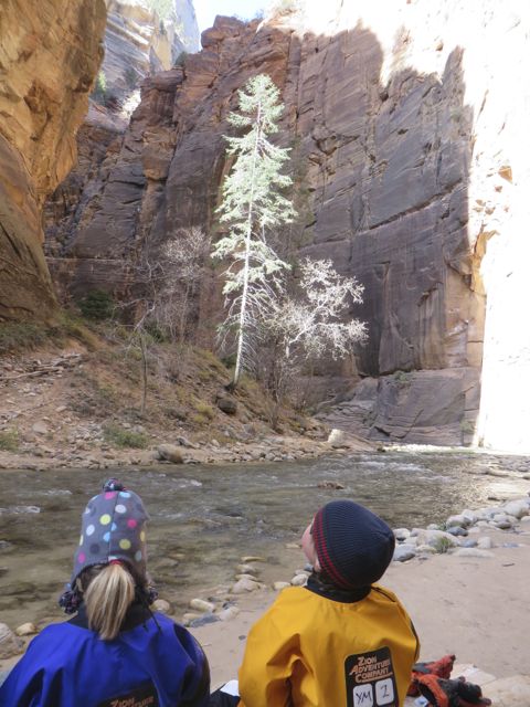
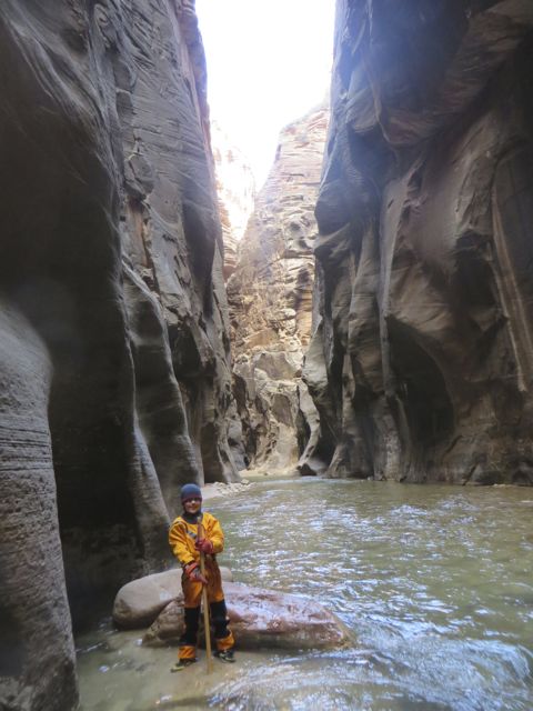
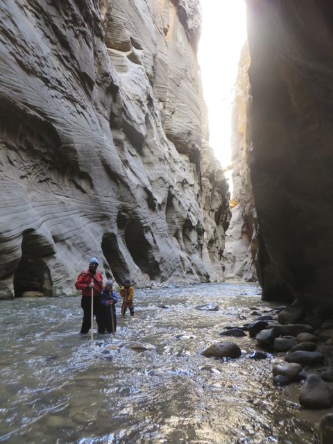
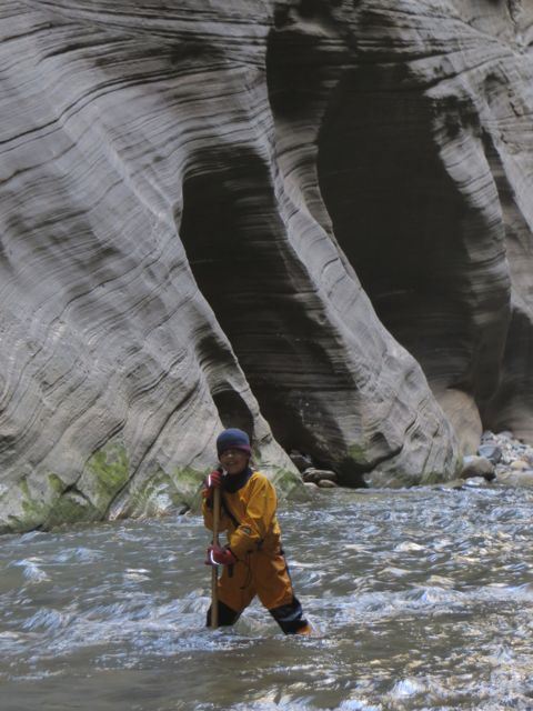
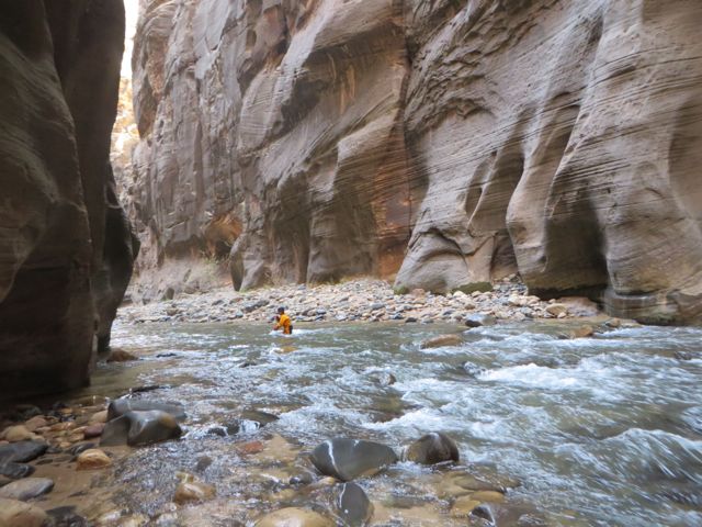
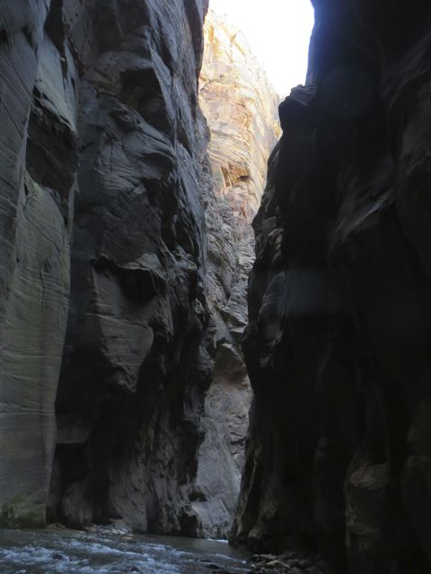
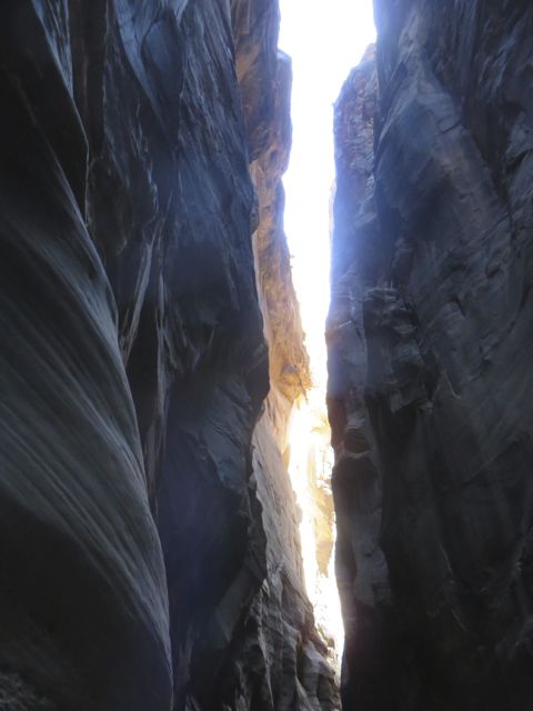
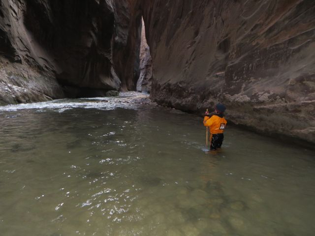
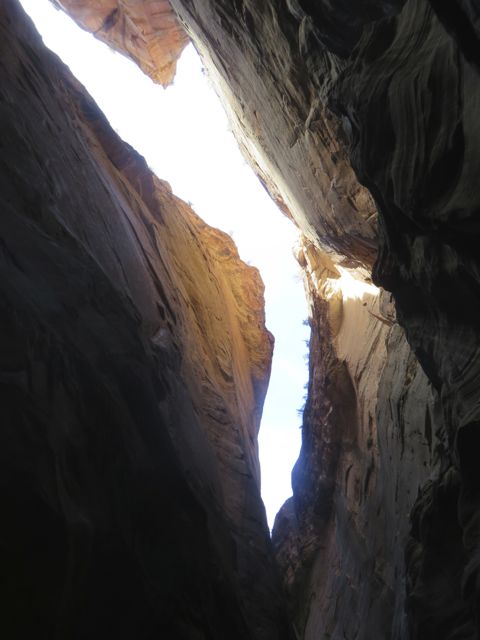
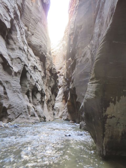
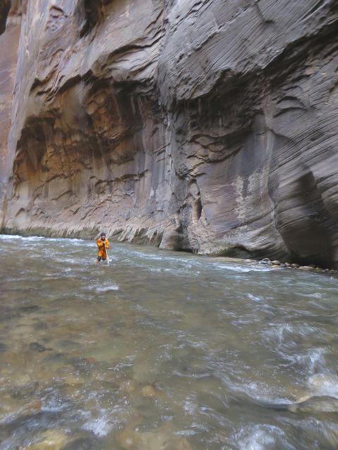
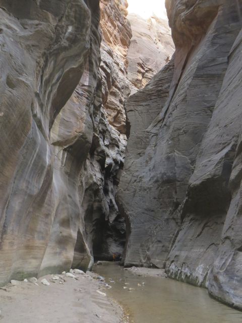
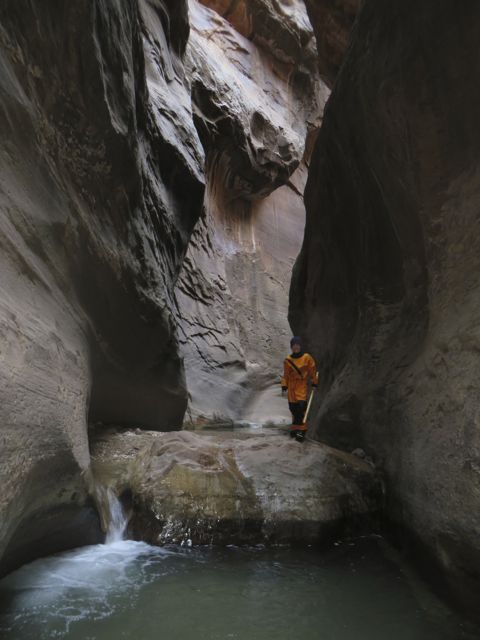
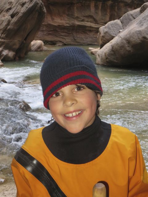
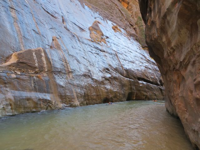
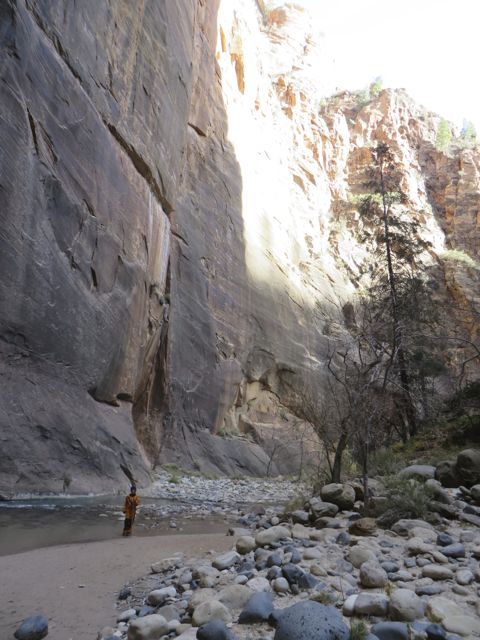
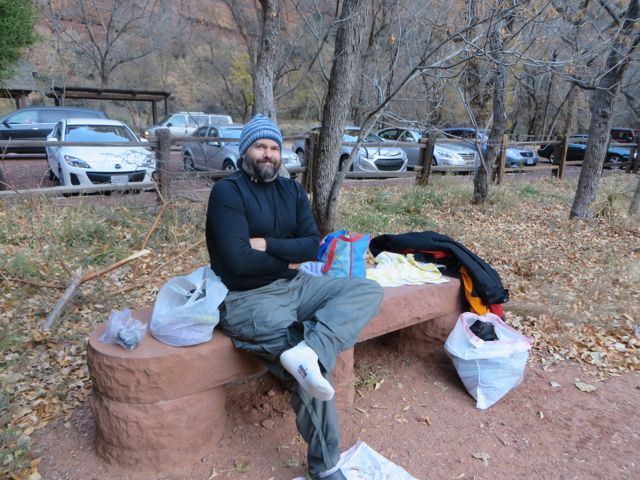
The third day was epic. Ever since we saw our first picture of the Narrows hike at Zion, we’ve (especially Kane) have wanted to do it. The Narrows is a slot canyon at the North end of Zion canyon. It runs anywhere from 10 to 15 feet wide and up to 2000 feet tall. It’s absolutely stunning! The main challenge with hiking the Narrows is that in most places, the only place to hike is in the Virgin river. That may be a mostly welcome environment in the heat of summer, but it’s late November now, it’s 50 out and the water is 40 (degrees F).
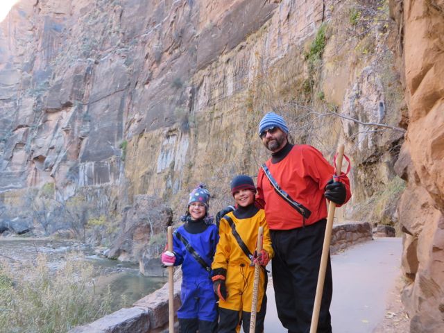
So when I found out we would need to rent drysuits, walking sticks, and special water hiking boots (to the tune of 200-250 bucks) in order to do the Narrows Hike, I really questioned it. Most hikes are free, couldn’t we find a nice free hike (like Observation Point?)? Kane and Kim wore me down, and we rented the gear Sunday night.
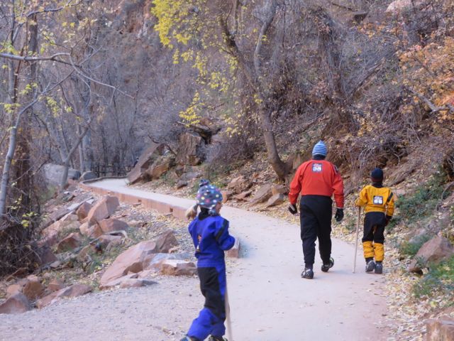
Monday morning, we got up early, got our gear on, and drove out to the “temple” section of Zion canyon (at the very North end). We hiked about a mile on a paved path along the river, then sort of anxiously started testing our water gear.
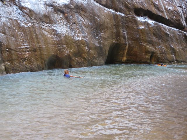
I’ve worn wet suits before, but never dry suits. Immediately, the kids complained that their suits were leaking. I can kind of see why. Any part of your body in the dry suit that is under water, especially, fighting 81 CFM (cubic feet per minute) flows at 40 degrees, does indeed feel wet. It just takes getting used to. Thankfully, we all got used to that feeling, and eventually we reveled in it.
The lady that rented us the gear, said we’d have to make a couple of crossings. She was wrong! Easily half the hike was in the water, we made dozens of crossings, in rapids. Kane led the way, and only needed a bit of help in a couple of deep/fast spots. Kim kept her eye on Kane, and I took Kat. Kat and I did the rapids together, and she did great. I only felt like I was dragging her a few times!
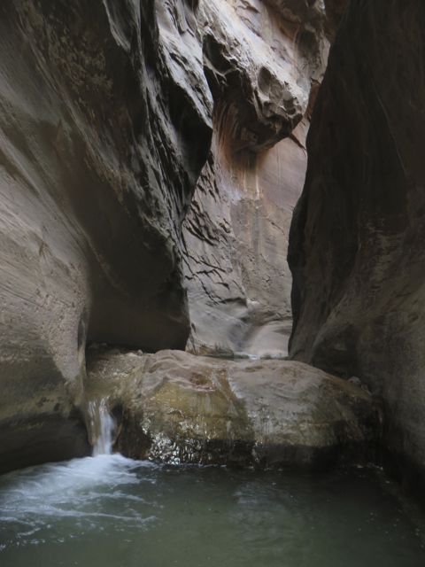
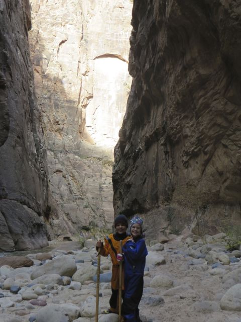
Our goal was to see “Wall Street”, which is the 15-20 wide section of the slot. Right after we hit Wall Street, Kat was cold, and the rapids were getting deeper. We decided to separate. Kane and I pressed on, going probably 1/2 a mile further. It did get a bit tougher, and then ironically a bit easier. We messed around for 45 minutes or so, then headed back to try to catch the girls.
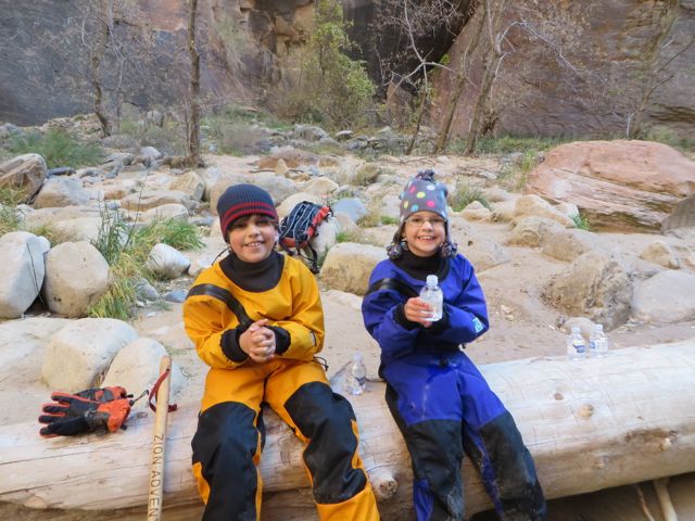
We caught up with them at around the spot were we had lunch (maybe 1/2 way back to the start of the river hike). It was fun to be back together, and soon, Kane had taught Kat his new trick. On the way back Kane had started “floating” back down the river. There were definitely spots where this was best done, deep enough to float, slow enough to be manageable. We had a great time hiking back down the river. It’s actually quite a bit easier to hike with the current!
Anyway, these pics speak for themselves. I didn’t have my DSLR, only Kim’s Point-n-shoot, but you get the idea. This was one heck of an experience for us all!
Gallery of Narrows Hike:
We all felt like space men in our dry suits.
1 mile of this.. plenty of time for doubt!
Love this place!
An omen? We saw this guy make a crossing.
It’s close to go time!
Looking back down the canyon
Whole family of space men!
Here we go…
Lunch
View from lunch spot
Side canyon (another river)
Floating!
Back!
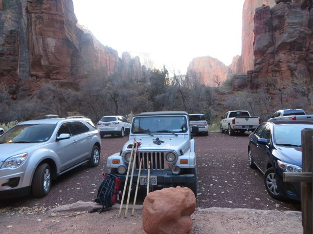
So Zion blew me away, and we did decide to take the Zion Mt. Carmel tunnel. I looked up our RV height on the internet, and it was listed as 12 ft 10 in. This left us 3 inches clearance, what could go wrong? So, we had to pull out of the park and back in, to buy a pass for the tunnel. They actually have to stop traffic for you, you can drive down the middle of the tunnel (it has curves too!). There were some “white knuckles” going through that tunnel, but we made it!
Well, we have gotten behind on our blog. We have been running from one National Park to another. I wish I could go back in time and thank the people that fought for these beautiful, amazing places! Look for Zion, Bryce, Canyonlands(snowstorm!) and Arches post soon…
It seemed crazy that we had to drive almost 400 miles from Sequoia to Death Valley National Park, since if we went straight east over the Sierra Nevada Mountains it would take us right into Death Valley. Unfortunately, there is no road running over the mountains from Sequoia. Luckily, we were mostly on the 4 lane highway.
We were able to camp in Death Valley at Watchman Campground, which made it very convenient. We dry camped(which means we did not have hookups for electricity and water), so we had to use the water in our tank sparingly and could only use our generator for electricity during specific generator hours. Here are some highlights from our time here:
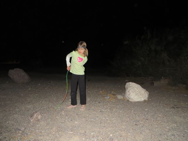
We started our first night with a fire. It was in the high 60s and was just beautiful! We enjoyed watching Kat dance with glow sticks. It was too funny! You had to be there to appreciate it.
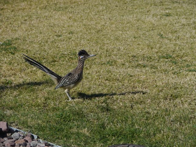
Can you see the glow stick?Kat also was wearing a headlamp. Very entertaining! We love the National Park Visitor Centers! Great info and kids get their Junior Ranger books.Leaving the visitor center, kids were excited to see a Road Runner.Gotta take the windows out since it is 80 degrees!
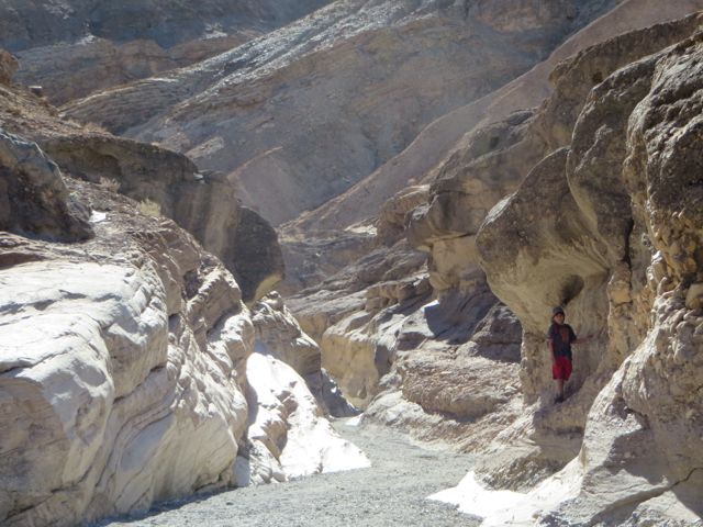
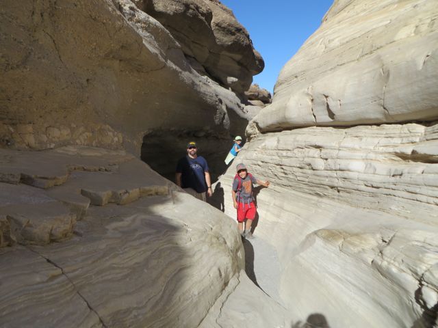
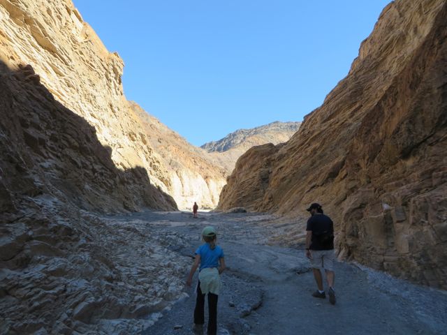
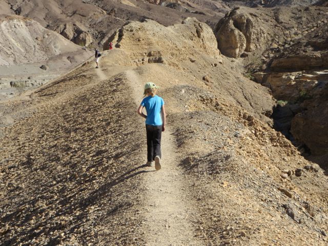
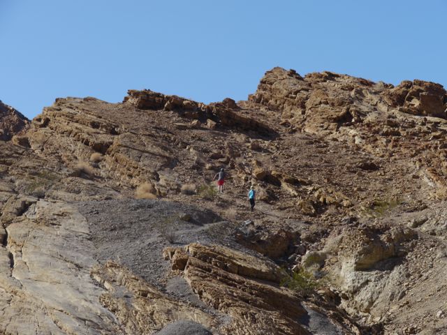
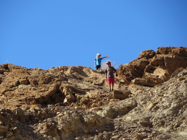
Headed to Mosaic Canyon for a hike in the marble polished canyon. Very cool slot canyon about 1/4 mile up trail. Kids climbed up to the top of a hill together and were so proud of themselves. Such great bonding! Love it!!
Cool Marble wallsHeaded up into Mosaic Canyon
Hiking Break!
Kane and Kat hiking up a hill together.They made it to the top!
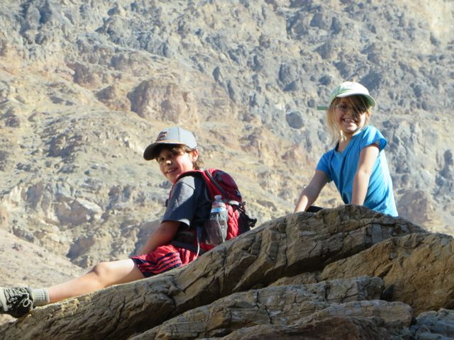
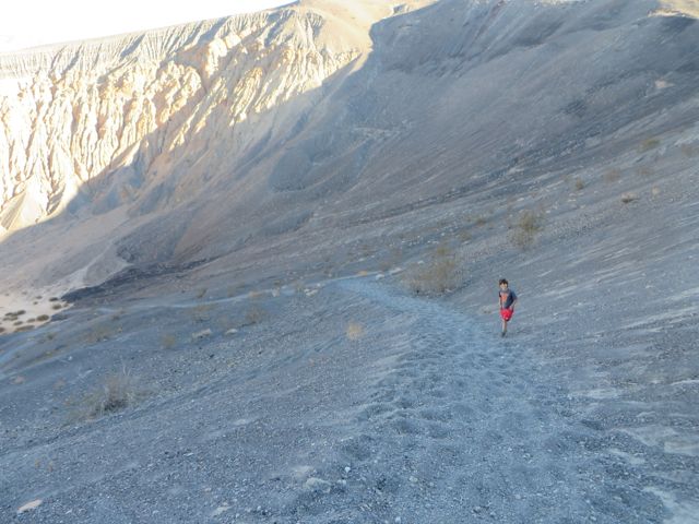
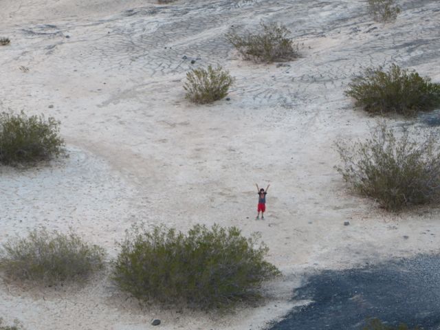
Next we headed north, drove by Scotty’s Castle then on to Ubehebe Crater. Kane wanted to hike 600 feet down into the crater, so down we went! He was so excited to be in a crater!!
Kane hiking down into the crater.Kane made it to the bottom!Cool sandstone colors!
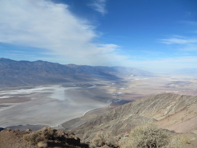
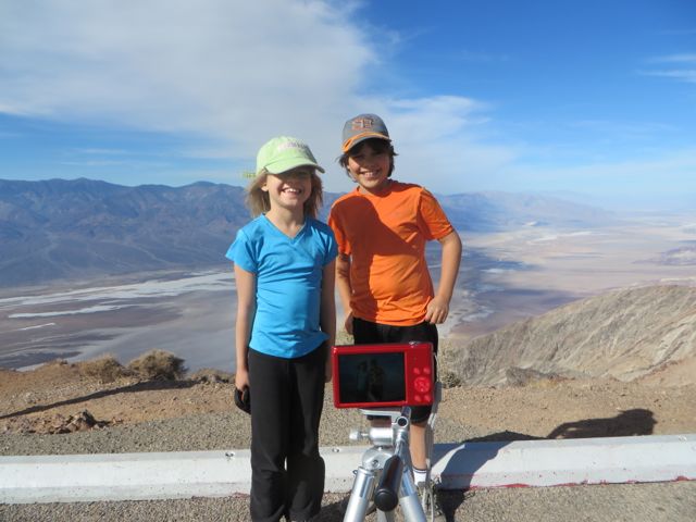
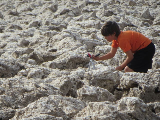
Day 2-We drove up to Dante’s View(5,476 ft.) which is along the crest of the Black Mountains overlooking Death Valley. On clear days, you can see the lowest(Badwater Basin) and highest (Mount Whitney in Sierra Nevadas)points in the continental US from this overlook. We could only see the lowest point on this day. Kane was excited to use the tripod Scott lent him!
View from Dante’s View. See the salt flats?Kane was excited to set up the tripod and timer to take a pic.
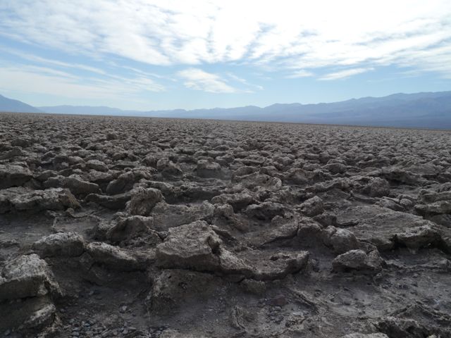
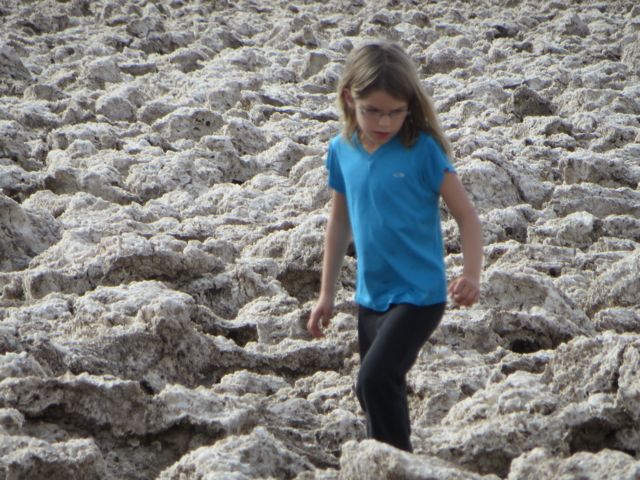
Then we headed to Devil’s Golf Course, which is a large salt pan on the floor of Death Valley.
Devil’s Golfcourse
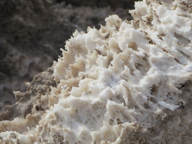
We had to walk carefully, so we did not trip and cut ourselves on the sharp salt chrystals.
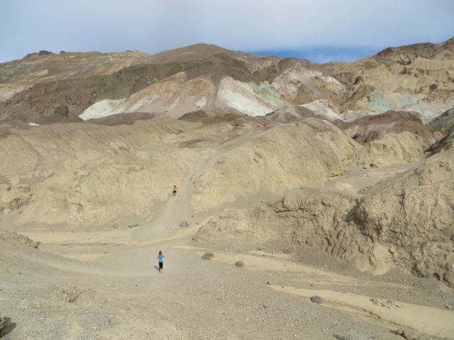
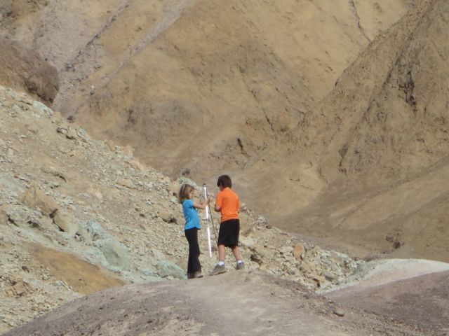
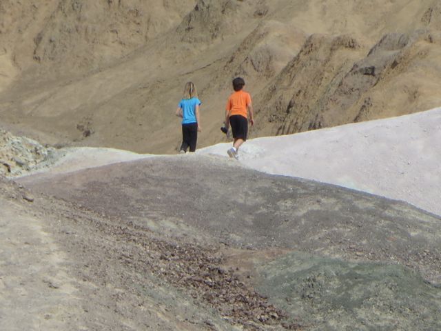
Artist’s Palette Drive-Multi colored volcanic and sedimentary hills. Kids wanted to hike the trail together, so we sat and watched them.
Headed down the trail
Kat helping pack up the tripod.They were so excited to hike alone together.They spotted a lizard!
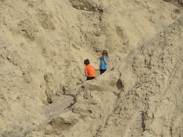
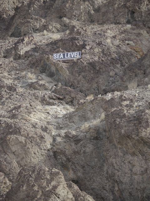
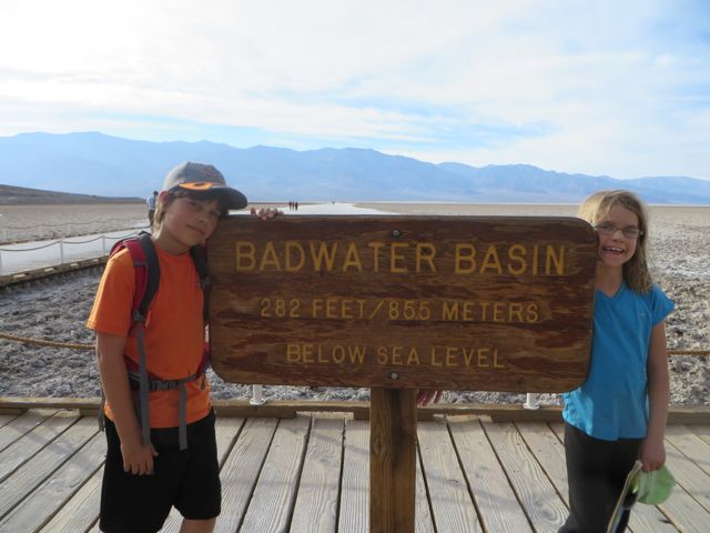
Then on the the lowest point in the continental USA(282 ft. below sea level). We attended a Ranger program here about water in Death Valley.
See the Sea Level sign on the side of the mountain?Kane was hot and ready to go cool off.
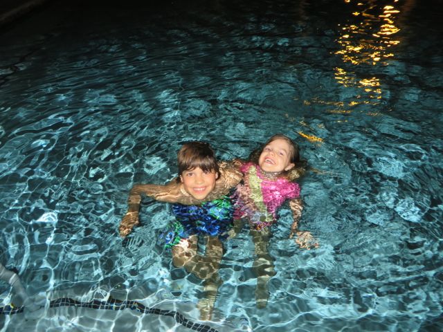
We ended the day buying a pass to take a shower at the Ranch of Furnace Creek! We were so excited to find out that we could use the pool also. The pool is spring fed, so the warm water felt perfect. The hot shower afterwards capped the night off!! We don’t get these in the RV(only so much hot water and can’t take too long or it fills up the tank).
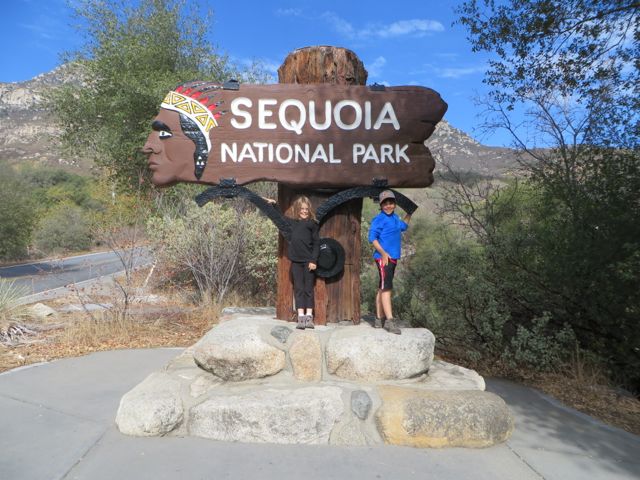
We headed south to Sequoia and King’s Canyon National Park after Yosemite. We stayed at Sequoia RV Ranch about 4 miles from Sequoia National Park entrance. Unfortunately, the campground in the park did not have sites big enough for our bus(we need at least 45 feet in length), but it was nice to have hookups(water, electricity and sewer) since we dry camped in Yosemite.
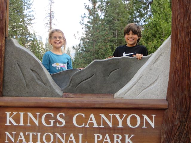
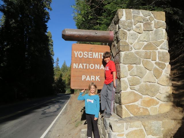
Gotta have our pic with the sign!
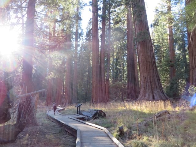
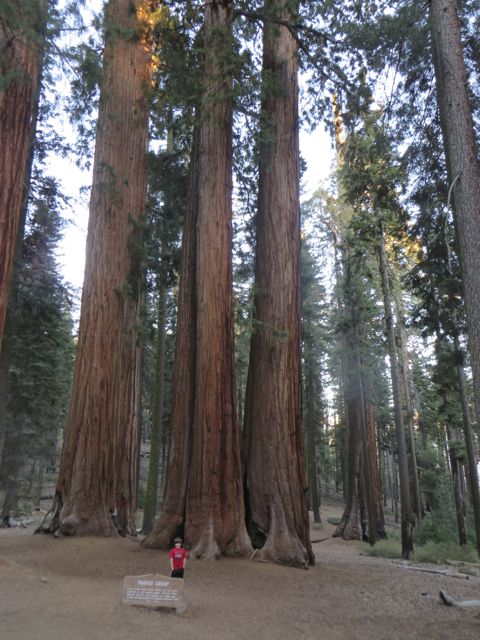
We started our first day at the second oldest National Park, Sequoia. We stopped at the visitor center and looked at the exhibits and our kids picked up the Junior Ranger books then we headed to the Giant Forest Museum and the Big Trees Trail. We were so surprised that we started in the foothills at about 1700 feet elevation and as we followed the road up the mountain to the Giant Forest Museum and Big Trees Trail how the landscape changed to coniferous trees around 5,000 ft. We visited the museum and attended a ranger led program then we did a short hike through the Big Trees Trail.
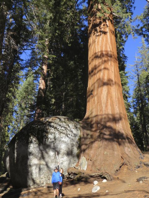
Walking along Big Trees TrailThe sequoias are huge!
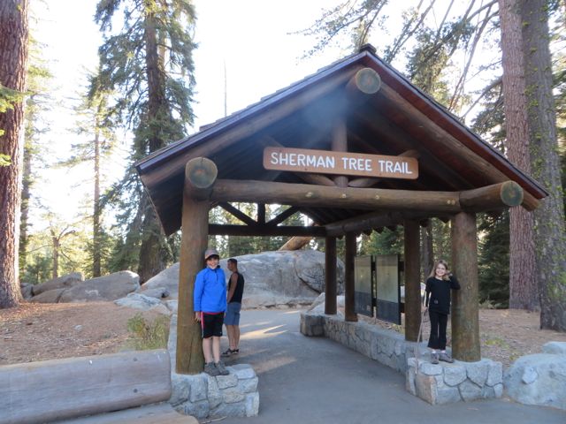
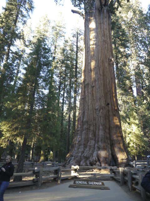
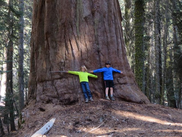
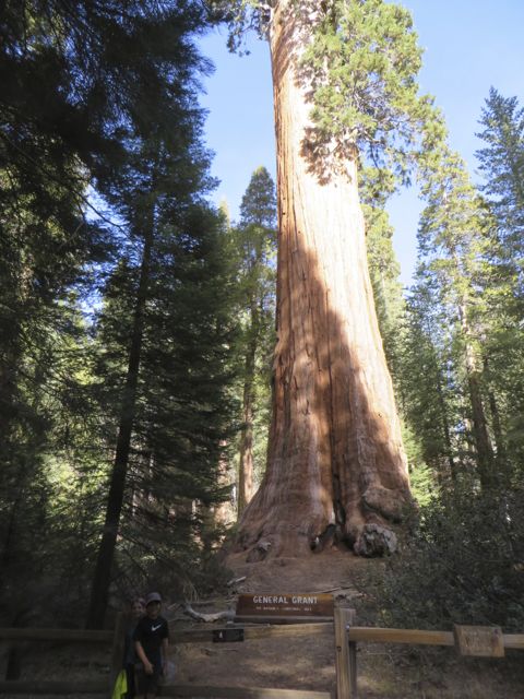
Next, we headed to the General Sherman Tree, which is the world’s largest tree by volume. It is also very old, somewhere between 2,300-2,700 years old.
Headed to see the General Sherman TreeLargest tree on earth by volume
So Impressive!
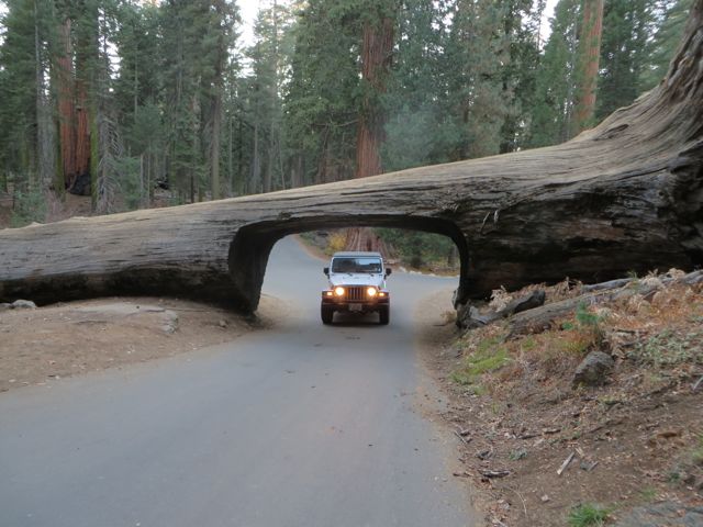
Driving through Tunnel Log
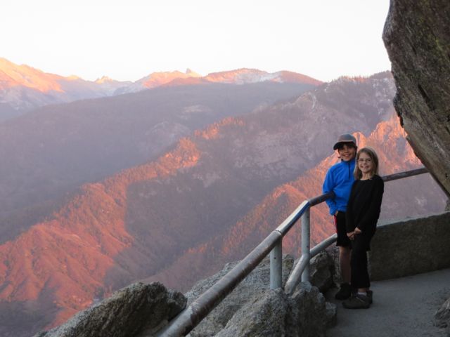
Our final stop of the day was Moro Rock(granite dome rock-6725 ft elevation). It was only a 1/2 mile hike to the top, but the 400 steps made it a nice little workout. I have to say that having our kids with us, helped me to not freak out over how steep it was at some points of the staircase. We got to the top just in time to see the sun setting. Definitely worth the scary parts!
Headed to the top of Moro RockSee Scott down below?
The view to the west was breathtaking!We could not have timed this better…
Day 2
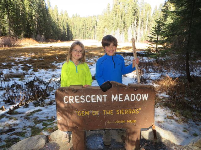
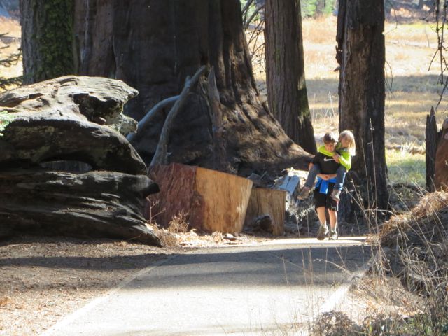
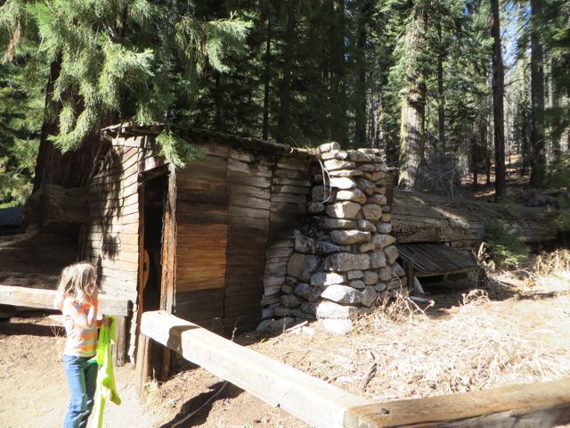
Scott hurt his back in Yosemite, so unfortunately, he rested and our kids and I headed back to Sequoia to hike Crescent Meadows and tour Crystal Cave. Crescent Meadows had a nice hike that passed Crescent Meadow(John Muir called it the Gem of the Sierras) into the woods to a little cabin that was built into a downed sequoia. Kane loved seeing the little fish swimming in the small stream. We took our time on this hike and so on the way back to the jeep, I had to play a round of tag to get Kat to run, so we would not be late for our cave tour.
Lunch by Crescent MeadowsJohn Muir loved this meadow.The width of the sequoias was amazing!It just touches my heart to see Kane being so sweet to Kat. She was tired and he gave her a piggyback ride.This little cabin was built into a sequoia. Hale Tharp lived here in the summers from 1861 to 1890 when Sequoia became a National Park.
Kane was really excited to see Crystal Cave. We had to hike 1/2 mile down a winding path. Kat was a little concerned after the tour guide told us to watch out for the bear, the bees and poison ivy. “Crystal Cave is a treasure-cavern of ornate marble polished by subterranean streams and decorated with curtains of icicle-like stalactites and mounds of stalagmites” per the website. The polished marble was beautiful!
View heading down the mountain after Crystal Cave tour.
Day 3 – King’s Canyon National Park
We headed to King’s Canyon on our third day. We took a shortcut, so it only took us about 1 hour and 45 minutes from our campground. Since 1943, both parks(Sequoia and Kings Canyon) are managed under one superintendent. There is a grove of Sequoias(the third largest in the world, General Grant is located there) that actually was the General Grant National Park(it became a NP on October 1, 1890(6 days after Sequoia became a NP). In 1940 it became King’s Canyon NP and included the area east of there(this area comprises 90% of the park). We stopped at the visitor center and our kids turned in their Junior Ranger books and earned their badge. We then headed to the General Grant Grove of sequoias.
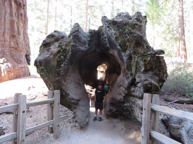
The sign is made from granite and wood from a sequoia.Kids loved walking through a fallen sequoia.General Grant Tree – third largest sequoia by volume in the world.
We found out that you gotta drive the 30 miles(1 hour drive) passed the General Grant Grove to get to “Kings Canyon.” It is breathtaking! We followed the winding mountain rode down, passing a narrow vertical-walled gorge before reaching the valley floor. We headed to almost the end of the road to Zumwalt Meadows Hike. We had a picturesque view of the Kings River with huge cliffs rising above it. We followed the trail along the river to a large suspension footbridge. We continued through the woods briefly to reach the Zumwalt Meadow loop. We followed the trail around the meadow to a slope that we had to climb which was made by small blocks of stone then over a rocky slope at the foot of immense cliffs. It truly was so beautiful! It reminded me alot of Yosemite with it being a glacial carved valley with granite cliffs. Such a blessing that this land is protected, so we all can enjoy it! The Sierra Nevada Mountains are amazing!! One thing that I did not know is that Mount Whitney is the highest peak(14, 505 ft.) in the continental USA and it is located in Sequoia. Unfortunately, you can’t see it from any road in the park. You have to backpack in to see it! Next time!!
Crossing the river on the Zumwalt Meadows hike.See the granite mountains. Reminded us of Yosemite.We had to hike through some rocks.Another amazing glacial carved valley!
I feel like kind of an idiot, now that I’ve visited several National Parks. I can’t believe that not only had I not visited them, but I actually had no concept of what they each were about. I know Yellowstone and Yosemite are mentioned all the time in news etc. I never knew that Yellowstone was essentially a huge Volcano, and I didn’t know that Yosemite was a glacier carved valley filled with grand granite peaks, numerous huge waterfalls, and beautiful trees.
Several people we’d talked to about the fact that we were headed to Yosemite made comments about missing the waterfalls (they dry up in the fall). I have to say, fall is a great time to visit. Very light crowds, and perfect hiking weather! I’d estimate that May might be the perfect month to visit, before school lets out, it gets hot, and peak rain/snow melt filling the massive falls.
That said, we’re simply trying to follow good weather south at this point, and see as much as we can. Even without the falls, this place is wonderful. We stayed 3 nights, giving us 2 full days to explore.
We rolled in from San Fran, and somehow we whiffed on planning our schedule for the day. We ended up driving the last hour in the dark, which was a HUGE mistake! A dog’s hind leg does not begin to describe the road we drove into the park, the last 40 miles of CA 140 leading to the park boundary were some of the steepest, curviest roads we’ve driven. In addition, there are a few areas where there is construction going on, temporary 1 lane bridges etc. It was a rough way to end a long day of driving in traffic. Once we were in the park, we were greeted immediately by a stone tunnel that looked about 10 feet tall and 8 feet wide (we are 12’10” tall). I can’t reverse the RV with the Jeep in tow, and there was no place to turn around, and the Ranger who checked us in didn’t mention it, so I went for it. Thankfully, we made it. That was followed by more narrow, curvy roads. The best part about these park roads were, they had NO SHOULDER, and there was a STONE WALL next to the road. I basically had to ride with my left tire on the center line, and pucker up when oncoming traffic met us. Thankfully, we didn’t pass any RVs on the way in, as no others were stupid enough to try it!
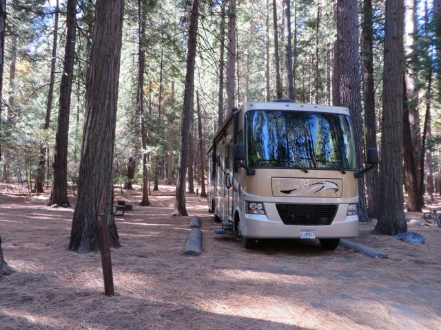
Enough complaining. The campground Kim reserved was called “Upper Pines”, and it was AMAZING! The loop was a bit tight for the big rig, as these parks are not optimized for Class A RVs, but once we were in, it was incredible. We had a huge site, with massive trees, and glacier strewn boulders laying around. The guys next to us in the VW Westfalia were none too happy to see us back in. Kim heard them on the back up camera saying something like “Our plan backfired!”. Oh well.
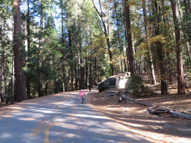
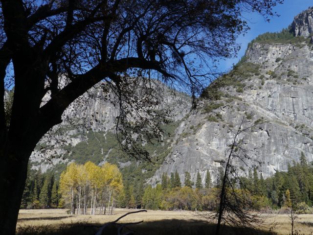
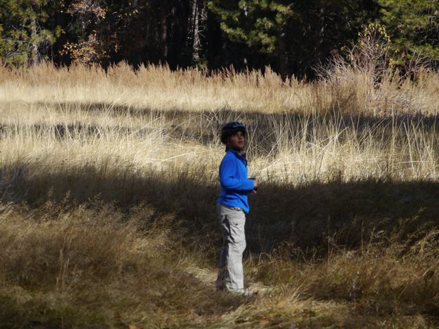
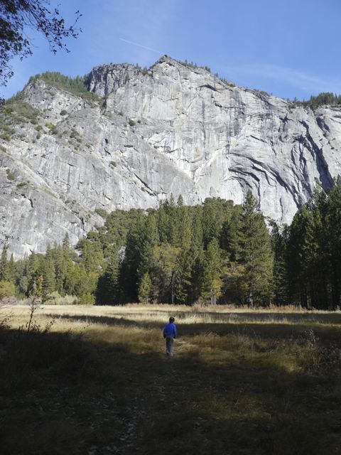
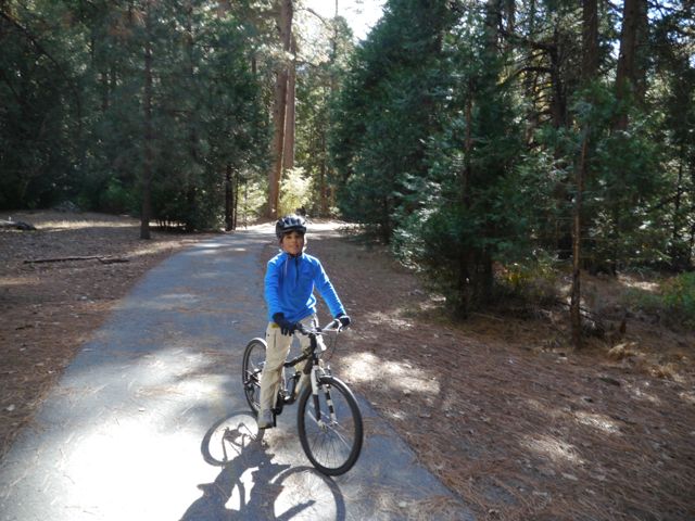
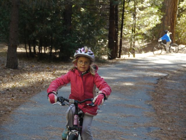
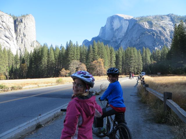
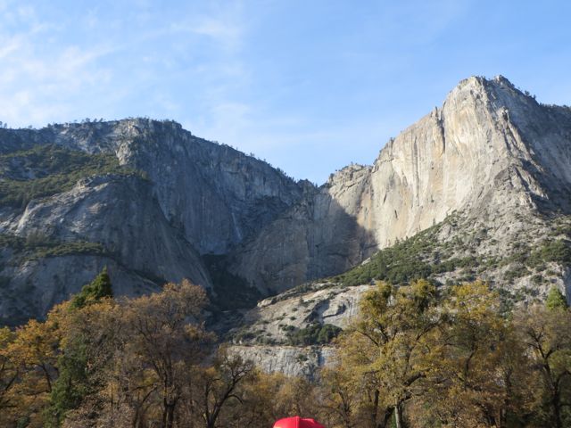
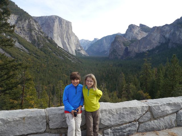
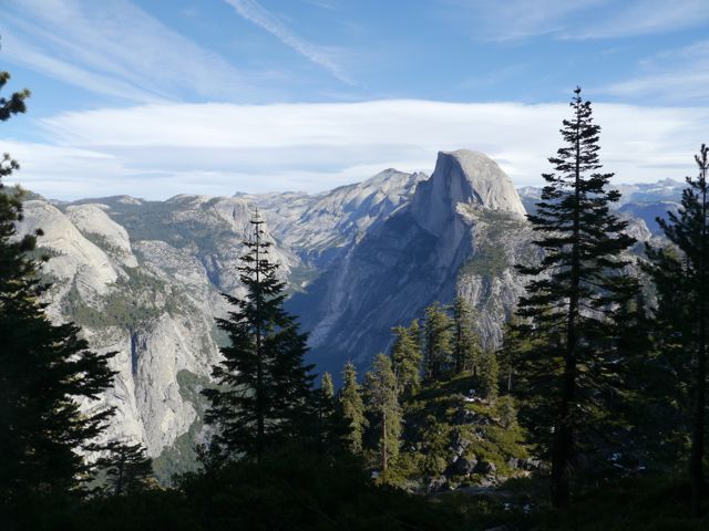
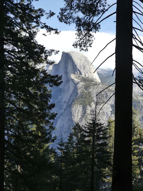
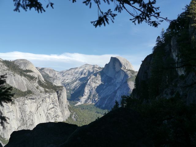
The next morning, we broke out the bikes and rode up the the visitor center. Upper Pines is smack dab in the Yosemite Valley. There are tons of other areas in the park, but the Valley is the “canonical” must see area including the famous “Half Dome” and “el Capitan” structures. The visitor center was a couple of miles from our site, and most of the ride was on a dedicated bike path completely separate from the road (you could not even see the road from the path). We were the only ones on the path.
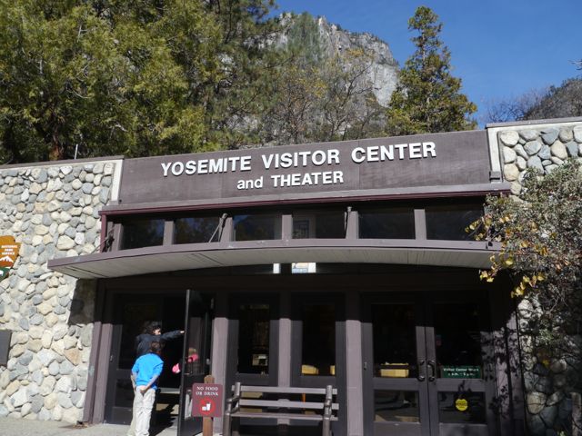
At the center, we got the lay of the land… watched the intro video, got our Jr Ranger books (we need a separate post on these, they’re great!), checked out potential hikes and ranger led programs etc. I’m always a sucker for the 3d scale models of the parks, and this center did not disappoint.
After riding back for lunch at the RV, the Kim drove the kids back for a Ranger led program on Yosemite Geology. They learned all about how the area came to be, and the history of how it became a National Park etc. They came back raving about the ranger Sheldon. I guess he was great.
After that, we went for a walk in the campground as it got dark, and the kids (of course) climbed the boulders that are laying around the place. Thankfully, we quit before anyone got hurt!
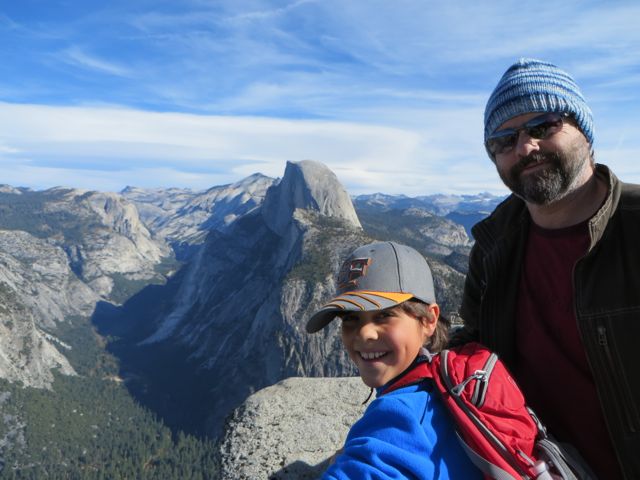
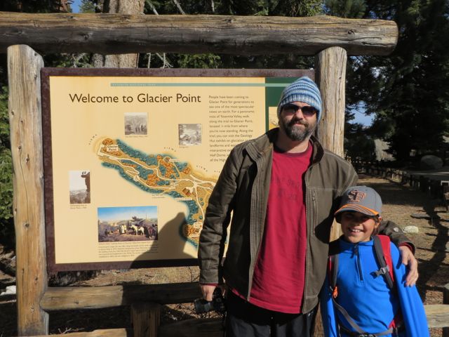
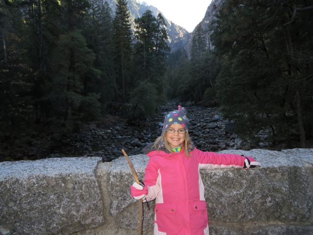
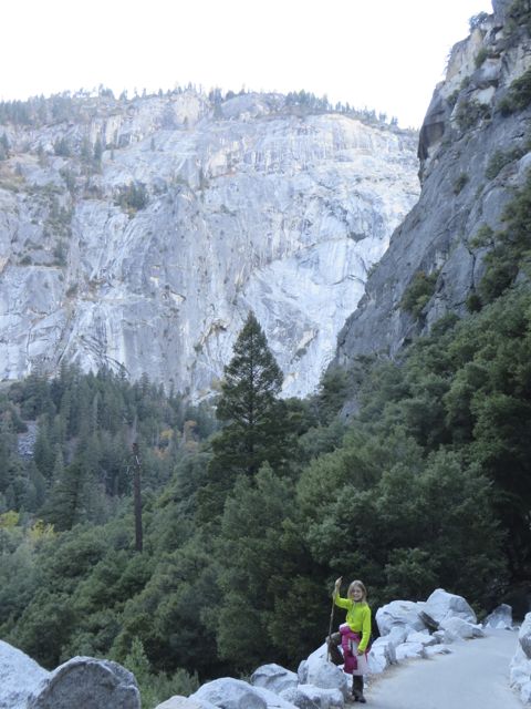
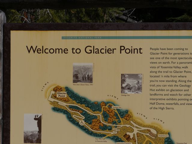
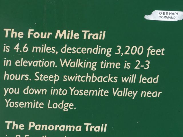
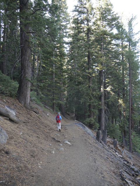
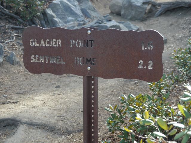
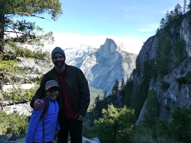
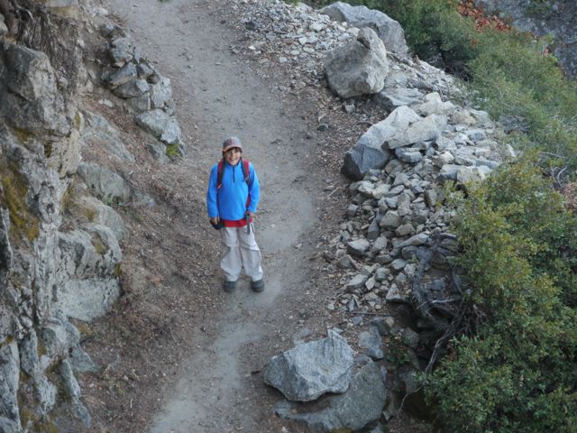
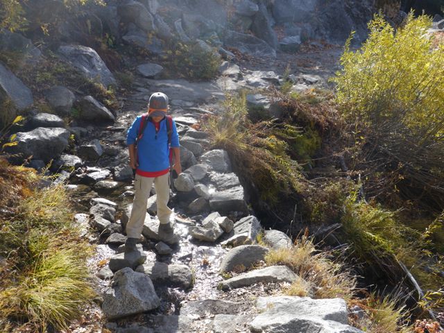
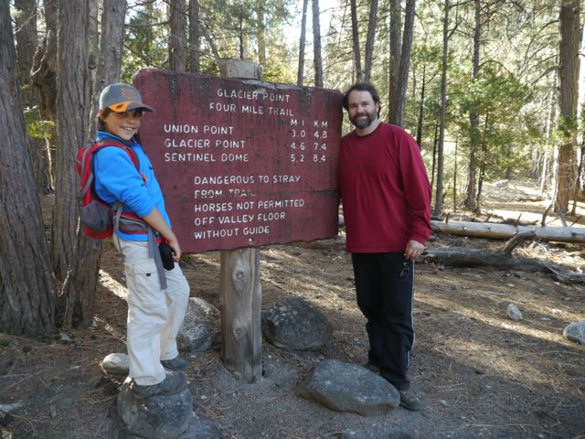
Day two Kim did me a solid. There was a hike that looked amazing, 4.6 miles of trail that run between the Valley floor and “Glacier Point” (this is the top of the granite wall that is directly behind our campsite). Kim had asked Sheldon about doing that hike with the kids, and he had really discouraged her from trying to do the 9 miles round trip (valley -> Glacier Point -> valley). Another option was a bus ride up to GP, and hiking 4.6 miles back. The problem with the bus is it’s private, and would have been > 100 bucks. So, Kim decided to we’d all drive the Jeep to GP, and she would drive it back with Kat, while Kane and I did the 4.6 miles down to the Valley. It was AMAZING! Sorry about the volume of pics, but these represent probably 25 percent of what I took.
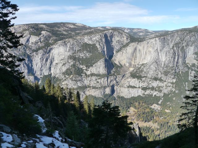
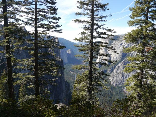
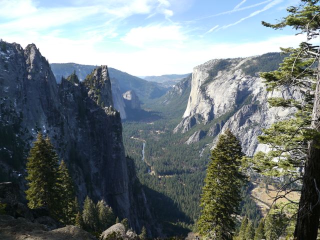
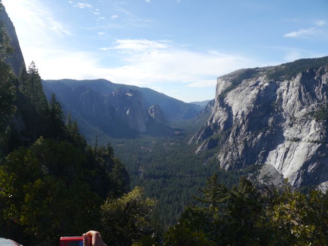
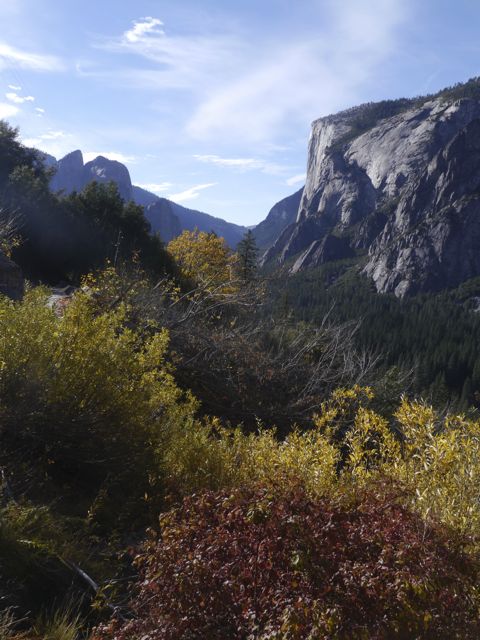
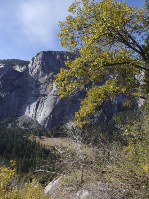
I can’t recommend this hike enough, there are so many great vistas on the way down… Half dome, Yosemite Falls, El Capitan, nearly the entire Valley can be taken in. The 9 mile round-trip would be quite a trip for 1 day and small kids.. it’s quite an elevation gain… 3200 feet.
That afternoon, Kim and Kat hiked the Vernal Falls, which sounded pretty cool to. It was nice to “divide and conquer” for most of a day, and it was indescribably cool to bond with Kane and do that hike down from Glacier Point.
Yosemite is going on my “must return and spend a week” list. What a beauty!
I’ve broken the pics into two galleries… mostly day 1 (all but Glacier Point hike), and the Glacier Point hike.
Pics mostly from day 1:
Kind of a cheat to put this one upfront, it was WAY too dark when we rolled in, so we caught this on the way out.
Our campsite in Upper Pines campground.
Biking up to the visitors center.
These rocks were too cool to pass by
She has a habit of climbing things that she’s not comfortable coming down from. Good excuse for a hug though!
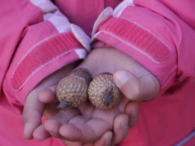
She really appreciates the little things… looking for acorns.
Rare close-up
She found a couple of beauties. We actually cut out the nut from one later on with Kane’s swiss army knife. He ate it. Kind of, he chewed for 15 seconds and spit it out. We had learned that the local natives had lived mostly on these… poor guys.
Just a random spot on our ride in
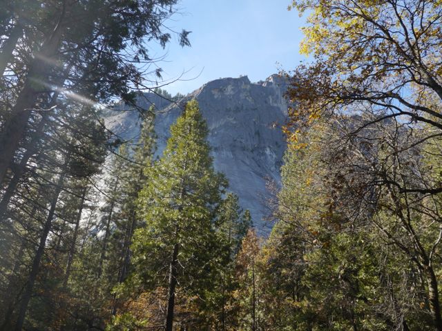
You spend a lot of time looking up in wonder in this place.
Kane got a new camera recently (his old one broke), and he’s gotten back into taking photos.
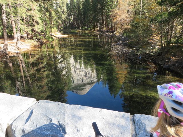
South Dome.
Kim took this one, reflectin of south dome in the river.
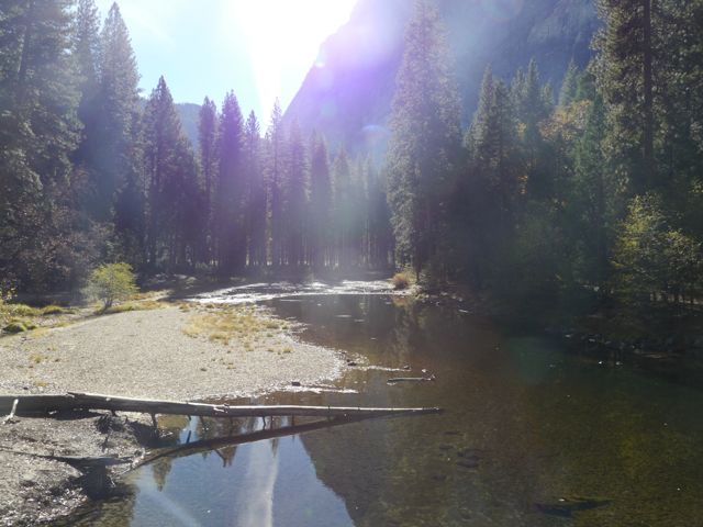
Another random shot from the bridge.
The bike path! It was a perfect fall morning.
Here she comes
Half Dome sighting!
Model of the part of the Valley were we are camping. Half-dome is on the right
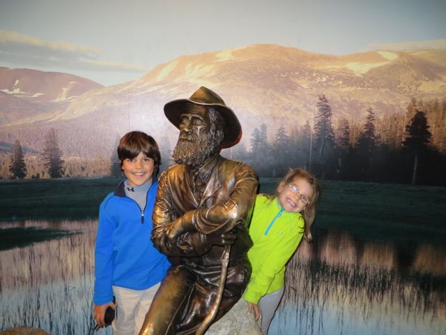
Bronze statue of the father of Yosemite… John Muir. Look him up, pretty amazing story.
Geology Program… I was not there, but heard it was amazing.
Sheldon was a great Ranger.
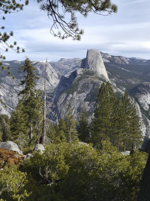
Half Dome
Kim took these at the program, I think this is Yosemite Falls.
Spire
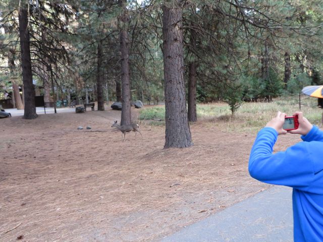
Mule deer, all over the place
Pic of Kane taking pic of deer
One of the small rocks laying around the Upper Pines campground. Imagine the power of the ice that carried this thing.
More climbing fun
Campsite with Jeep wedged in.
These shots were taking at the viewpoint near the tunnel on the way up to Glacier point. Amazing Spot.
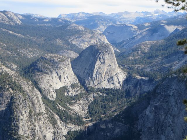
This was a stop along the road to Glacier Point. Now we see Half Dome from the profile (on left). We can also see Vernal and Nevada falls.
Looking north from road up to GP.
Another side view of Half Dome
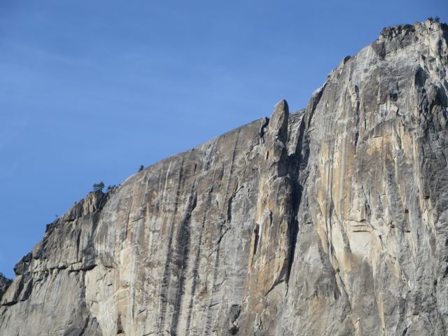
Looking up the valley to the East from the tunnel viewpoint. El Capitan on left, Half Dome obscured in the background, BridalVeil falls on the right. Valley of course in the middle
Tighter shot of the same view. I love this view.
I tried to get the same shot looking into the bronze scale model of the valley. It’s close, but I could not get low enough.
Kat at the tunnel viewpoint.
Typical of the road up to Glacier point. This was actually taken on the way out of the park.
The tunnel itself. Yes, we drove our RV through this!
View of Half Dome from Glacier Point
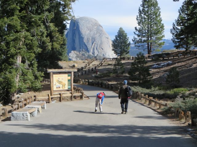
Ready for the big hike.
Another view further up the valley from GP
Here we go!
Kat on the Vernal Falls hike with Kim.
Vernal Falls hike
Glacier Point Hike Pics:
Our Huckleberry
Now we see how Half Dome got it’s name!
The campground down in the valley from GP
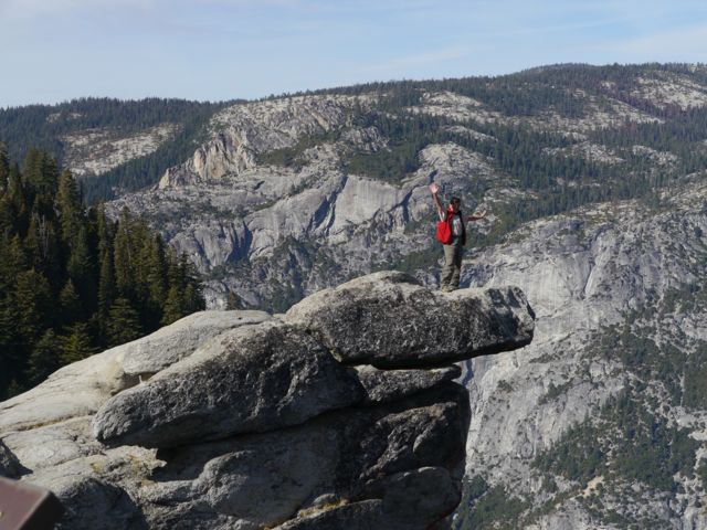
Famous outcropping at GP, we don’t know that crazy lady out there. It’s 3200 feet straight down from there.
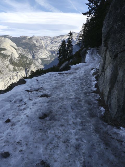
We weren’t sure where the path was for some of the beginning.
Our first glimpse of Half Dome about a 1/4 mile into our hike.
There is that outcropping from the West.
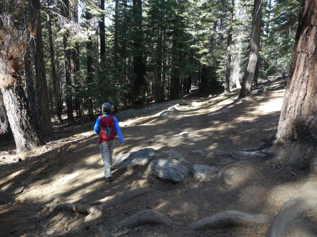
Trail became more prominent, and really, a great trail. Big trees at the top.
There it is again, and I can’t help myself.
Snow!?
Yosemite Falls (dry) across the valley. You can make out the trail to the top, switch backs up the hill to the left.
Kane can’t help himself either.
Some spots were quite slippery, with dropoffs.
The whole way down, we had views like this.
The path took us pretty far West, and now we’re seeing another part of the Valley altogether.
El Capitan makes an appearance.
Fellow hikers offered to take a photo of us both. We met some nice folks.
We were looking for a sunny place to eat lunch by this point.
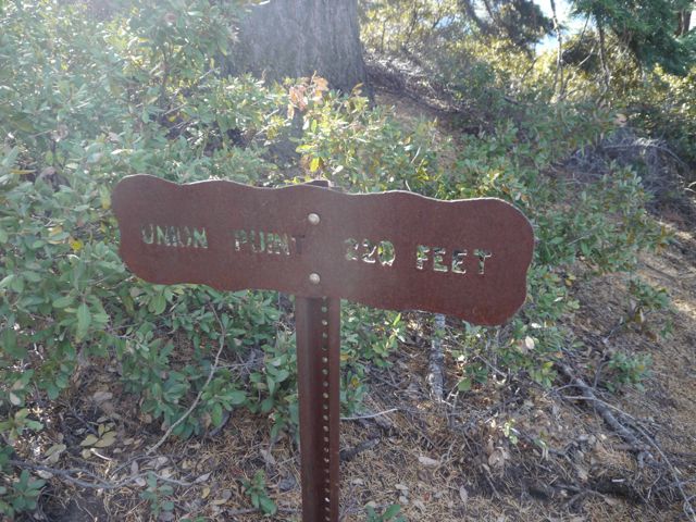
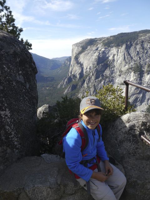
Union Point? Looks promising. 220 sounds OK.
Looking back up the hill at Union point, we know we’re 1.6 miles into our 4 mile hike.
Kane sitting at Union Point.
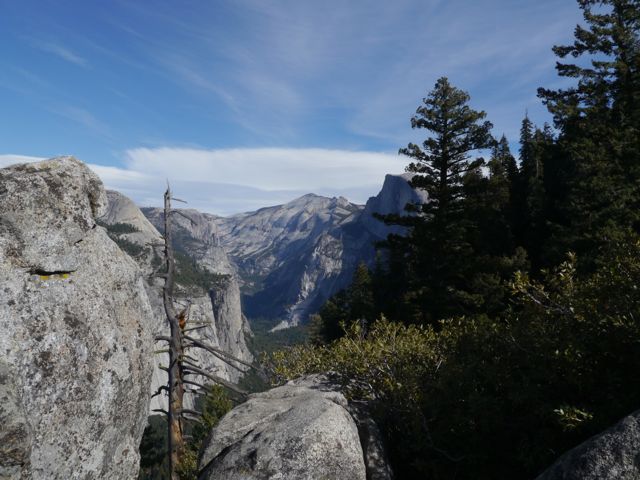
This was the view from our lunch spot looking East (yes, it’s half dome again)
We moved up to the top of these rocks, and had great view of El Capitan to the West.
Good spot for lunch, but it did get windy eventually.
3 miles to the end!
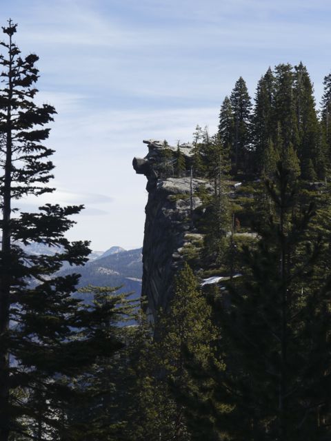
I think these are called Cathedral Spires.
Back around looking East now, a bit lower.
A European couple was so pleased with a photo I took of them, they offered to take one for us. Those are two happy hikers.
Kane ran ahead a bit, on a switchback.
Had to stop to empty rocks from his boots.
Vegitation changing to more mixed and deciduous forest.
Crossing a stream. Kane was so happy, and he dunked his hat in the water to cool of.
Love the depth and textures in this one.
Made it! We ended up catching a lift from here back to campsite.
This is a view of Glacier Point from the Upper Pines campground. Gives you a feel for our hike. You can see infamous rock outcropping up there.
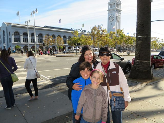
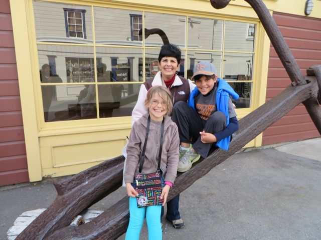
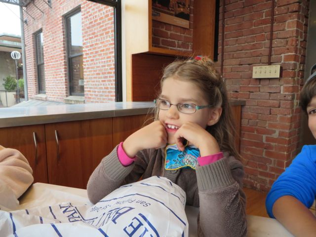
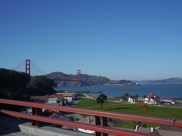
We all really enjoyed spending time with Kim’s mom in San Fran. The kids were loving it! Saturday was a huge day which went like this:
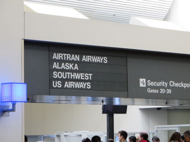
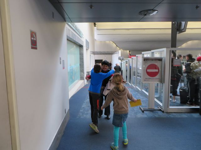
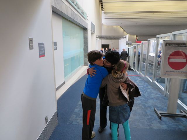
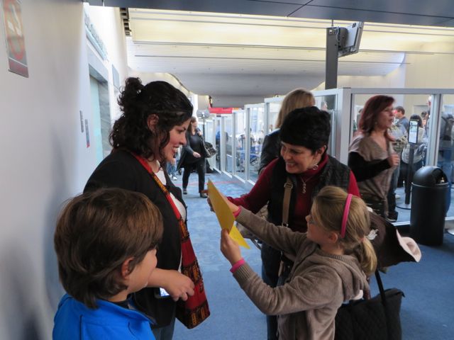
1) Met Nana at the airport, complete with signs the kids made.
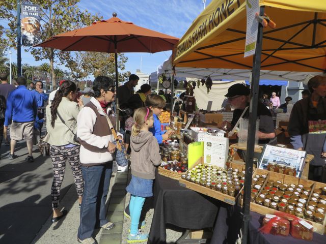
2) Farmers Market near Fisherman’s Wharf.
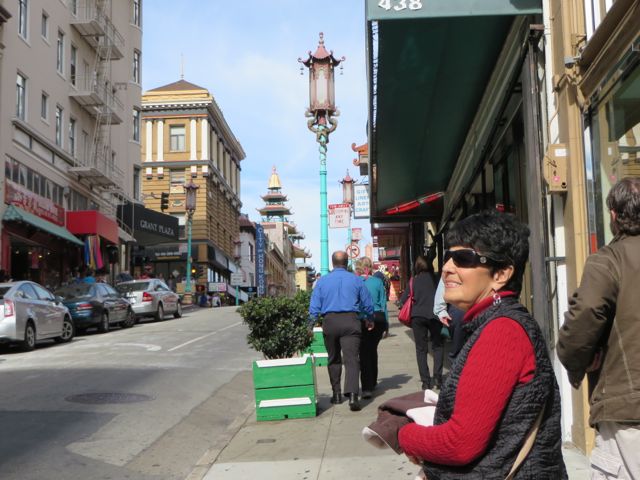
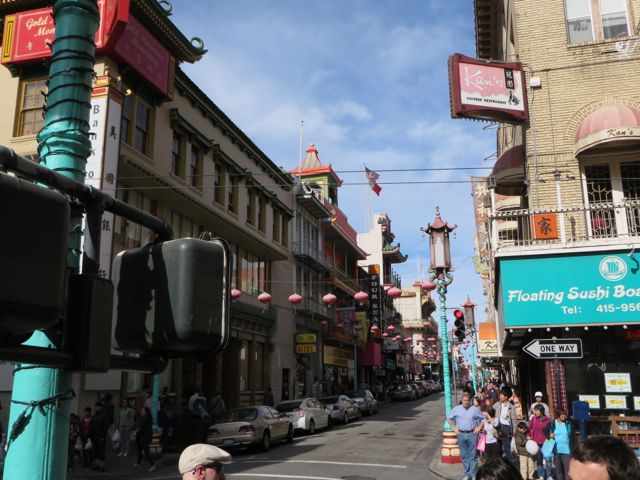
3) Shopping/Lunch in Chinatown.
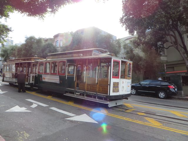
4) Trolly Ride and visit to Fisherman’s Wharf.
5) Junior Ranger program and tour of the Maritime Museum.
6) Papa Murphy’s Pizza for dinner. We had planned to cook Salmon and Clams, but got home too late.
She was coming in on Southwest.
There she is!
We love you Nana!
Kat showing Nana the sign she had made.
Nana’s #1 request… City Market!
Buying honey stix!
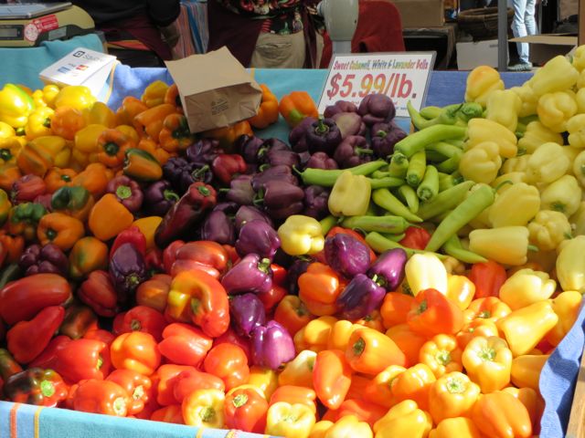
Nice produce… never saw purple bell peppers back home?
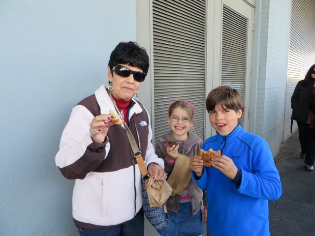
Sampling some pastries.
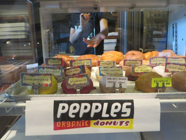
Vegan Donuts!?
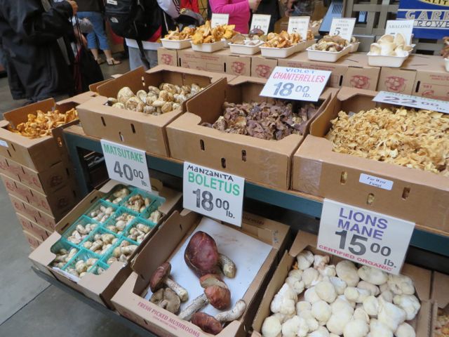
Shrooms, so we could explain to Nana some of our hunting conquests.
Shanties! You gotta try them.
Walking to Chinatown, hand-in-hand.
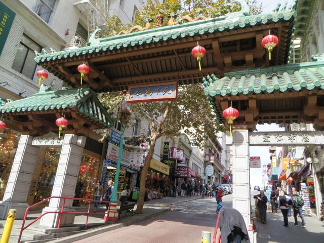
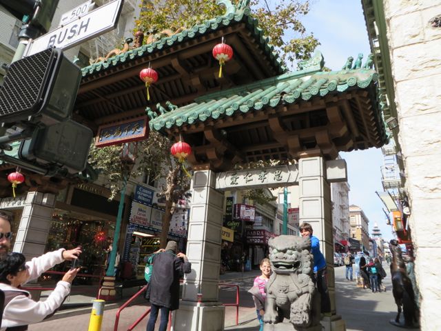
Never mind that Kim made us walk an extra mile, to enter Chinatown via this gate.
You’re not in Hannibal anymore, Nana!
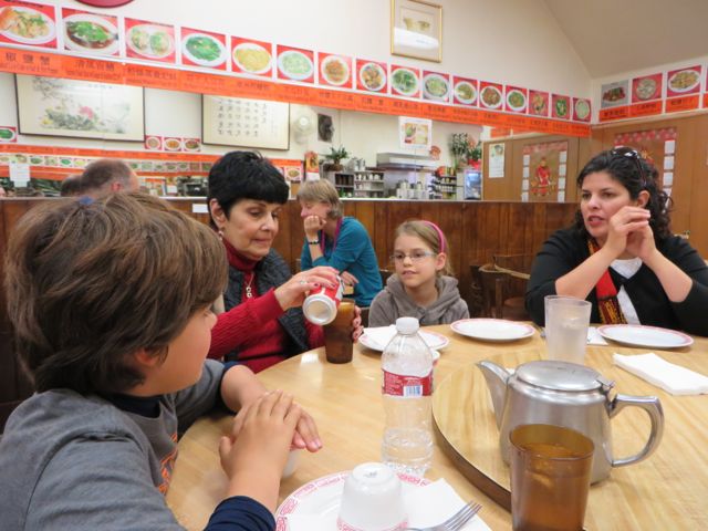
Looking for Lunch, in all the wrong places.
4 stars on Yelp, and close, it’ll do. Capital Restaurant
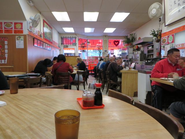
The place was pretty busy, so good sign.
Known for wings, and they were the highlight. This Bass might be a good choice!
Cool market with dried seafood.
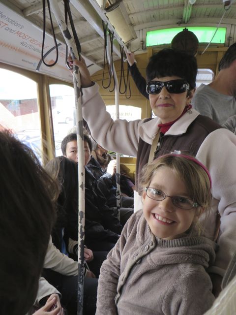
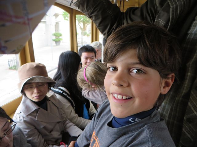
Riding the trolly.
First trolly experience.
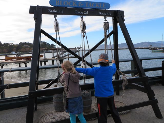
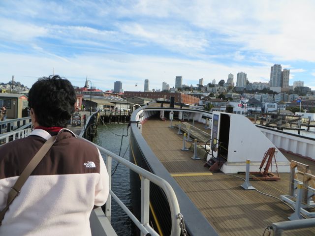
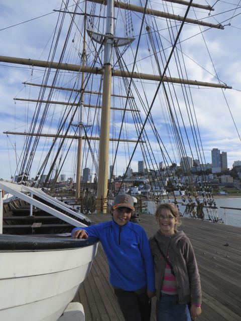
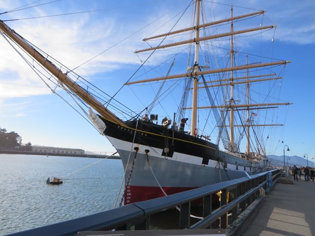
Maritime Museum
Blocking and Tackling
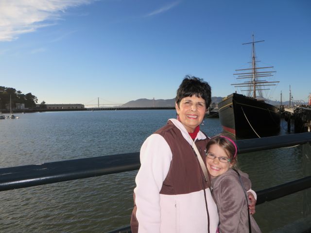
Nana checking out the clipper ship under re-construction
On the deck of the Balclutha.
1886 Square Rigger, Balclutha.
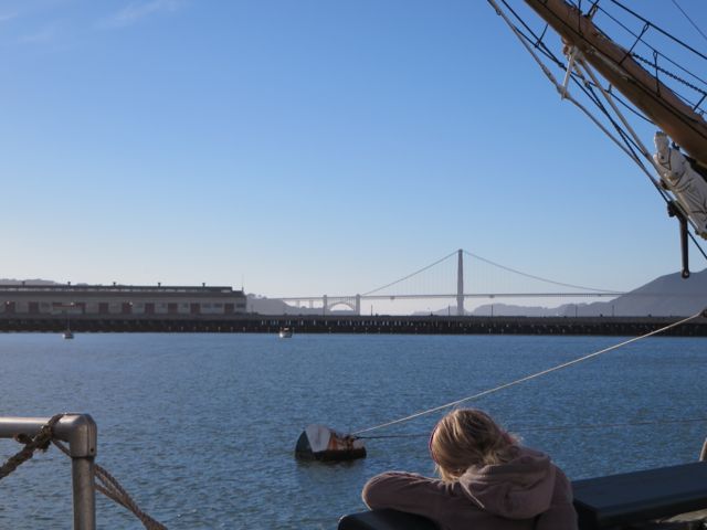
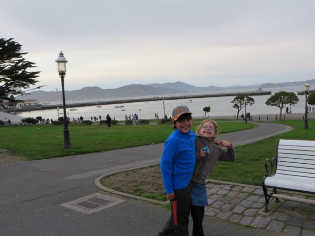
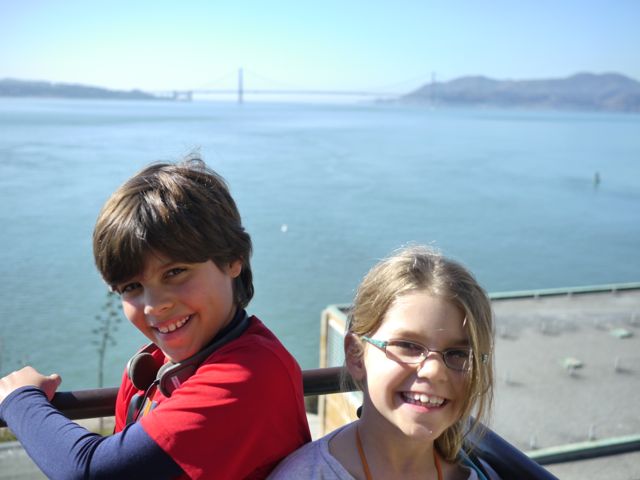
Kat ejoying the nice weather and view of the Golden Gate bridge.
Nice day, winding down.
Kids love to have Nana read to them.
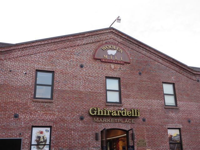
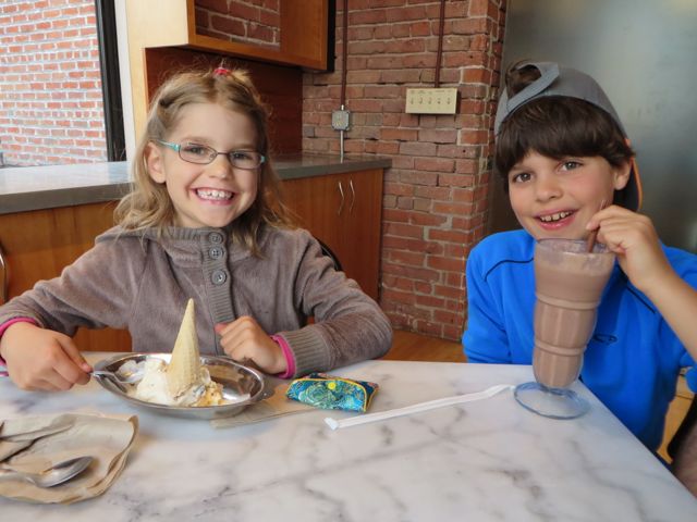
Sunday, the kids made breakfast (pancakes and eggs). Scott watched the Chiefs game, then we all went downtown to Ghirardelli Square. We cooked Salmon (Kane caught in Alaska), and Fried Clams (We dug them on Oregon Coast) for dinner.
Old Ghirardelli buildings nicely rehabbed.
Chillin, waiting for ice cream.
A $2 cone and a $6 shake. Kane chipped in the extra 4 bucks.
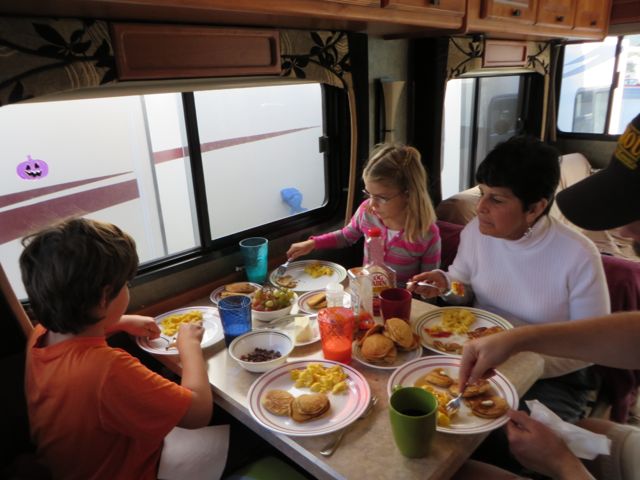
Kids made breakfast!
Fried Razor Clams… battered in saltine cracker crumbs.
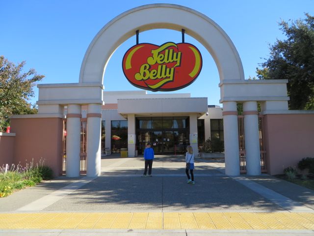
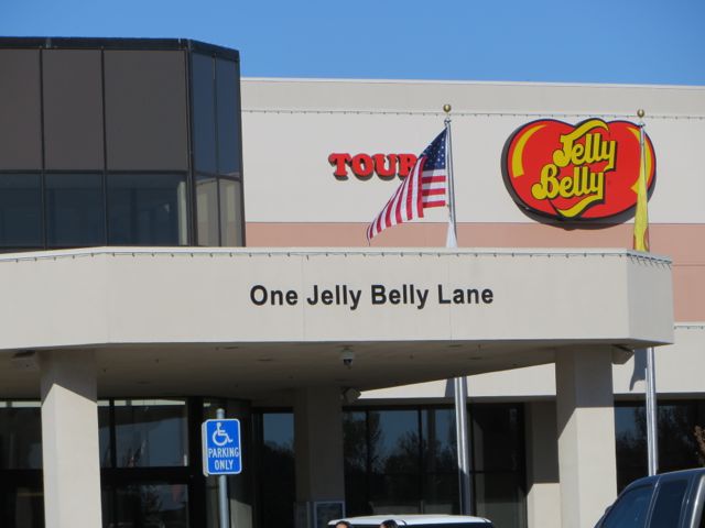
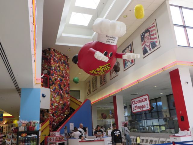
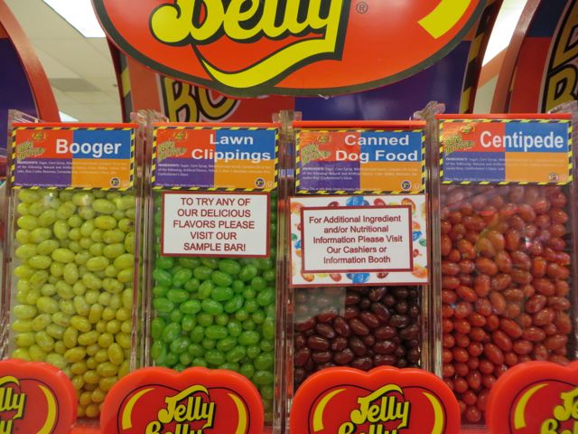
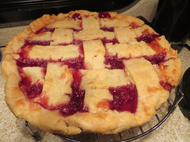
Monday, Scott hung out at home, and Kim, Nana and our kids went to visit the Jelly Belly factory. Much needed time for me to update the blog, and the kids loved the factory. Kane and Kim decided that Dog Food Jellybean does taste like Dog Food! After dinner that night, we had a tasty treat… Nana’s homemade Cherry Pie!
Jelly Belly Factory… amazing these things are made here, when the company started in the Midwest?
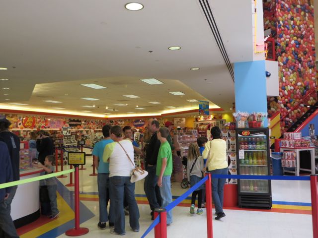
Uh oh… the gift shop! Kane bought a “jelly bean machine”. (gumball machine for jelly bellies.
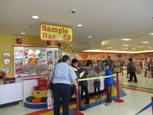
Ready for some samples.
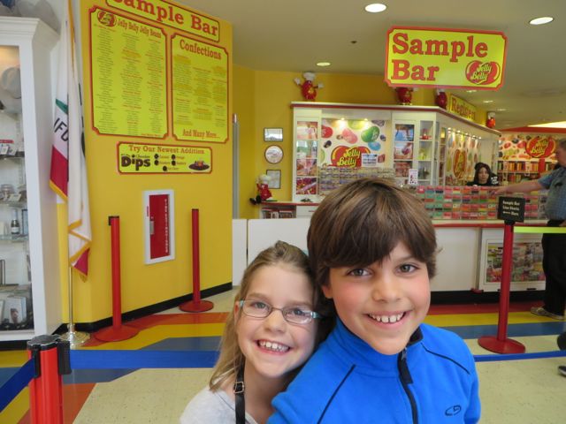
Loving it!
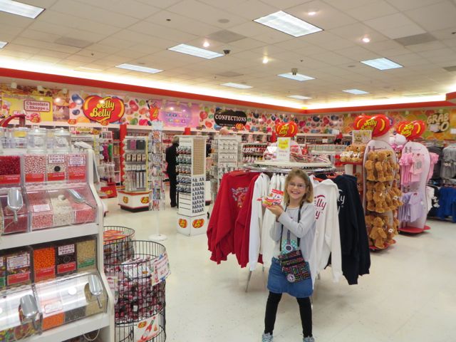
Kat brought money in her new purse (Nana bought it for her at the wharf).
Every Flavor beans for tricking somebody… me!
Nana brought her own cherries from home to make this bad-boy.
We made it to San Francisco! We were so excited, with big plans here. Back in Cape Outlook Oregon, we met some interesting folks, the Trojac family from Philly.
It was early evening, and we were working on dinner, when we saw a Tiffin Class A RV with the same color scheme as us pulling into the campground. I felt bad because we had just pulled in, and I knew we got the last spot with hookups. I felt really bad when I noticed that they were towing a Honda Van on a dolly, and their stairs were deployed. (folding stairs leading to front door were extended). Knowing how tight the loop was, I flagged them down and told the driver that their stairs were deployed. He said “oh, my sensor…”. We saw them pull around the loop and take off.
The next day, we were doing the cape lookout hike, on our way back, we passed a family of 5, and I recognized the Dad as the guy with the Tiffin. We started talking, and it turns out the Trojac’s are also on a yearlong sabbatical. They are from Philly, and started their trip in June. We chatted for a few minutes, exchanged contact info, and vowed to connect later.
Well we had a few near misses with meetups with the Trojacs and it finally happened in San Fran. We decided to meet them there, camp in the same campground, and do Halloween together. It was great to socialize with another family with kids, and naturally, we have a lot in common to talk about wrt our trips. They are trying to hit all 50 states, and as such are going to Hawaii from LA. They also took a cruise from Vancouver to Alaska, which was neat to hear about.
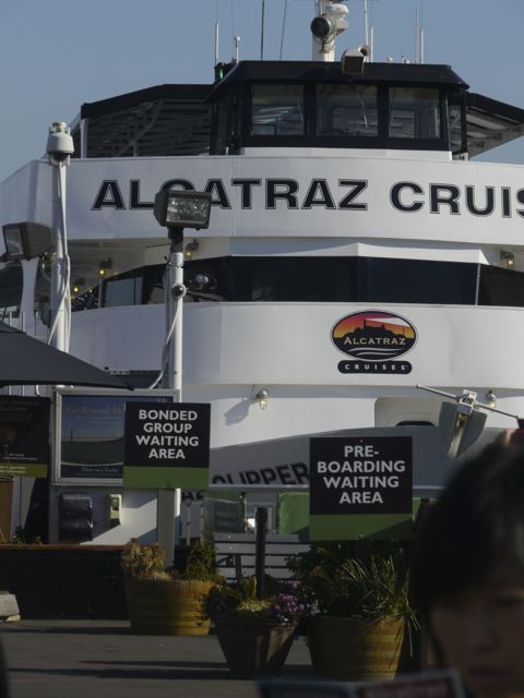
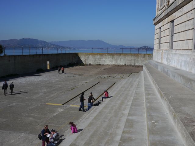
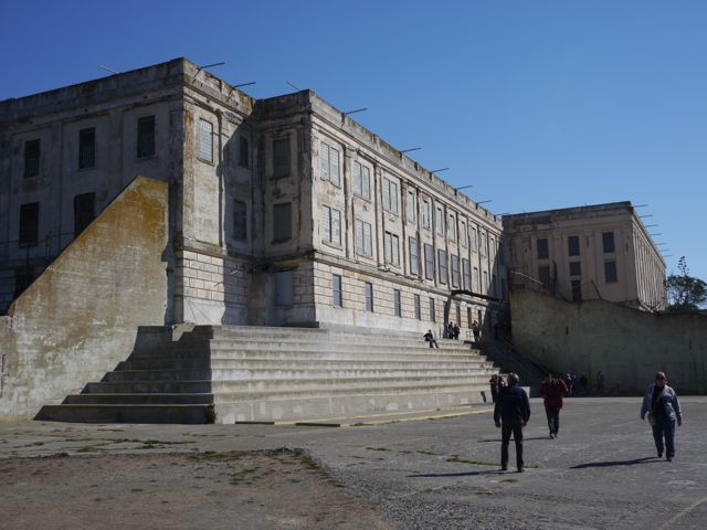
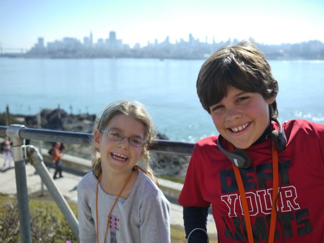
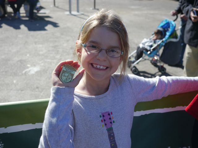
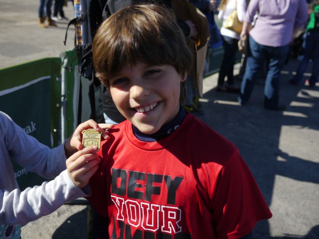
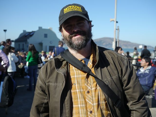
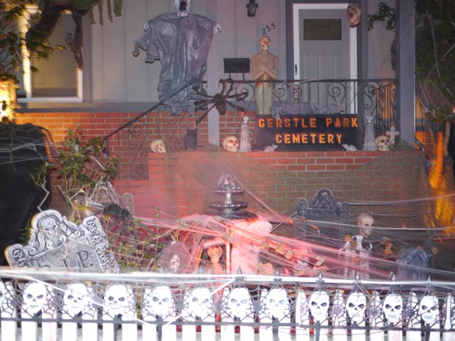
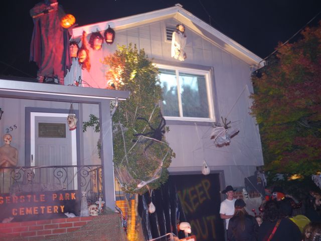
At any rate, it made for a fun Halloween. We went to Alcatraz (which is run by the National Parks), and the kids were able to take advantage of the “Junior Ranger” program there. Once we got back home, we went over to the Trojac’s house for dinner. Mike T had asked around about places to trick-or-treat, and we considered going downtown, but didn’t want to fight traffic and/or parking. One of the full-time campers at our campground, suggested a neighborhood 10 minutes away and gave us directions. It was a really nice, older neighborhood, evoking memories of Webster Groves, tucked into the city of San Rafael. Lots of young families, and a tight knit area. The place is called Grestle Park.
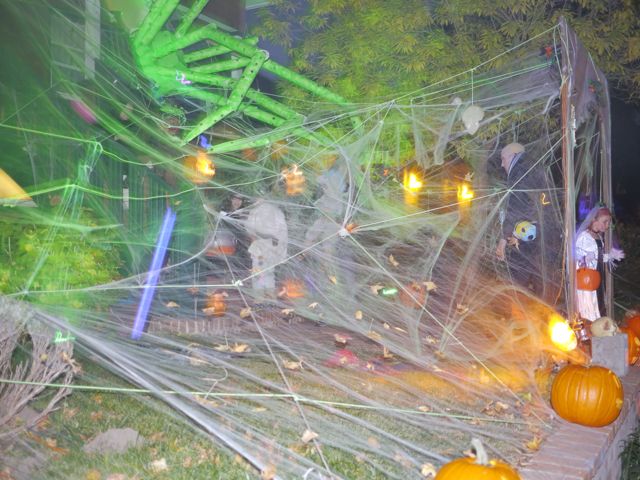
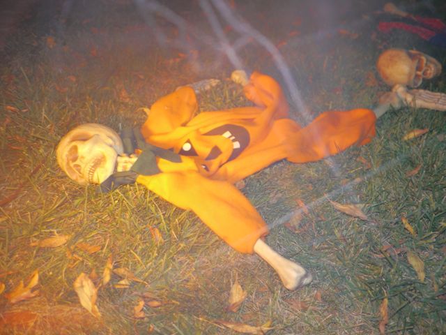
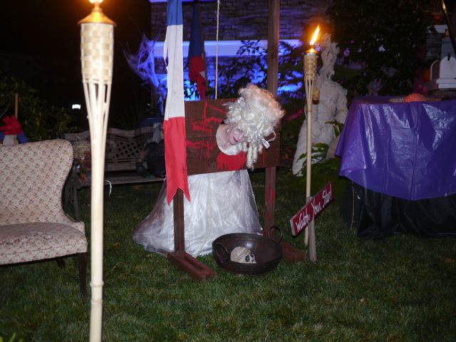
Several of the houses were totally decorated in themes… huge spider web, with the spider from LOTR, including dead trick-or-treaters (skeleton bones in costumes). The French Revolution, with Marie Anionette in the guillotine. GhostBusters theme, actually playing the movie on a 20 foot screen. It was great fun.
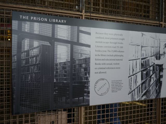
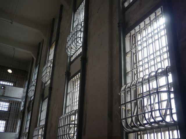
Alcatraz was great, and even though Kim and I had visited 16 years ago, I still learned some things (or re-learned perhaps). I love the audio tour, especially the stories of escape attempts. The kids really enjoyed it too, and didn’t seem to be scared at all, just fascinated.
The following day, we moved Campgrounds to a place closer to the airport, and got ready for our first visitor, Nana Kane (Kim’s mom) was coming Saturday morning and staying until Tuesday Morning.
Alcatraz pics:
Our ship. These guys get over a million visitors per year. At least 3 of these boats.
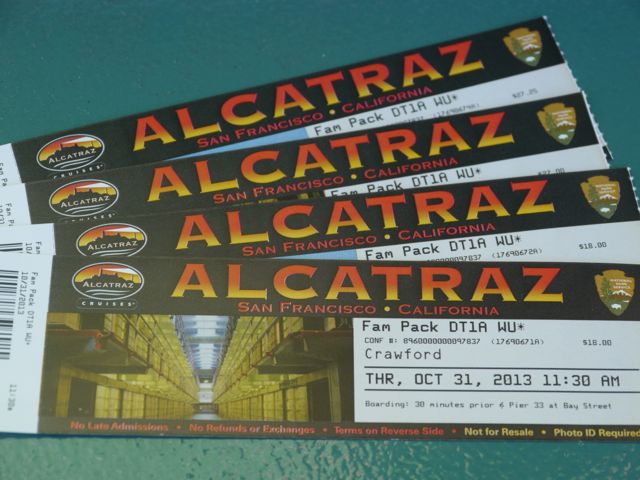
Our Tickets… expect to spend 100 bucks for a family of 4
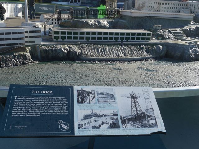
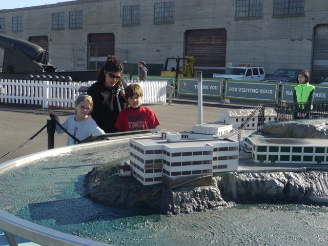
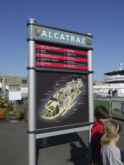
Cool scale model of the island with info on each area.
Learning something over there.
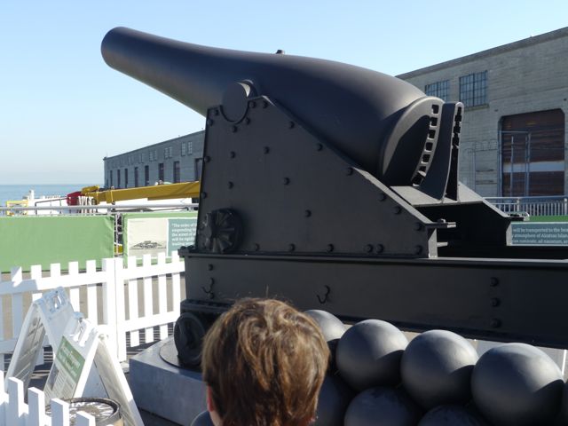
Model of the guns originally outfitting the island to defend the bay during the Civil War. They were never needed.
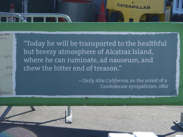
Love this quote. “Chew on the bitter end of treason”.
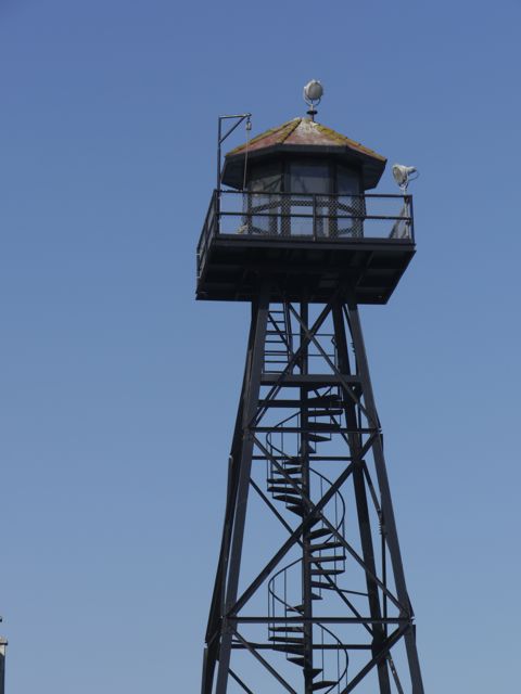
Old watch tower.
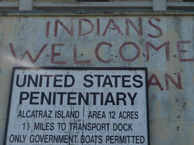
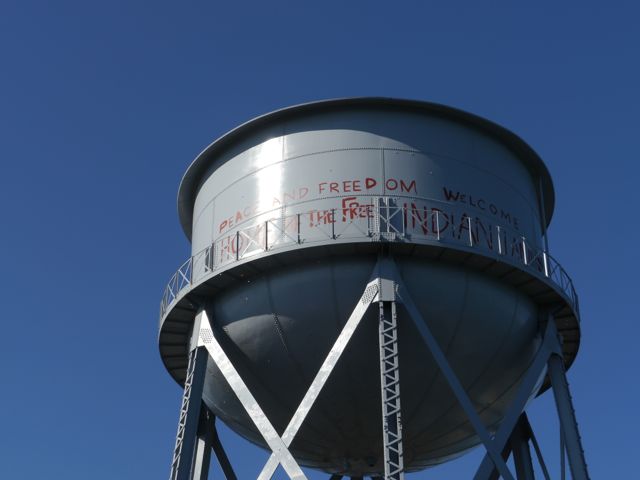
Still fascinated by the Indian occupation after the federal prison closed.
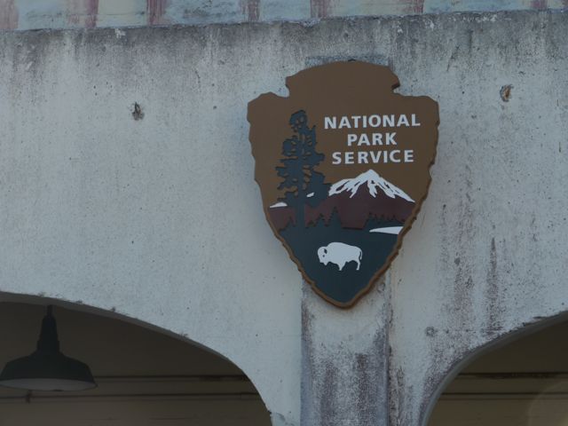
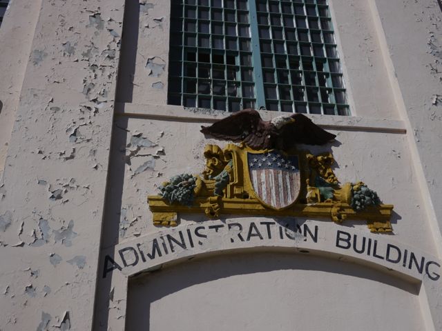
National Parks!
I wonder how many times they repainted this and re-painted the indian graffiti?
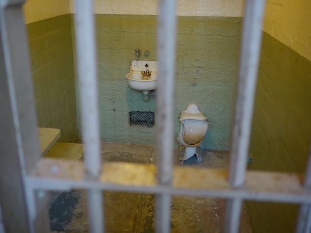
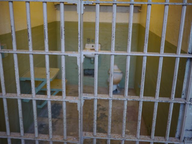
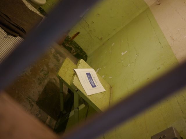
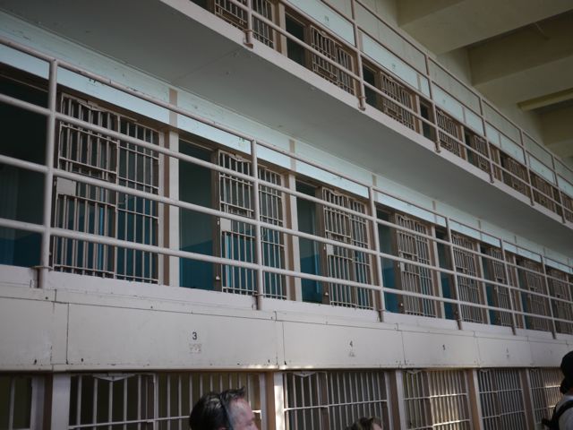
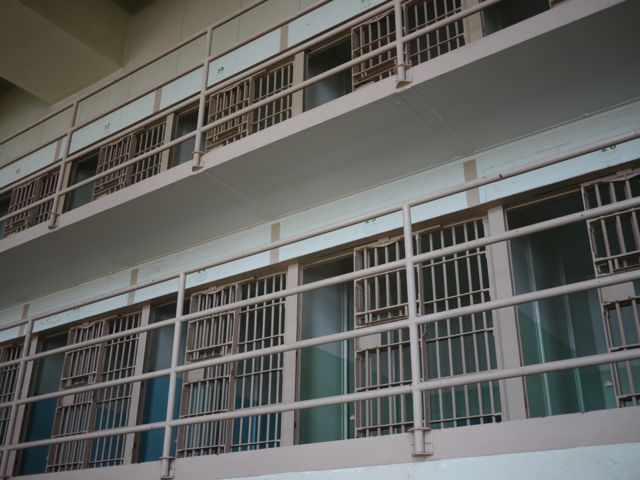
Typical cell, empty
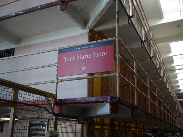
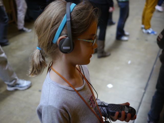
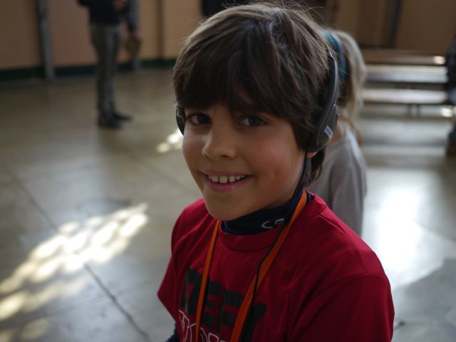
Audio Tour! Love it!
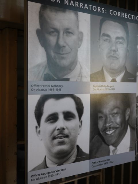
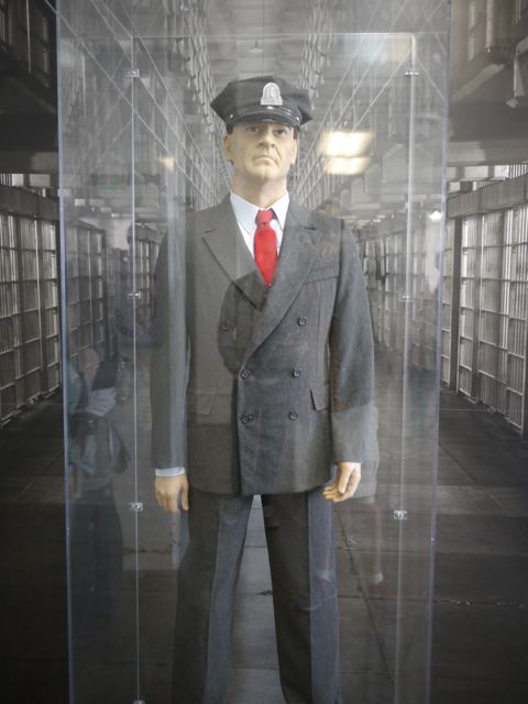
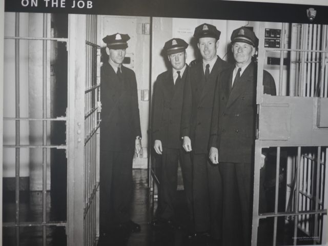
The guards who narrate the audio tour.
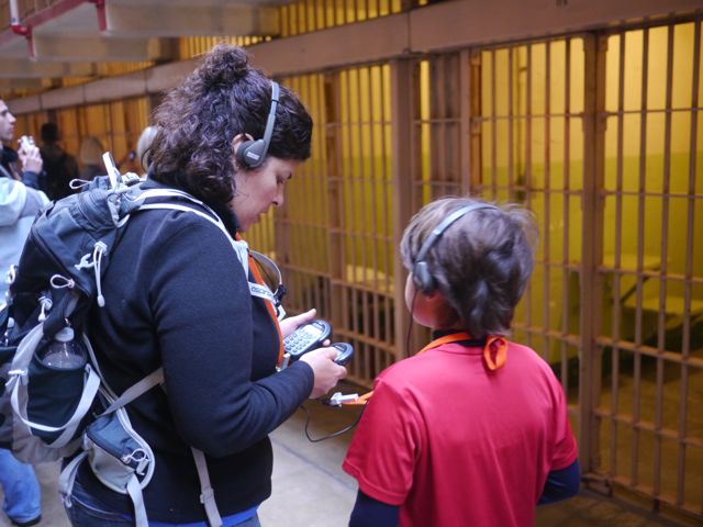
Kim, working on Kane’s audio tour which got out of whack.
Photo op
She LOVED the audio tour.
Copy of the rules/regulations for Alcatraz
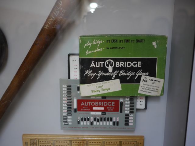
Interesting, that the inmates became obsessed with Bridge, and figured out how to play by themselves with dominoes?
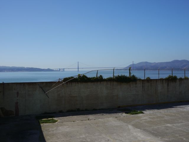
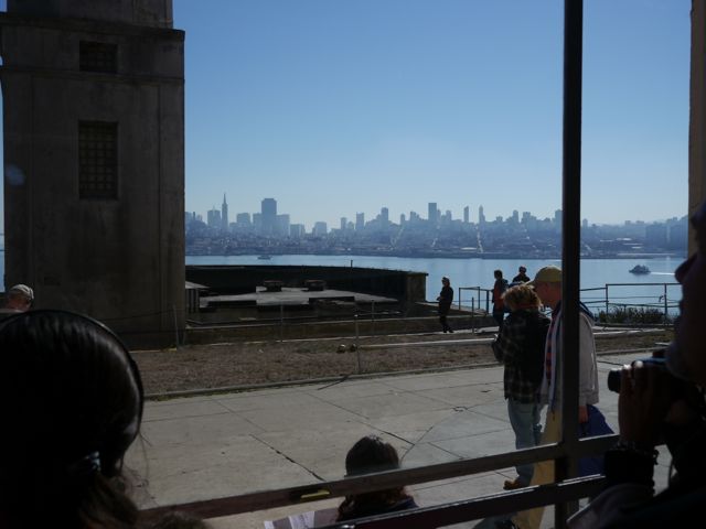
Rec Yard. Nice view of the Golden Gate Bridge, but they only got 2.5 hours on Sat and Sun
From the door of the rec yard
Cell Block “D”. Nobody wanted to be here because it was dark, wet, and cold. The Birdman, Robert Stroud stayed here.
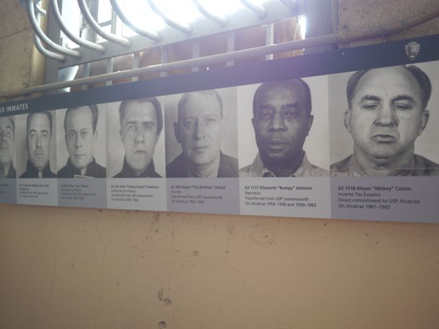
Famous cell block “D” inmates.
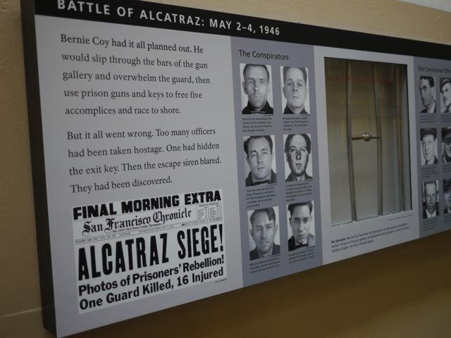
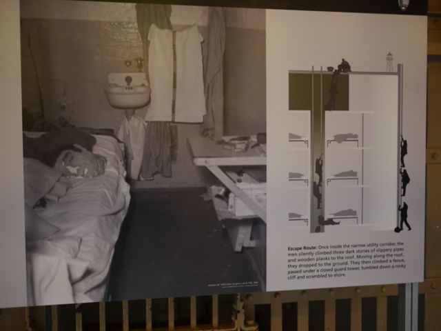
Story of this escape attempt is amazing.
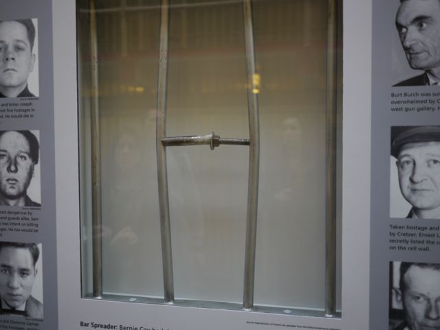
Example bar spreader.
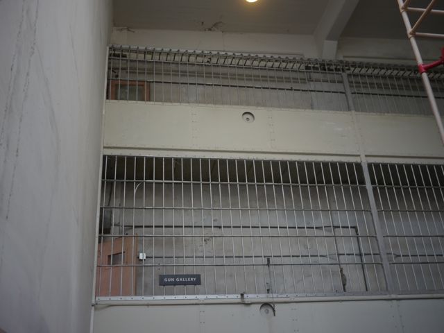
The gun gallery, where it all began.
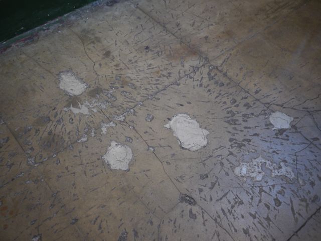
Floor where you can still see grenade damage from the battle.
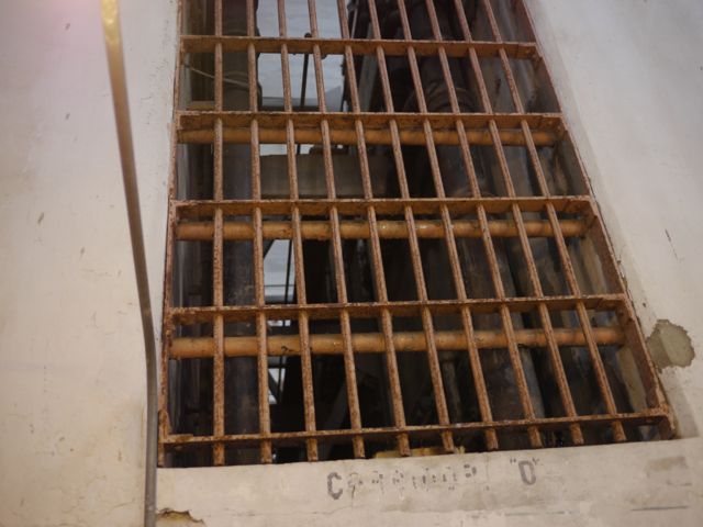
Pipe chase where the found the escapees after the battle. (dead)
The much desired sunny east side of the prison.
View of the city. They say on New Years eve, the inmates could hear the party at the yacht club.
Guard Uni… called them red ties.
Stepped outside for a breath of fresh air.
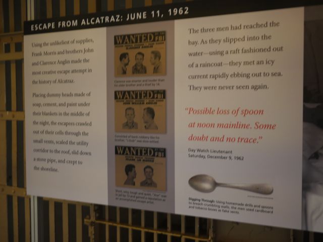
They never found two of these guys… brilliant escape.
The movie “Escape from Alcatraz” was based on this one.
Jr Ranger Program!
Jr Ranger!
I don’t think Kim would have agreed to go if not for these badges!
Waiting to board the boat back to the city
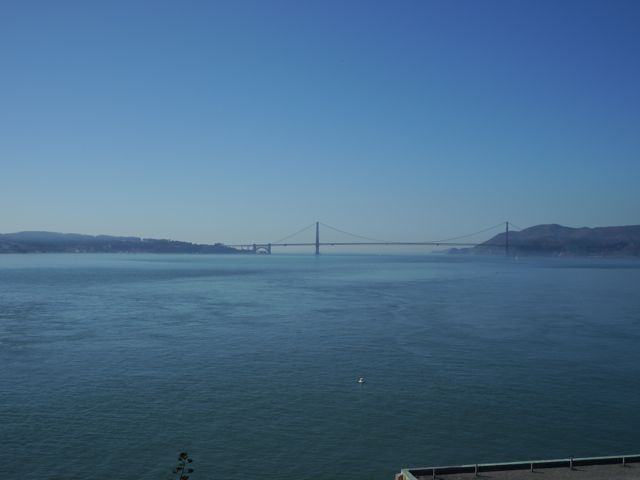
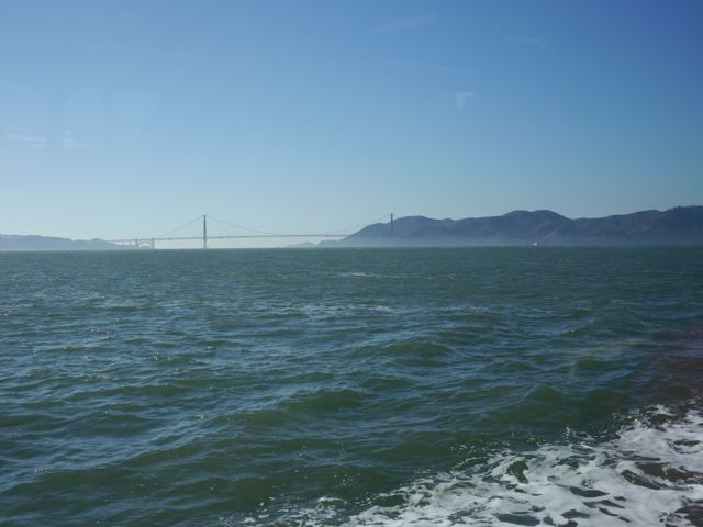
Golden Gate Bridge from the boat
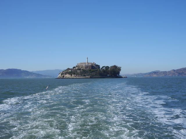
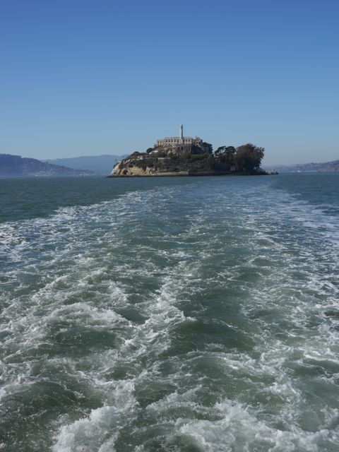
Bye Bye Alcatraz
I thought this was sweet. Kat was tired (we all were).
Great view of the Golden Gate bridge on the way home
Halloween Pics:
At Trojac’s for dinner
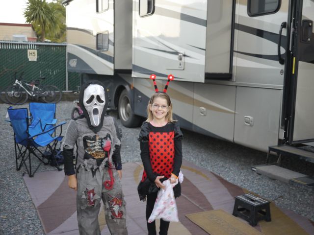
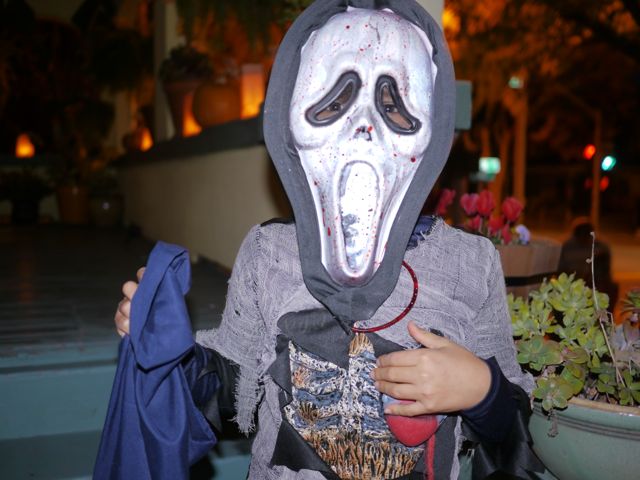
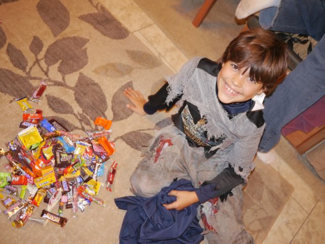
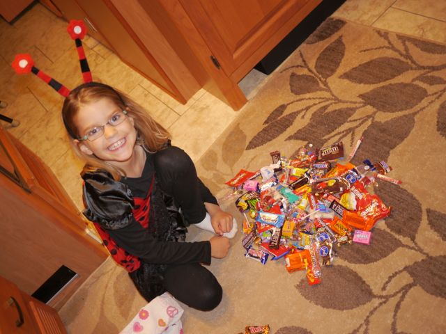
Kids in their “Goodwill” purchased costumes. Ghost Face Zombie, and Ladybug
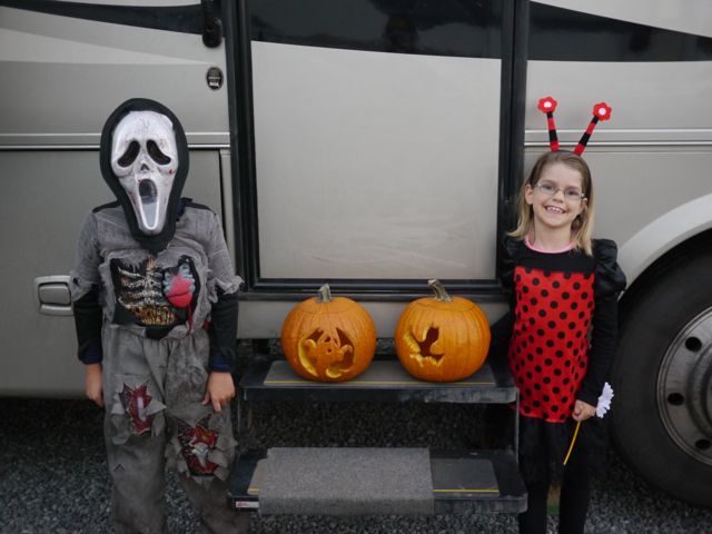
With their jack-o-lanterns… Kane carved his own, Kat designed her own.
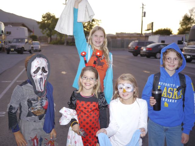
Our kids with Trojac’s… ready for action
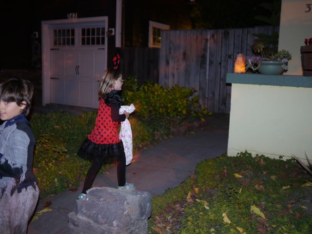
First house
Kane’s mask is genius, squeeze a bulb, and blood runs down, but it also runs back down into the bulb… unlimited blood!
Spider house
Dead trick-or-treater at the spider house.
French Revolution House
These guys had a real haunted house… incorporated the backyard, basement, and garage!
Loved the haunted house
Counting loot and deciding what to trade back to Mom and Dad for cash.
Well, we had plans to be in San Francisco for Halloween, and that gave us a couple of days to spend in between the Redwoods and the Bay. We’re finding that the State Parks in CA are not nearly as RV friendly as those in Oregon. After much research, and discussion, we booked a couple of nights in Fort Bragg.
It was OK, but I don’t really recommend it. The RV park was fine, but Fort Bragg was kind of a pain to get to, and some of the sites over-hyped.
On the way in, we debated our route… do we take highway “1” down the coast, or stay longer on 101 South and cut West on “20”? Mapping software seemed to suggest 1, but the RV park directions explicitly call out 101->20. I was trying to minimize our travel time so I could catch the Cards game. Based on Kim’s timeline for the “1” route, and the RV park recommending 20, we took 101 to 20. It turned out to be “dumb luck”. Kim’s estimate of the time was off by about 1/2 hour, but in talking with the RV park managers, we probably would have had to turn around if we had taken 1.
That said, highway 20 was EXTREMELY windy, hilly, and narrow in spots. Thankfully, it was freshly re-surfaced. Drives like the 30 miles on highway 20, makes me very thankful for my 11,000 miles of experience driving the RV!
I felt like somebody didn’t want me to watch the Cardinals game! The game started just as we turned off of 101 and got onto 20. I pulled over, searched the radio (unsuccessfully) for ESPN radio, fired up the MiFi and got ESPN Radio on my phone (using the “tunein” app). So happy I had the game. About 2 minutes in, Wainright was already in a jam, and we lost our AT&T signal. By the time we got it back, it was the bottom of the 3rd, and Cards were down 1-0.
When we got to the RV park, and Kim was checking it, I checked the ATT signal… nothing. Then I fired up the generator to run the TV and check the broadcast signal… nothing. Then Kane was able to get the RV Park WiFi. So we started following the updates on his Kindle. Soon after Matt Holliday hit a game-tying homer.
We got to our campsite, hurried to setup, got the cable TV setup. We had 30 channels, but for some reason FOX was near-complete snow with no audio. I was ready to explode! Thankfully, the Davises who sold us the RV gave us a 30 foot coax cable. I went out, got the long cable, and ran it to the campsite behind us (nobody in it). The FOX signal was “PERFECT”. Yeah! Then the Cards lost the game. (probably my fault).
The next day, we hung out in the morning and did school. Then, after lunch, we headed out for some sight-seeing. First stop, “Glass Beach”. This is where a former landfill has eroded over the years by the waves. It has created a “pebble-like” beach, intermixed with small pieces of glass. The glass has been broken and rounded into little glass pebbles (white, green, amber mostly). Glass Beach was highlighted for us by a Redwoods NP Ranger the week before. I have to say, this has either been “picked over” over time, or it’s the best marketing campaign in the history of Chamber of Commerces. It was really a mediocre beach, smelly, covered with flies, with a modest amount of glass in it.
That said, our kids still enjoyed it, Kane had fun climbing around on the rocks. Kat had fun looking and collecting glass (which she had to put back based on rules). I was glad we found the glass, but ready to go!
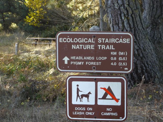
Next stop, the Ecological Staircase Nature Trail. This is an area along the coast where within a 3 mile trail, you can experience 5 different eco-systems. Evidently, the coast here is continuously rising over time. Every 100,000 years or so, the whole coast lifts enough to raise the others and create distinct environments for plants/animals.
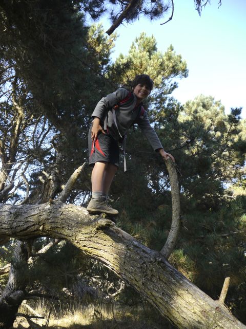
The highlight, by far, was finding a really cool Bishop Pine tree on the trail. See pics below, but this tree was an amazing mass of twisted branches, all large and strong enough to climb on safely. The whole thing was covered by a canopy of green needles.
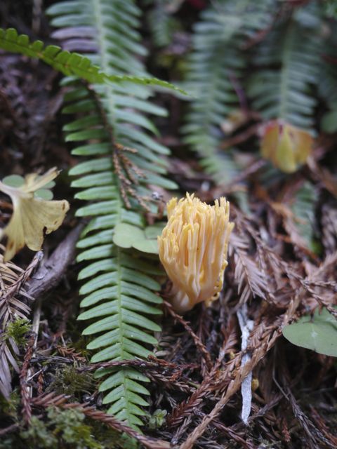
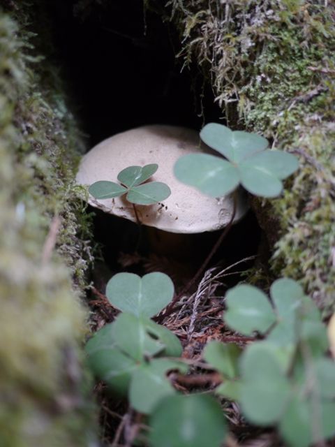
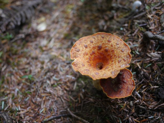
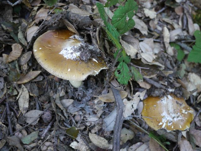
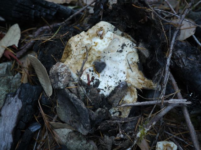
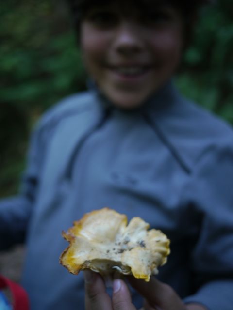
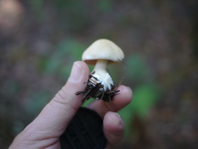
We (Kat) found a couple of nice King Bolete mushrooms near the end of the hike, in the pygmy forest. We quickly ate them that night, with our “korean beef” for dinner! Yum! All in all, not a bad place to kill a couple of days, but not a destination.
From the CA state parks site:
Ecological Staircase Trail
This trail takes the visitor on a tour of the geological updrift from the coast to the Pygmy Forest two and a half mile inland. This marine terrace sequence illustrates a successional story unparalleled elsewhere in California. The composition and processes responsible for this unique ecological setting offer a diverse selection of interpretive opportunities.
Jug Handle State Natural Reserve is a special place. Few places on earth display a more complete record of ecological succession. Each of the five terraces represents one stage in a progression of successional environments. Jug Handle, then, is one of the few opportunities to interpret this aspect of the coastal spectrum of ecological succession and landscape evolution.
The material base from which the terraces were fashioned is composed of a uniform body of graywacke sandstone (Bailey and Erwin 1959). Although each terrace has evolved from the same parent material, each has been weathered for different lengths of time. The soils, plants, and hydrologic associations on each terrace are affected by the degree of change the weathering has produced in the sandstone (Fox 1976 p. 5).
The structure of the terraces at Jug Handle is a result of the movement of the earth’s crust (plate tectonics) and the fluctuation of sea level during the Pleistocene. In the last several million years, the continent of North America has moved northwest, and the coastline along the Mendocino coast has risen slowly in relationship to the increase of the sea level brought on by the melting of the continental glaciers. These two factors are massive agents in the shaping of land forms and are rarely seen so clearly outside the desert regions of the world.
The principal sculpturing agent at Jug Handle has been the sea. During periods of the Pleistocene when the glaciers were retreating northward, sea level rose more rapidly than the land was rising. As the pounding waves were uplifted onto the land, they fashioned a smooth underwater terrace. With renewal of glaciation, the waves slowly receded as the sea level fell.
Deposits of gravel and sand (beach material) were spread across the emerging terrace by the retreating waves (Jenny 1973 p. 8). Continued uplifting raised the terrace clear of subsequent rises in sea level. In this fashion, new terraces were created where older ones had existed. Terrace No. 5 (the oldest) was once at the elevation now occupied by No. 4 and so on.
This repetitive sequence proceeded at intervals of approximately 100,000 years and involved about 100 feet of uplift to form each of the terraces. The higher the terrace the older it is, and the longer its beach materials have been subjected to weathering.
Another active agent forming the land at Jug Handle has been the wind. Coastal breezes have been depositing beach material on the first terrace where the bluffs are low. Similarly, in the past the seaward edge of each terrace was covered with dune-building material that is now ancient.
Pics!:
Glass Beach in Fort Bragg, it took some time to actually find the much ballyhooed glass.
Found some glass!
Kane is the consummate optimist. I can’t claim any portion of this trait, other than he’s compensating for my bad example.
Kat was happy, until we made her put the glass back. There was a big sign saying “no collecting glass”.
I love watching her getting into Nature. She loves it!
Kanes looking for some sealife in there.
Any chance to climb is taken advantage of
Gotta see a “pygmy” forest
Excited to do our hike!
Hopeful that we can go back to “Clowlick’s Ice Cream” that we saw when we went to the post office (we didn’t)
Found a tree to climb.. this was not a dead tree, but a branch that had grown into the ground.
Trail started along the beach/cliffs in a scrubby area
Kim was concerned…
Watching the waves crash in, and watching roll away again
Found the coolest climbing tree ever… Bishop Pine
Climbing the pine
Those cones are huge and attached directly to the branches
This is our new favorite tree ever. Second one is on the Wash U campus.
You’d swear this was 10 trees rather than one.
Loving It
Even I could not resist this tree!
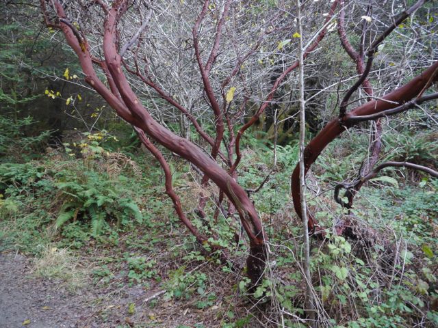
Manzanita Bark… love this stuff
Manzanita Tree. Kane does not recommend the fruit!
On the trail in the second tier. This area was still scrubby, but was covered with plants.
Pygmy Pine tree, full grown at about 7 feet tall.
Typical fo the middle of this hike.
We were racing the sun on the way back.
Nice view once we made it back to the shore
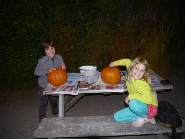
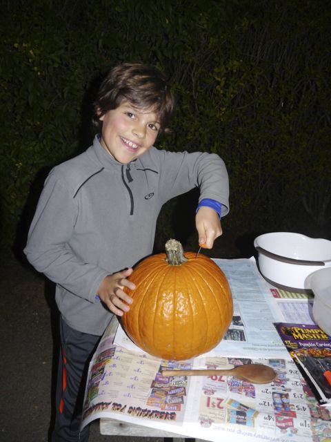
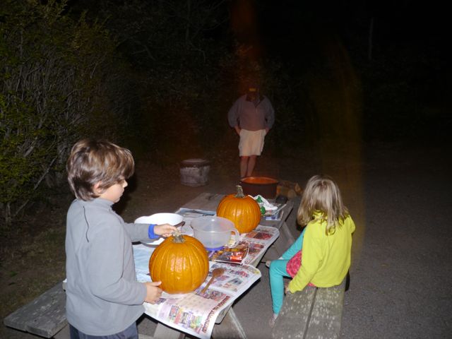
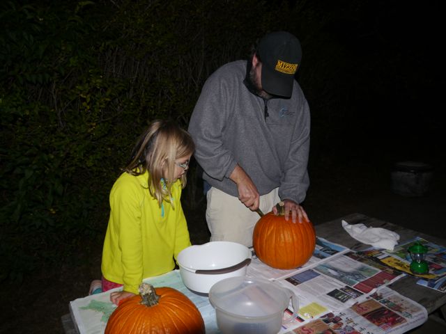
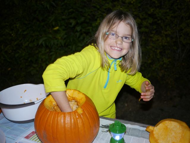
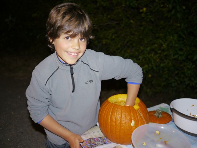
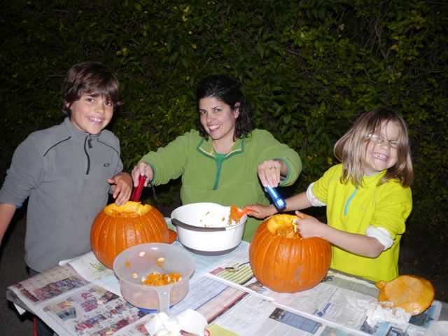
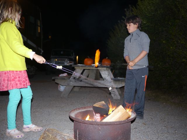
After the hike/dinner, we started carving our pumpkins. We decided to get them cleaned out, and do smores, rather than finishing the jack-o-lanterns this night. It was a fun evening!
She still loves to get her hands dirty.
He still does not love to get his hands dirty, but he’s come a long way!
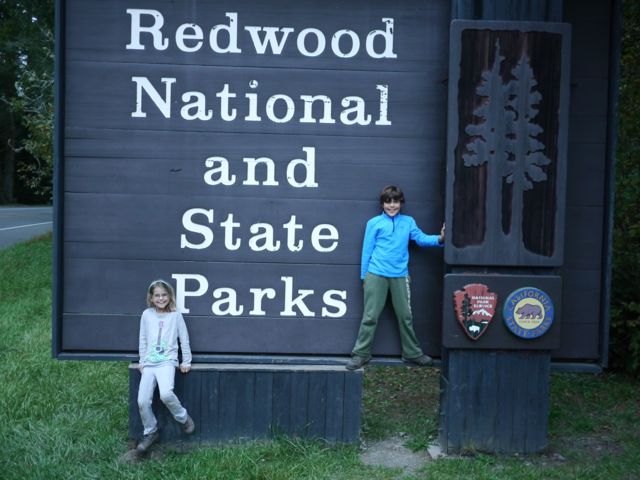
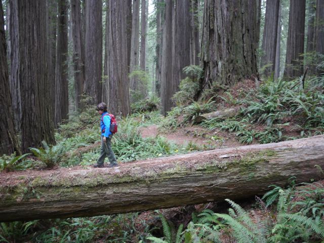
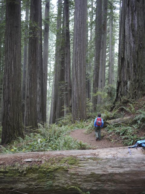
We spent a couple of days in the Redwoods National / State Parks. Camped in a commercial RV park (so I could have cable and World Series). It was a nice place.
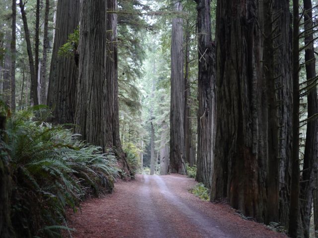
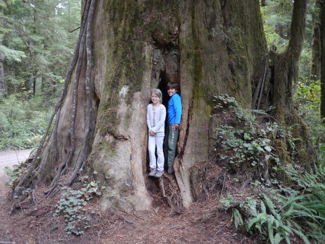
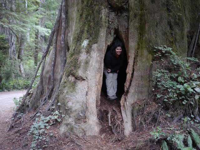
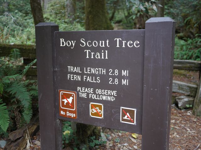
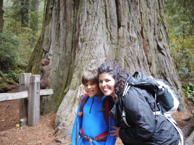
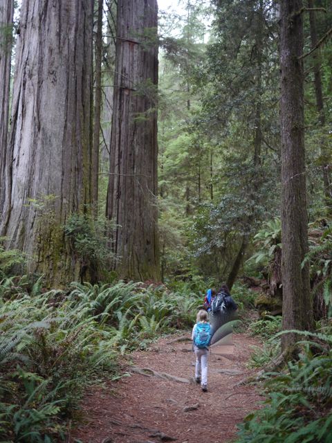
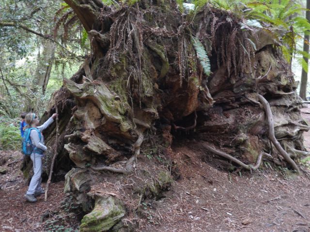
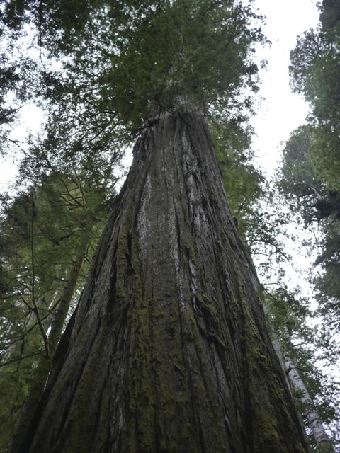
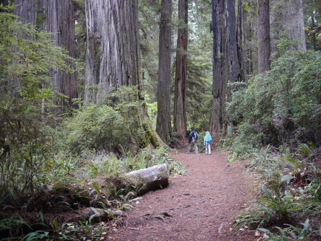
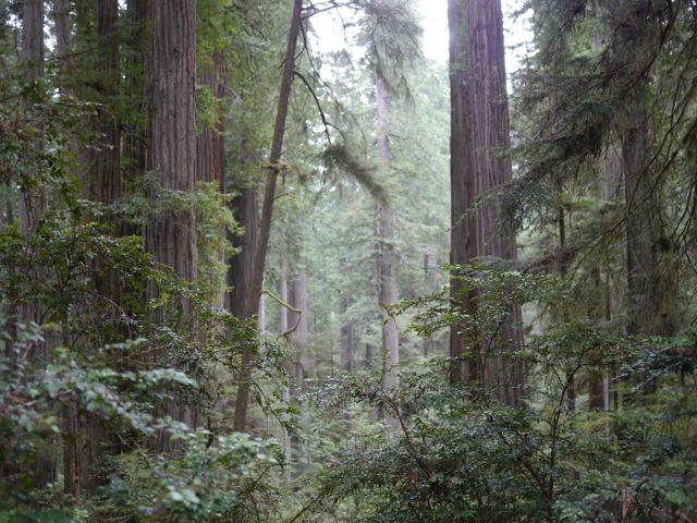
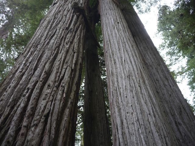
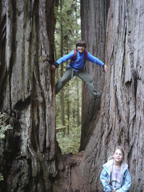
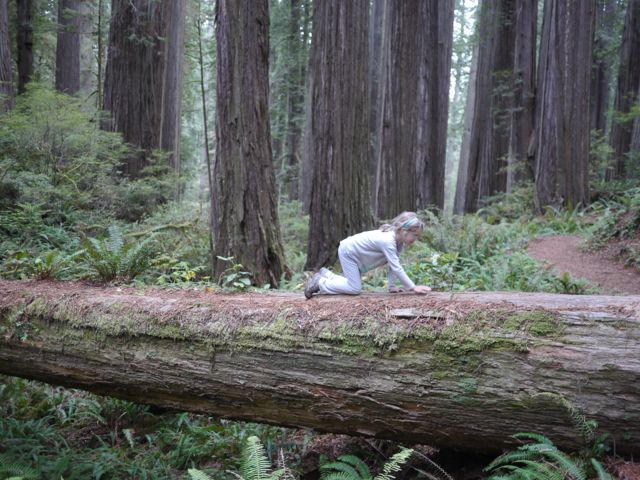
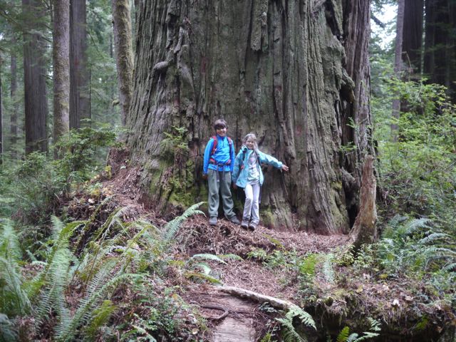
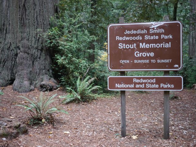
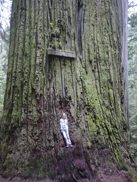
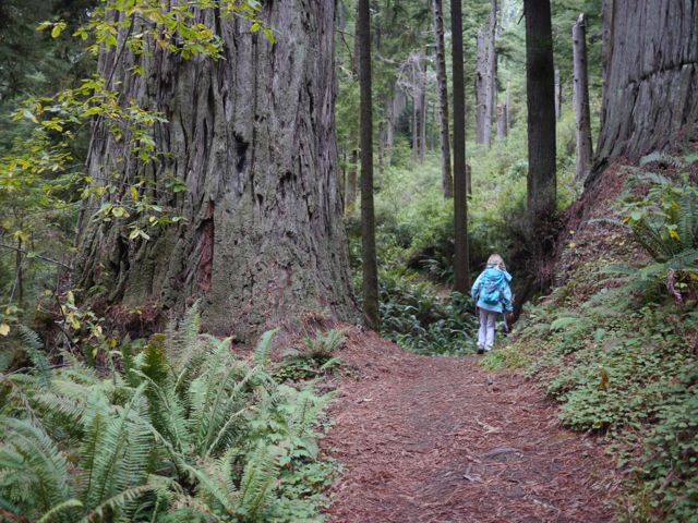
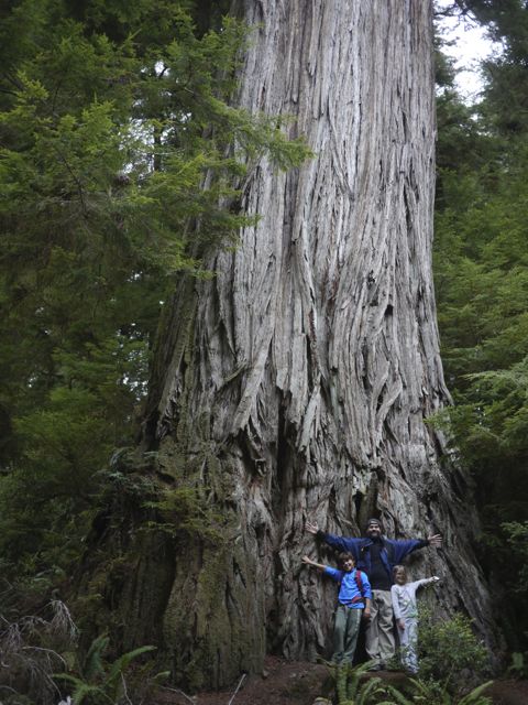
The hike in the Jedediah Smith State Park (Boy Scout Tree Hike), was a real highlight. These trees are up to > 2000 years old, and MASSIVE. It’s surreal walking amongst these giants. They’ve been used in many movies including Star Wars (Return of the Jedi… home of the Ewoks).
I’ve determined that a tree can be “just as” unique and majestic as a mountain. I love the sense of history that I get realizing that these trees where alive in Biblical times. Kids love climbing, crossing fallen logs, and hunting for mushrooms. We all loved this hike!
Boy Scout Tree Hike / Stout Grove
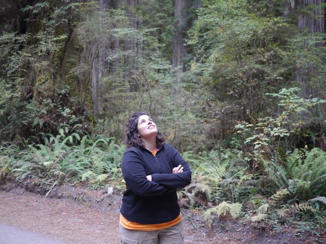
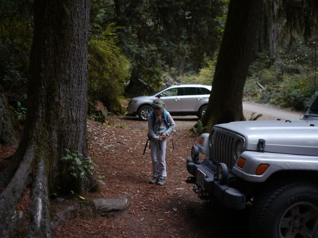
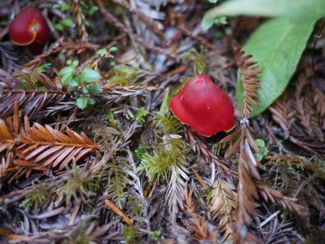
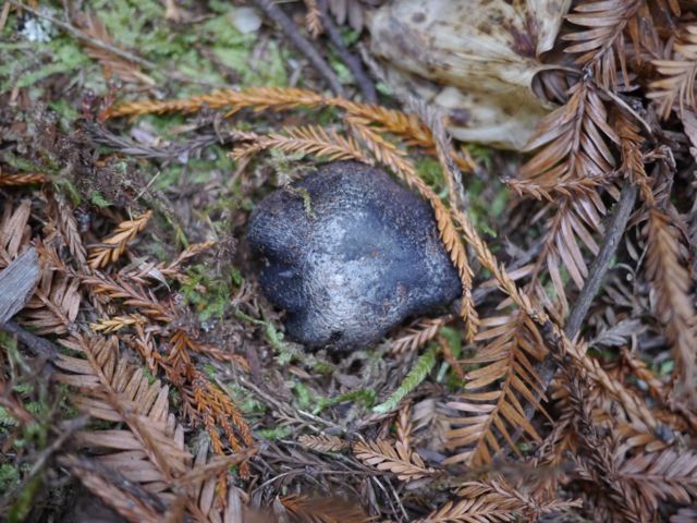
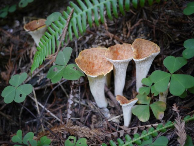
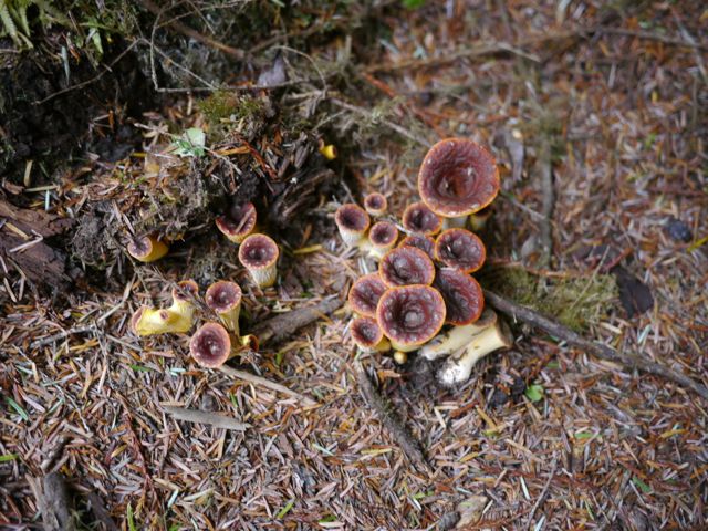
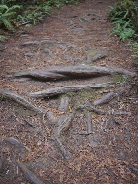
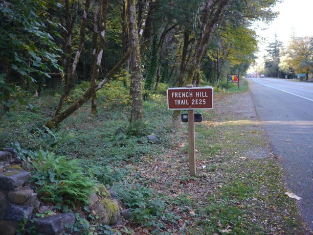
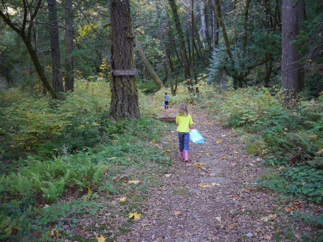
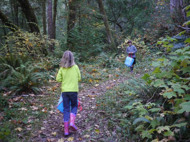
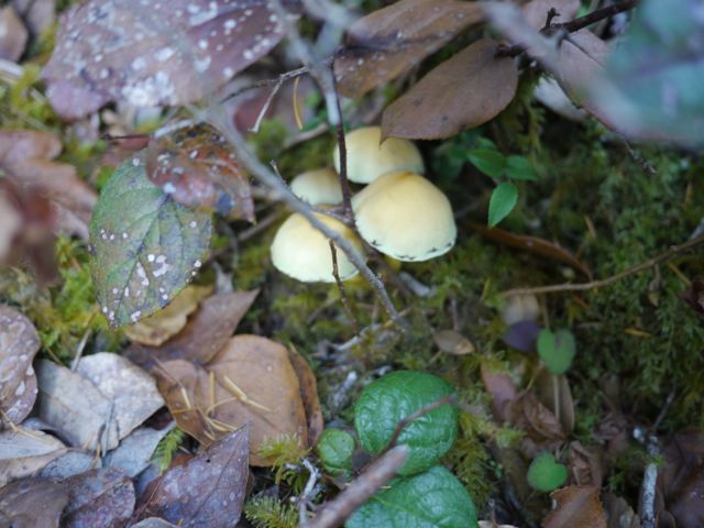
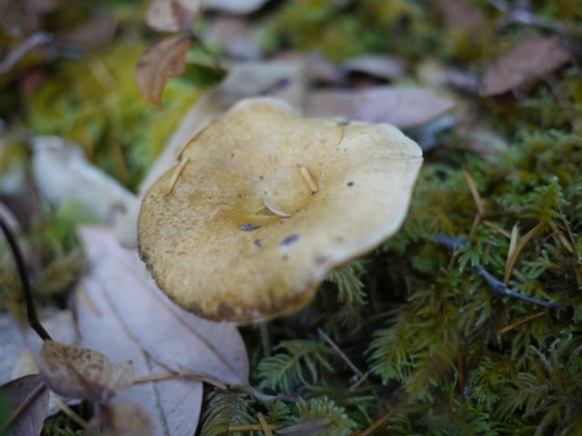
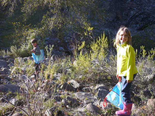
The following day, Kim got some alone time, and I took the kids mushroom hunting. We only found one Chanty, but we had a good time nonetheless, and saw lots of other “stuff”. (including a tiny frog).
Mushroom Hunt / French Hill
In the “mixed emotions category”, Kat told me the best thing about hugging me is “I don’t have breasts”. Kim’s been trying to get her to stop head-butting her when she’s coming in hard for a hug. I took the compliment in stride, and didn’t have the heart to tell her she was wrong on multiple points.
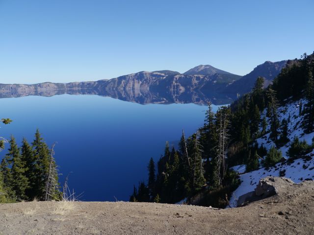
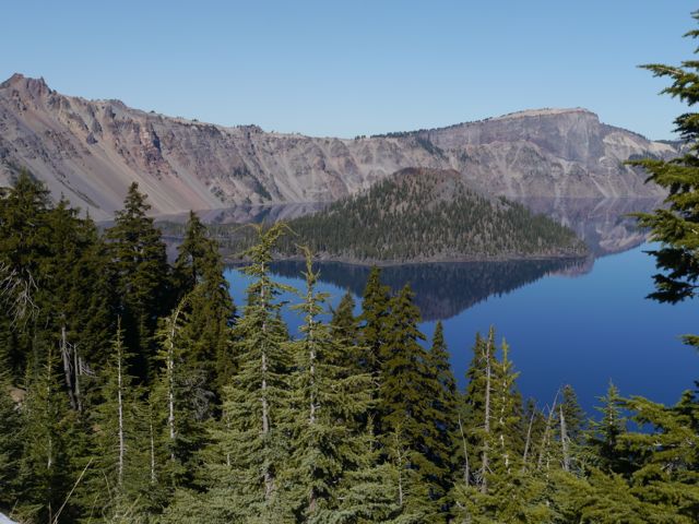
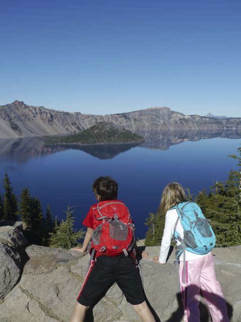
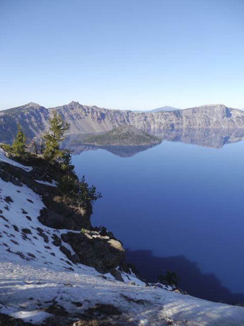
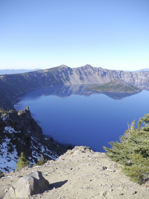
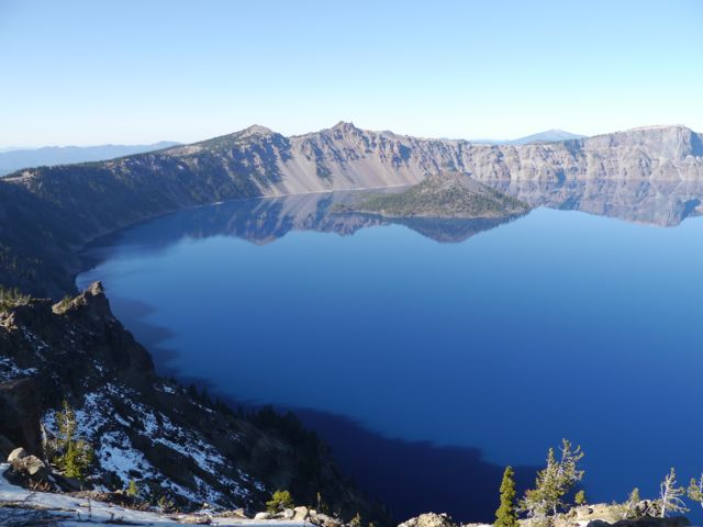
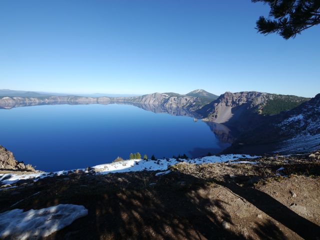
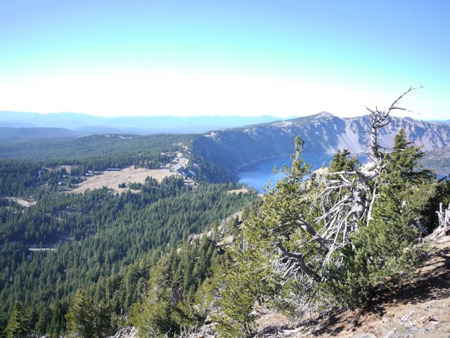
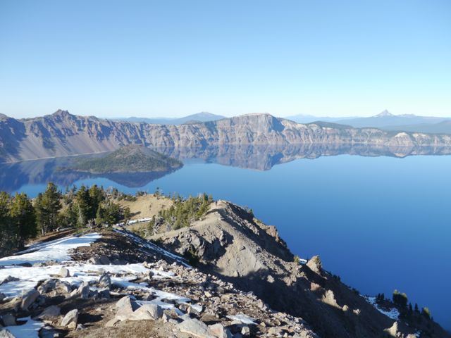
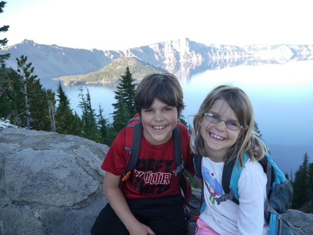
Ho hum, you’ve seen one Volcano that blew it’s top creating a perfect crater, subsequently filled with melted snow to become a pristine lake, you’ve seen’m all.
The video running on the 1/2 hour at the visitor center says that just 7700 years (in geological terms, yesterday) ago, Crater Lake was Mount Mazama. In fact, the indiginous indians, claim to have handed-down eyewitness accounts of the fateful event.
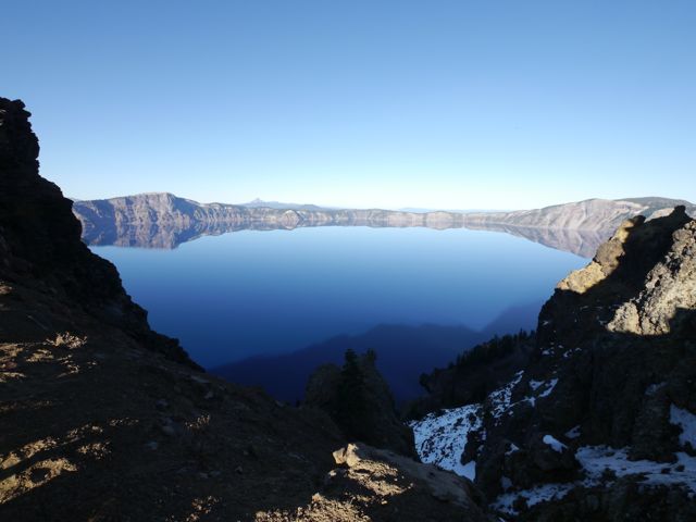
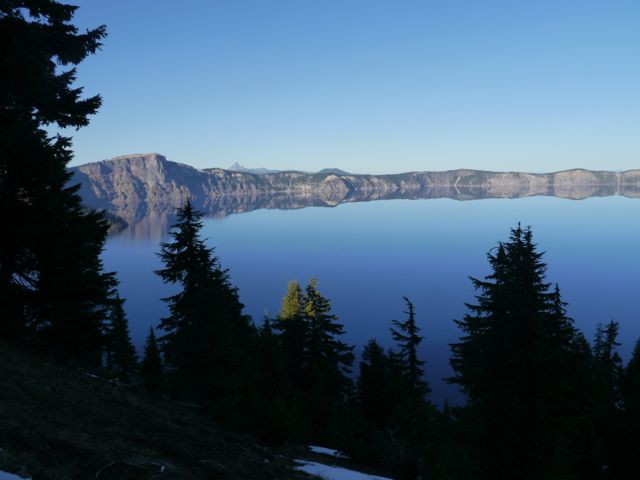
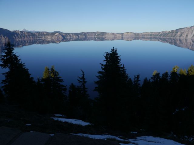
Scientists estimate that what took millions of years to create, caved in over the course of 2-3 hours. Well, we spent our 2-3 hours there, and it was amazing… crystal clear, blue sky, no wind (water was mirror like), mid 60’s… perfect hiking weather. Some locals assured us that we were seeing it “at its best”.
All that said, the State Park that we chose to camp in based on proximity to the lake probably equaled the lake in my mind. It was perfect. Large, treed campsites. Full hookups. Lush grass. Bike trails. Deer. Firepit. Mixed forests with falling leaves. A lake. Amazing stars at night. I could go on and on, but within 5 seconds of being setup in camp, I felt the last little bit if stress leave my body. It was perfect. (except for no tv or wifi, but you can’t have it all!).
Check out these pics! The kids are getting back into taking pictures, since Kane bought himself a camera, and Kat dusted off her DS (that she bought from Kane). Kane had a blast taking pics of the lake, and his camera has a built-in “paranorma” (he pronounced it… really “Panorama”) mode which was perfect for the lake.
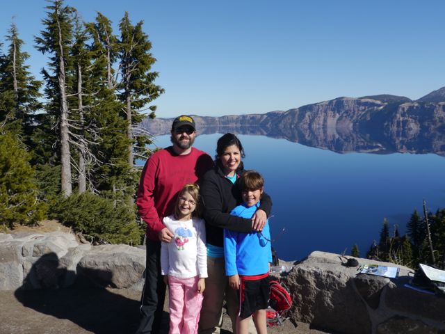
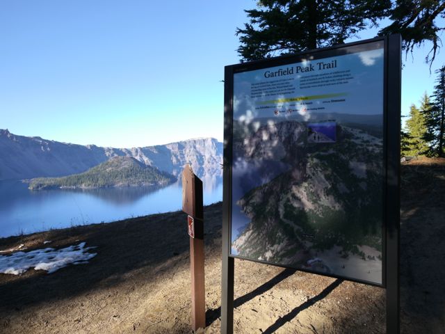
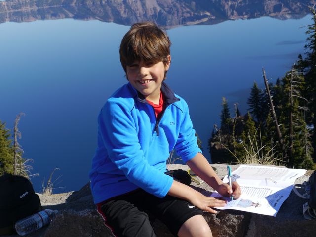
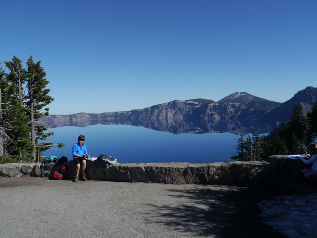
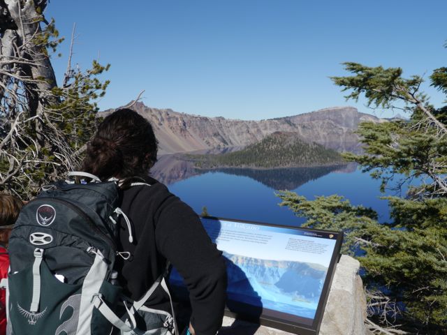
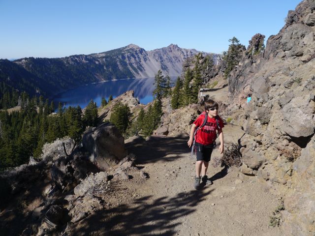
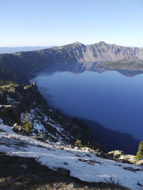
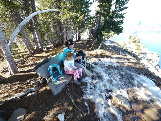
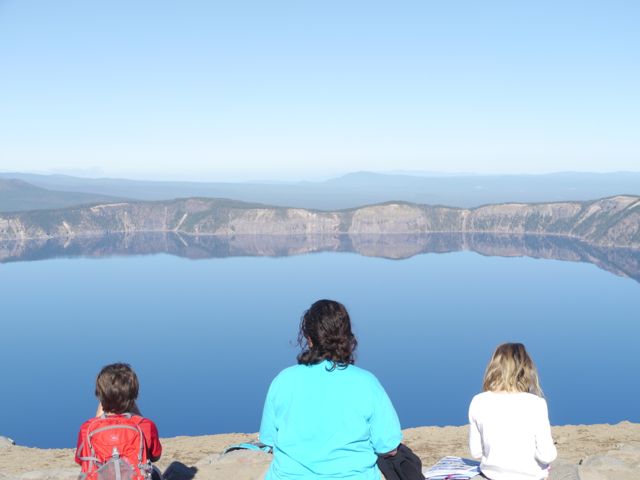
We drove up to the visitors center (got in free because we have an annual NP pass), got he lay of the land, drove up to “rim village” to park. At the lunch we packed on the stone wall overlooking the lake. Then we did the the “Garfield Peak Trail” to the top for the exercise, the feeling of accomplishment, and the views. What a day!
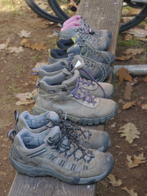
After 3.5 months, our hiking shoes are good and broken in!
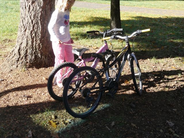
Kids bikes have to come off the jeep immediately after we are setup (and sometimes before).
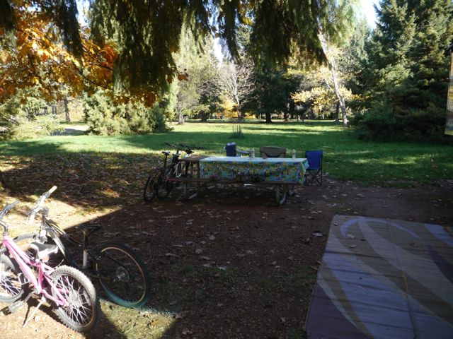
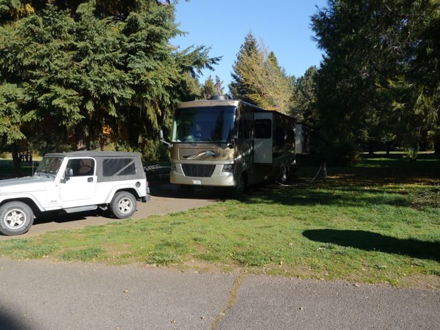
This was our yard for a few days… Joseph Stewart State Park… wow!
Our campsite. It was aided by sparseness of the late season, and the face that the loop behind us was closed
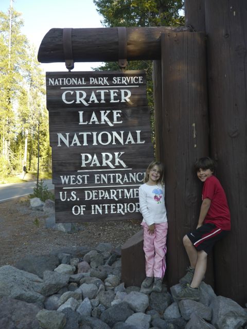
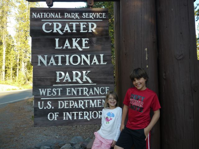
Interesting how this sign is totally different from the other NP signs we’ve seen.
Kim and I “almost” had a fight about this sign. We didn’t stop on the way in, and we thought we were going to have to argue about turning around on the way home if we missed it. Turned out moot because we didn’t miss it! Everybody’s a winner.
Kim took this with her iPhone. I thought it was interesting how more saturated the colors were by default. Nice blue water.
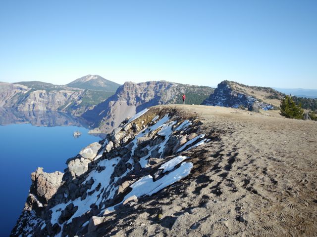
Kids with Wizard Island (sunken volcano tip) to the left.
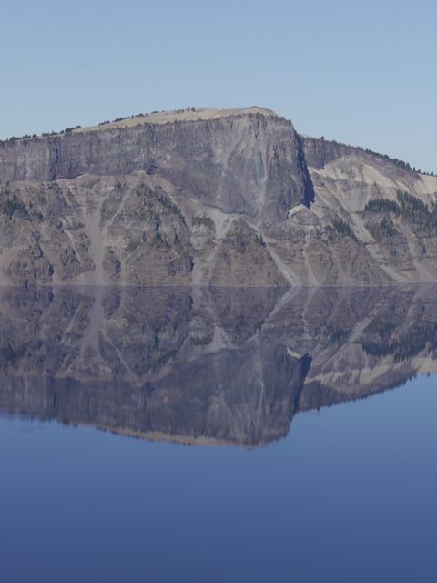
A lot of these are “Just cool” pics of Crater Lake… no story here.
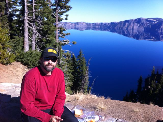
I was laying on the wall, relaxing, while Kim was taking the lunch trash back to the jeep. I notice a couple struggling to take a “Selfie”. I offered (and took) a shot for them, and they returned the favor. Why not, we’re due for a new banner photo for the blog!
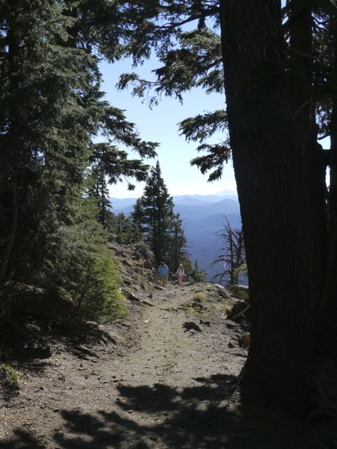
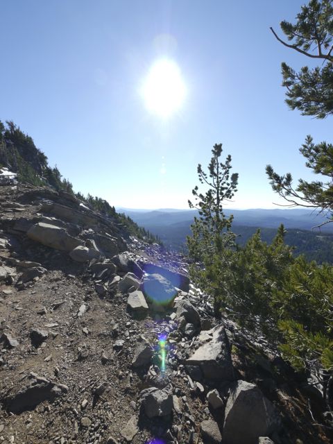
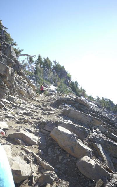
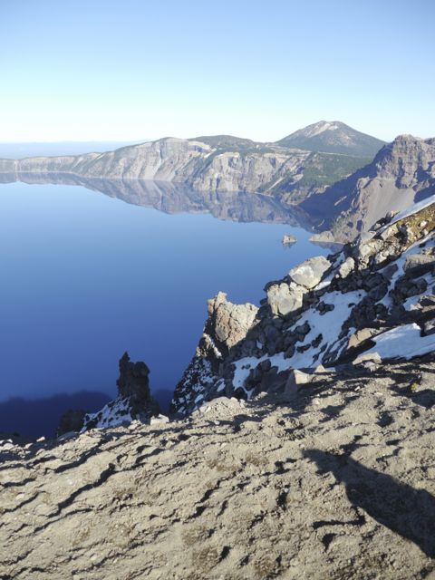
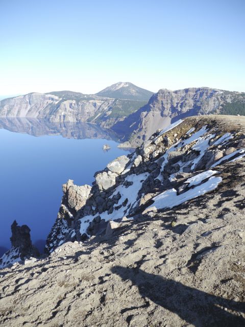
Garfield Peak Trail Hike – 3.4 miles round trip, and 1000 ft elevation gain
Junior Ranger in the making
Our lunch spot
Wizard Island
Kim’s learning again!
We spent a lot of time looking at the lake. It was amazing how walking a few feet would completely change the view.
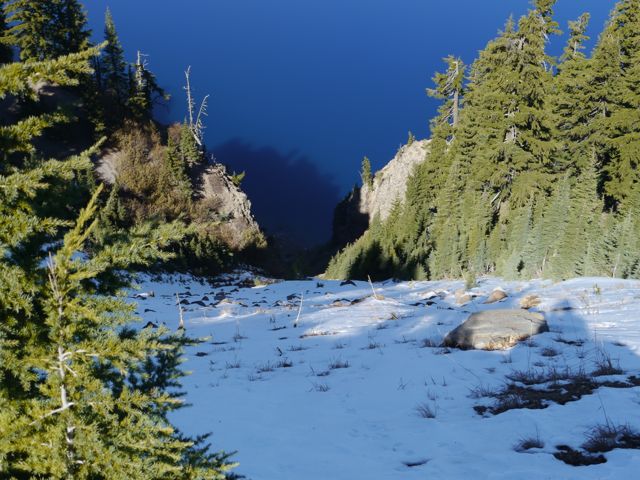
Lots of snow around, and some steep areas down to the lake.
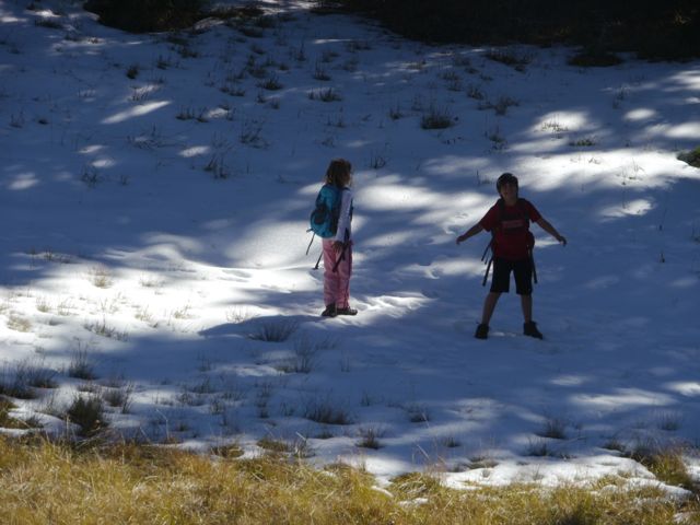
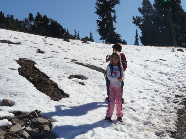
Kids + Snow = Snowballs = TROUBLE
LLao rock. Natives say the crater was created basically by the underworld god (Llao) and the aboveworld god (Skell), having a fireball battle. Llao was mad that an indian princess would not marry him, Skell was sticking up for the indians. This rock formation is called Llao rock for the underworld god.
1/2 of this trail is on the “wrong side” of the peak (no view of the lake). Cool views down into the valley though.
Kanes on the prowl for a photo op.
The Valley south of the lake.
Various views of Wizard Island coming…
Hiking through the snow this time. Parts were slippery.
Parts were muddy too!
Rest break… and some messing with the fish eye (super wide) lens.
Liked the flare.
Kane always wanted to take the lead and shortcuts straight up where possible.
Getting up there!
We got the peak!
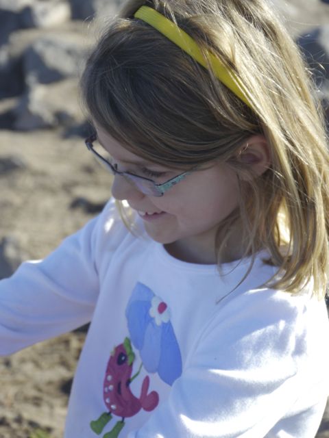
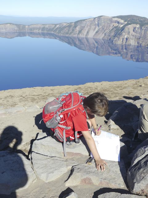
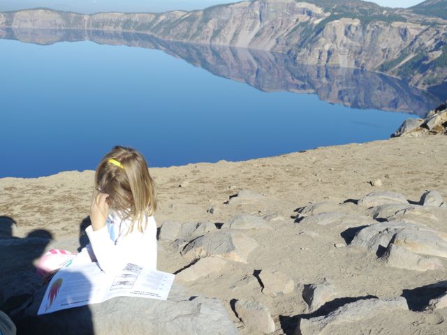
Working on her Junior Ranger program. We needed to turn them in at 5:00. Pic taking at 3:45… gotta hustle.
Some nice views up there.
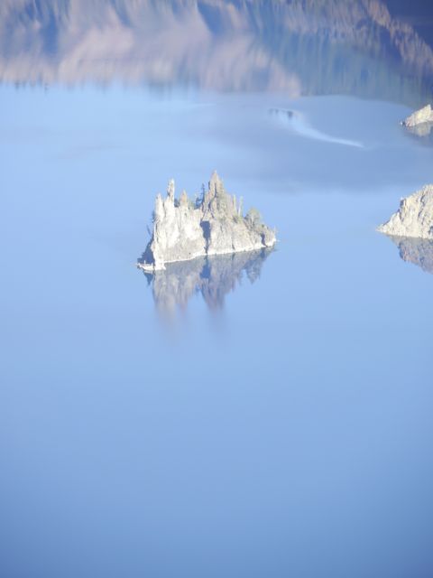
Little outcropping is called “Phantom Ship”, it’s actually as tall as a 6 story building. Kind of messes with your sense of scale?!
Not a bad place for a school lesson?
Could not help getting these of the kids working on their Junior Ranger books in this place.
Kat, working hard.
Zoomed in on the Phantom Ship.
Snapped a few wide-angle shots of the lake on the way back.